


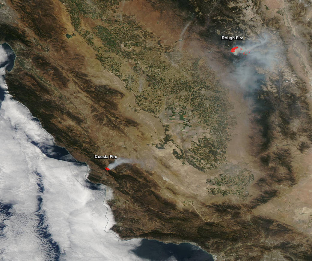
NASA’s Aqua satellite saw smoke from southern California’s Cuesta Fire near San Luis Obsipo and the Rough Fire, five miles north of Hume Lake.
The Moderate Resolution Imaging Spectroradiometer (MODIS) instrument that flies onboard NASA’s Aqua satellite captured an image of smoke from these fires Aug. 18, 2015. The multiple red pixels are heat signatures (red) detected by MODIS. The smoke appears to be a light brown color.
InciWeb is an interagency all-risk incident information management system that coordinates with federal, state and local agencies to manage wildfires. For updates on all fires, visit the Inciweb website:
InciWeb noted that the Cuesta fire was reported at 6:14 p.m. PDT on Aug. 16 as a result of a vehicle fire on U.S. Highway 101, in an area known as the Cuesta Grade, protected by CALFIRE San Luis Obispo Unit. According to InciWeb hot, dry and windy conditions allowed the fire to spread quickly. As of Aug. 19, the fire was estimated at 2,500 acres, and has burned into the Los Padres National Forest. The fire is being managed under unified command between CALIFIRE San Luis Obispo and the US Forest Service. A CALFIRE Incident Management Team has been ordered. The fire is threatening the community of Santa Margarita. Mandatory evacuations have been issued for Highway 58 south of the town of Santa Margarita and all of Miller Flat area. For updates on the Cuesta Fire, visit:
http://inciweb.nwcg.gov/incident/4540/
In the MODIS image, smoke from the Rough Fire is northeast of the Cuesta Fire. The Rough Fire started on July 31 from a lightning strike. InciWeb reported on Aug. 18 that the fire was spotted across the South Fork of the Kings River and crossed highway 180, in the area of Horseshoe Bend and became established in the Lockwood Creek Drainage. As a result of the fire crossing the river, there was an evacuation of the Hume Lake area. As of Aug. 18, this fire had covered 30,901 Acres. On Aug. 18, Highway 180 was closed to the public from the Hume Lake intersection to Cedar Grove in Kings Canyon National Park. For updates on this fire, visit:
http://inciweb.nwcg.gov/incident/4456/
For an unlabeled version of this image, visit:
https://www.nasa.gov/image-feature/goddard/californias-cuesta-and-rough-fires-unlabeled-image
Image: NASA MODIS Rapid Response Team, Jeff Schmaltz.
Text: Rob Gutro, NASA’s Goddard Space Flight Center, Greenbelt, Md.