


April and May see an increase in fire activity throughout Central Asia, as farmers begin to prep their fields for the coming season. This year has seen those fires go from agricultural to wildfire when some of those fires quickly spread out of control. According to media reports, these escaped fires devastated several villages, caused the deaths of about two dozen people, and left thousands of people homeless.
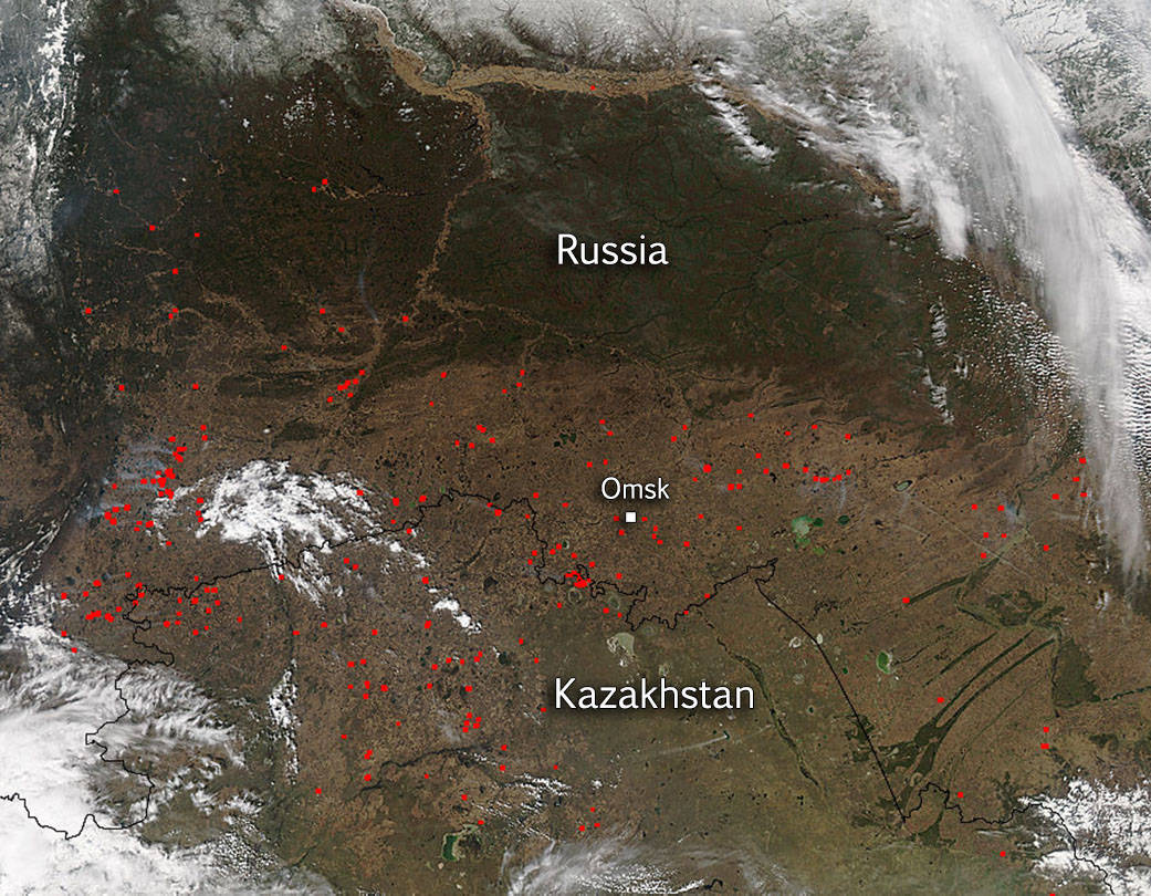
In this image, thousands of hectares of land can be seen burning as the the Moderate Resolution Imaging Spectroradiometer (MODIS) instrument on the Aqua satellite captured this image of fires in a rural area surrounding Omsk, a city in south central Russia near the Kazakhstan border. Red dots mark the locations of actively burning fires. This image was taken on May 03, 2015.
The area around Omsk is one of the most productive agricultural regions in Russia; some of the main crops include wheat, rye, barley, and oats. Growers often burn debris from the previous year’s crop before replanting in order to clear the land and fertilize the soil. Officially the clearing of land in this manner is prohibited but each year the farmers continue to use this method. It is the least expensive method of clearing land. It has been estimated that Russia is responsible for 31 to 36 percent of the world’s agricultural fires—more than any other country.
NASA image courtesy Jeff Schmaltz, MODIS Rapid Response Team. Caption: NASA/Goddard, Lynn Jenner with information from Earth Observatory site