


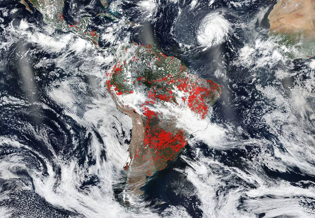
NASA/NOAA’s Suomi NPP satellite captured this image on September 26, 2019, which shows two dual threats in one satellite image. In the upper right-hand corner is Hurricane Lorenzo which satellite data has confirmed is a major hurricane in the eastern North Atlantic Ocean. As of Sep. 27, Lorenzo revealed a clear eye and a solid structure of thunderstorms around that eye. More information on this storm can be found on the NASA.gov hurricane page here: https://www.nasa.gov/hurricanes. So, too, this same Suomi NPP image shows South America with hundreds of fires blazing across the continent. Fires have plagued the continent of South America during 2019. In fact, satellites have detected an increase in fire activity early in the 2019 dry season in the southern Amazon per NASA’s Earth Observatory. In fact, several stories have appeared on NASA’s Earth Observatory discussing fires in Paraguay, Brazil, Bolivia, and of course, the devastating fires across the Amazon. These stories can be found at this link: https://earthobservatory.nasa.gov/images/event/145465/south-american-fires-in-2019.
NASA’s Earth Observing System Data and Information System (EOSDIS) Worldview application provides the capability to interactively browse over 700 global, full-resolution satellite imagery layers and then download the underlying data. Many of the available imagery layers are updated within three hours of observation, essentially showing the entire Earth as it looks “right now.” Suomi NPP is managed by NASA and NOAA. Image Courtesy: NASA Worldview, Earth Observing System Data and Information System (EOSDIS). Caption: Lynn Jenner