


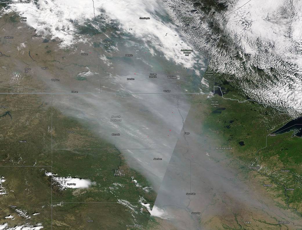
Alberta, Canada is in the midst of a ferocious fire season this year and smoke from the fires that criss-cross the province are drifting down into the United States. In this natural-color image that was captured by the Moderate Resolution Imaging Spectroradiometer (MODIS) aboard the Terra satellite on June 2, 2019 the smoke from the Alberta fires can be seen drifting from the Canadian province into northwest North Dakota. From there the smoke continues down in a southeastern direction and travels into northeast South Dakota, then into southwest Minnesota and then finally starts to break up as it continues down into northwest Iowa from Sioux City to Cedar Rapids.
NASA’s Earth Observing System Data and Information System (EOSDIS) Worldview application provides the capability to interactively browse over 700 global, full-resolution satellite imagery layers and then download the underlying data. Many of the available imagery layers are updated within three hours of observation, essentially showing the entire Earth as it looks “right now.” Image Courtesy: NASA Worldview, Earth Observing System Data and Information System (EOSDIS). Caption: NASA/Goddard, Lynn Jenner