


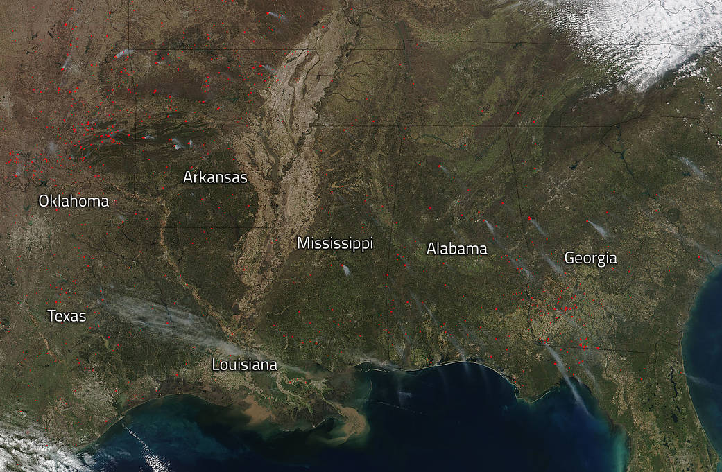
Mid-March saw a lot of fire activity in the southeastern United States, mostly in Oklahoma and Texas. The National Interagency Fire Center (NIFC) released a situation report on March 16, 2018, which shows that the southern area (which includes the states in this Suomi NPP satellite image) had 66 incidents of wildfires recorded that affected 83,022 acres. However, the majority of fires in the southeastern U.S. were not wildfires, rather they were prescribed fires set by various governmental agencies such as the National Park Service and U.S. Forest Service for many purposes. After years of fire exclusion, an ecosystem that needs periodic fire becomes unhealthy. Trees are stressed by overcrowding; fire-dependent species disappear; and flammable fuels build up and become hazardous. The right fire at the right place at the right time:
- Reduces hazardous fuels, protecting human communities from extreme fires;
- Minimizes the spread of pest insects and disease;
- Removes unwanted species that threaten species native to an ecosystem;
- Provides forage for game;
- Improves habitat for threatened and endangered species;
- Recycles nutrients back to the soil; and
- Promotes the growth of trees, wildflowers, and other plants;
Just last week 5,091 fires were lit in this region for a total of 323,099 acres.
NASA’s Suomi NPP satellite collected this natural-color image using the VIIRS (Visible Infrared Imaging Radiometer Suite) instrument on March 14, 2018. Actively burning areas, detected by MODIS’s thermal bands, are outlined in red. NASA image courtesy Jeff Schmaltz LANCE/EOSDIS MODIS Rapid Response Team, GSFC. Caption by Lynn Jenner with information from the National Interagency Fire Center’s March 16 report.