


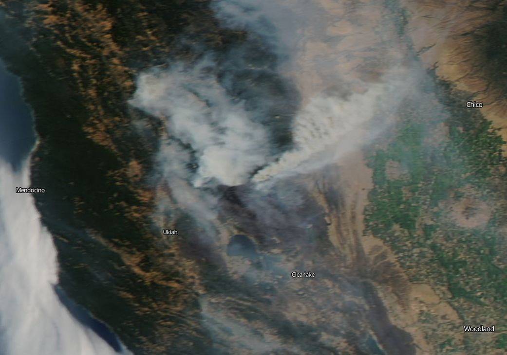
The largest fire in California’s history, the Mendocino Complex, is still spewing clouds of smoke across the state. Smoke from this fire and other California fires can be seen as far east as parts of Montana and then up into Canada.
The Mendocino Complex is comprised of two fires, the River Fire and the Ranch Fire. These two fires are being managed in unified command by the CAL FIRE Mendocino Unit and the U.S. Forest Service. The River Fire is located northeast of the community of Hopland, and the Ranch Fire is located northeast of Ukiah, in Lake County and Mendocino County, California. The Ranch Fire is actively burning in the Mendocino National Forest north of Clearlake. The combined total of acreage that have burned in this complex is 344,890 acres and is currently 68% contained. There have been two injuries but no fatalities with this fire. This fire has destroyed 146 residences and 119 other buildings, and another 1,025 structures are being threatened. The Ranch fire is still continuing to exhibit active fire behavior including: uphill runs, torching and flanking. The northwest corner of the Ranch fire remained active overnight until the early morning hours towards Lake Pillsbury. The River Fire had no movement overnight. This portion of the complex is mostly contained. The Ranch fire portion continues to grow.
The weather still continues to be of concern to firefighters. The hot temperatures, low humidity, and winds are all factors which can reignite slowing fires, push ongoing fires, and swiftly change the direction of a fire which can put lives at danger in an instant.
There are evacuations in place. A list of those can be found at the Inciweb site for this incident: https://inciweb.nwcg.gov/incident/6073/#
NASA’s EOSDIS provides the capability to interactively browse over 600 global, full-resolution satellite imagery layers and then download the underlying data. Many of the available imagery layers are updated within three hours of observation, essentially showing the entire Earth as it looks “right now”. This natural-color Terra satellite image was collected on August 12, 2018. Actively burning areas, detected by thermal bands, are outlined in red. NASA image courtesy NASA/Goddard Space Flight Center Earth Science Data and Information System (ESDIS) project. Caption: Lynn Jenner with information from Inciweb.