


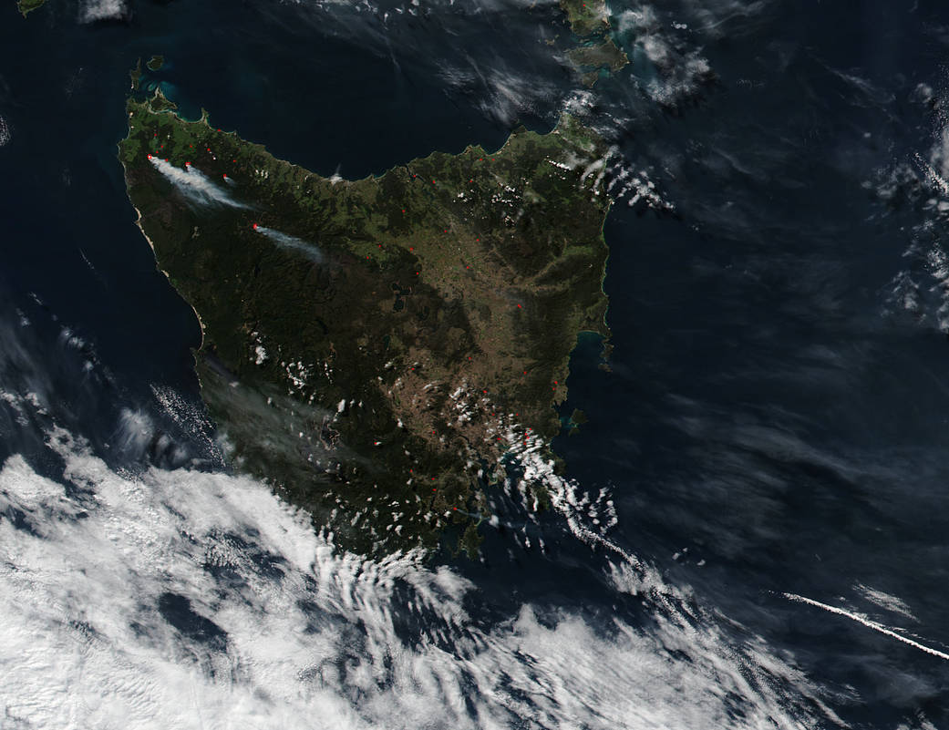
NASA’s Suomi NPP satellite captured this image of the island of Tasmania on April 19, 2016. Within this image smoke rises from the fires on the island. Tasmania is a state island of Australia and is found off the south coast of the country. It is mostly rugged wilderness and has protected areas with parks and reserves throughout. With wilderness comes fires from natural sources and from humans. In this image, the fires seen are combined bushfires started usually by lightning strikes and prescribed fires. Prescribed fires are those deliberately lit by fire professionals to reduce the fire fuel (tinder wood and dry brush) in the area so that if a fire were to break out naturally it would be easier to contain. These fires are carefully contained and once the excess fuel is burned out, the fire is extinguished. The Tasmania Fire Service publishes a map online to show both wildfires and prescribed fires on the island. Actively burning areas are outlined in red.
NASA image courtesy Jeff Schmaltz LANCE/EOSDIS MODIS Rapid Response Team, GSFC. Caption by Lynn Jenner