


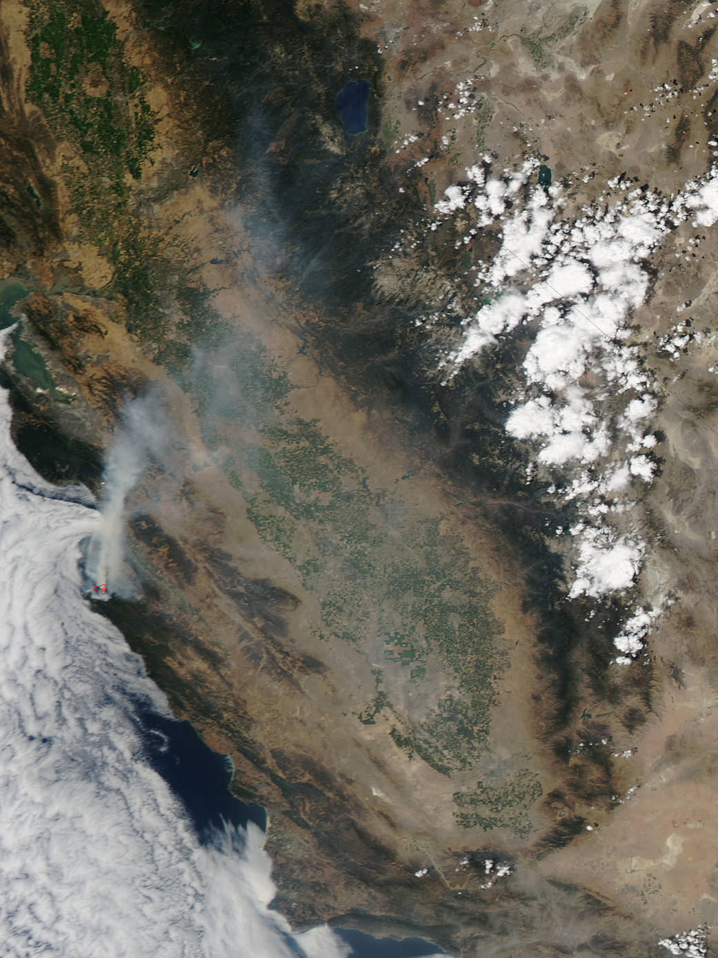
Inciweb, an interagency all-risk incident information management system that coordinates with federal, state and local agencies to manage wildfires reported that the Sobranes Fire had covered 40,618 acres as of August 1, 2016.
Inciweb indicated that CAL FIRE and the United States Forest Service, Los Padres National Forest were jointly managing the firefighting efforts. Extremely remote and rugged terrain with limited access coupled with hot and dry weather and an above average cured grass crop has resulted in a high resistance to control. Fire continues to burn in steep, rugged and inaccessible terrain.
California’s Governor Jerry Brown declared a State of Emergency. A total of 57 residences and 11 outbuildings have been destroyed. Three residences and two outbuildings have been damaged.
This natural-color satellite image was collected by the Moderate Resolution Imaging Spectroradiometer (MODIS) aboard the Aqua satellite on July 30, 2016 at 4:35 p.m. EDT (20:35 UTC). Actively burning areas, detected by MODIS’s thermal bands, are outlined in red.
NASA image courtesy Jeff Schmaltz, MODIS Rapid Response Team. Caption: NASA/Goddard, Rob Gutro with information from Inciweb.