


Summer in southern Australia brings with it the threat of bushfires and right now (Jan. 7, 2016) there is an emergency bushfire alert for the following areas of Southwestern Australia: A bushfire EMERGENCY WARNING remains in place for people in an area bounded by Forrest Highway, Dorsett Road, Williamson Road, Mayfield Road, South Western Highway, Nanga Brook Road, Dawn Creek Road to Murray River, Murray River to Driver Road, Logue Brook Road, Dupont Road, Tallanalla Road, Harvey-Quindanning Road in the Shires of Waroona and Harvey. This includes the town sites of Waroona, Hamel, Yarloop and Harvey. A bushfire EMERGENCY WARNING is also in place for people in Preston Beach and Lake Clifton in the Shire of Waroona. An alert rather than a warning is more dire. It signals immediate danger. In the case of this alert the following warnings are in place:
* You are in danger and need to act immediately to survive. There is a threat to lives and homes.
* Homes are under threat by fire at Preston Beach, Lake Clifton, Waroona and Yarloop.
* It is not safe to leave these locations, excluding Lake Clifton, where it is safe to leave in a northerly direction.
* The fire has breached containment lines under influence of strong winds, life and asset protection is a priority.
In addition the Australian Weather Fire Road and Police Warnings provide this information about the specific bushfire’s behavior:
* The bushfire is moving fast in a south westerly direction.
* The bushfire has crossed Forrest Highway near Peppermint Grove Road and Old Coast Road. Flame heights are up to 50 metres in state forest.
* The fire has crossed South Western Highway near Yarloop.
* It is out of control and unpredictable.
* The wind is expected to be north easterly overnight with strong gusts up to 60 km/hr
* Burning embers are likely to be blown around your home. Spot fires are starting ahead of the fire.
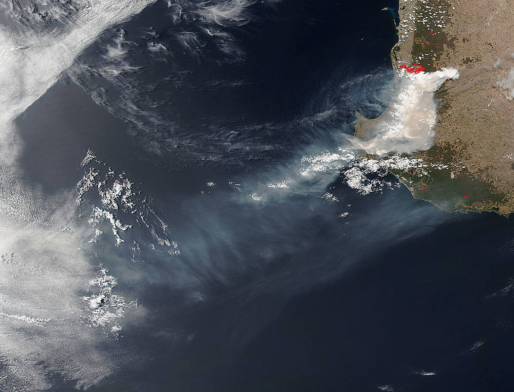
NASA’s Suomi NPP satellite collected this natural-color image using the VIIRS (Visible Infrared Imaging Radiometer Suite) instrument on January 07, 2016. Actively burning areas, detected by MODIS’s thermal bands, are outlined in red. NASA image courtesy Jeff Schmaltz LANCE/EOSDIS MODIS Rapid Response Team, GSFC. Caption by Lynn Jenner with information from the Australian Weather Fire Road and Police Warnings Facebook page.