


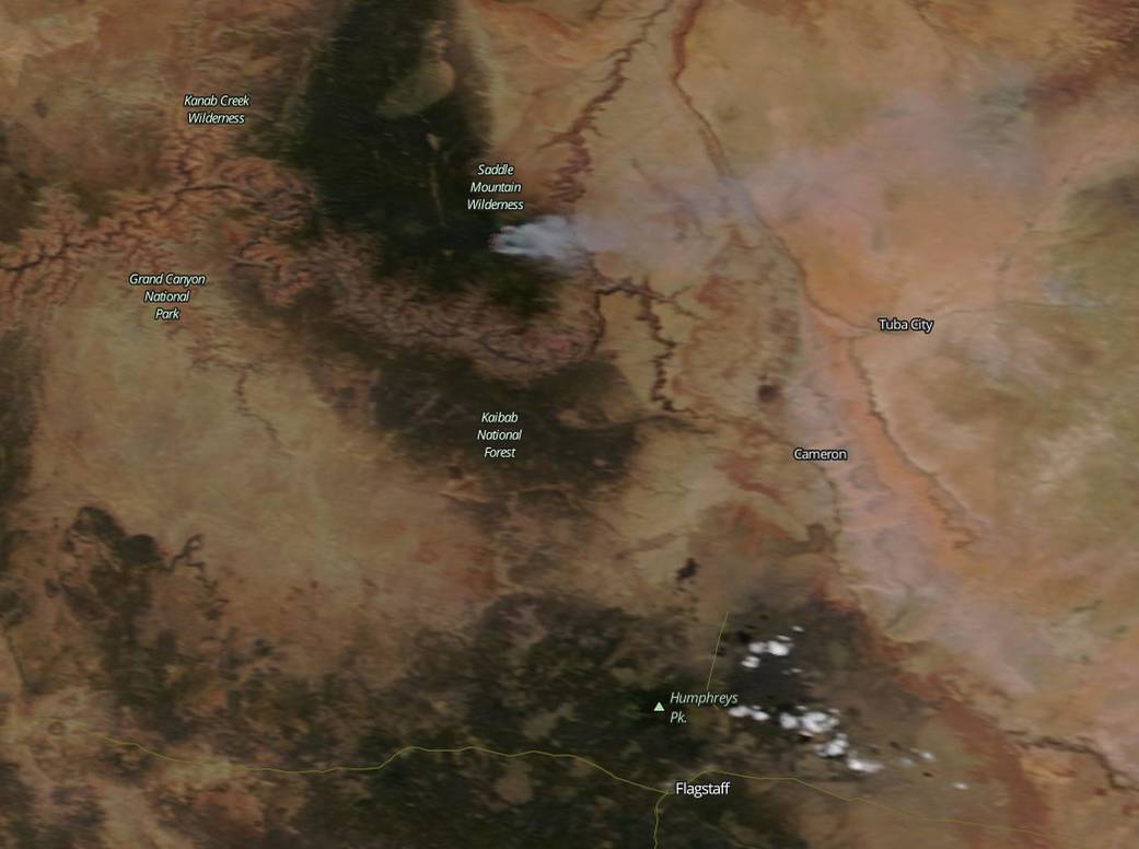
NASA’s Terra satellite passed over Arizona on July 14 and captured a visible image of smoke from several wildfires located north of Flagstaff.
The Scott Wildfire, Airstrip Wildfire, The Wildcat Fire, and Fuller Fire are burning in or near the Kaibab National Forest or Grand Canyon National Park. The Moderate Resolution Imaging Spectroradiometer (MODIS) instrument that flies onboard NASA’s Terra satellite captured an image of smoke from the combination of several of the fires on July 14, 2016. The large red pixels are the heat signature from the fire as detected by MODIS. The smoke, blowing to the east, appears as a light brown color.
The Scott fire was discovered June 28, and has grown to approximately 2660 acres in size. It is located in a remote area on the Coconino rim and Upper Basin near forest road 310 and 307 eleven miles east of Tusayan. Smoke may be visible from both rims of the Grand Canyon, the communities of Tusayan, Cameron, Tuba City, Valle, and from Highways 64 and 180. Inciweb reported this fire is 85 percent contained as of July 14.
The Airstrip Fire was discovered on June 29, and is currently at 679 acres in size. The fire is located just south of the town of Tusayan on the east side of highway 64. As of July 14 this fire was 75 percent contained.
The Wildcat Fire it located in the Kaibab National Forest. The North Canyon and South Canyon trail closures associated with the Wildcat Fire on the North Kaibab Ranger District. The fire began Monday June 13th, 2016 and covered 1,502 Acres. As of July 14 the fire was 70 percent contained.
The Fuller Fire was sparked by lightning on June 29, 2016. It is located on the north rim of the Grand Canyon, near Point Imperial. The fire has covered 2,949 acres and is being managed by the Grand Canyon National Park Service fire managers. Smoke is visible from Highway 67 and the North Rim, Kanab, Marble Canyon, Cameron, and the South Rim.
Image Credit: NASA MODIS Rapid Response, Jeff Schmaltz, Text: NASA Goddard Space Flight Center, Rob Gutro