


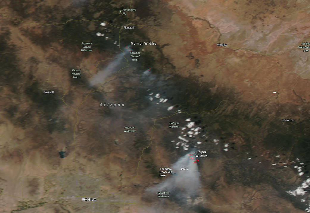
NASA’s Aqua satellite captured an image of smoke streaming from the Mormon and Juniper fires between Phoenix and Flagstaff, Arizona, on June 2, 2016.
NASA’s Aqua satellite passed over the Coconino National Forest and captured a visible image of the two fires. The Mormon Fire is located north-northwest of the Juniper Fire. The Moderate Resolution Imaging Spectroradiometer or MODIS instrument aboard Aqua saw the smoke and detected the heat signature (in red) of the fire on June 2 at 3:50 p.m. EDT (19:50 UTC).
InciWeb provided updates on both fires. Inciweb is an interagency all-risk incident information management system that coordinates with federal, state and local agencies to manage wildfires. For updates on all fires, visit the Inciweb website.
InciWeb said that fire managers with the Coconino National Forest are utilizing the lightning-caused the Mormon Fire to benefit the landscape and maintain a healthy ecosystem by allowing fire to fulfill its natural role in the environment. The fire started on May 15 and has covered 7,847 acres.
The Mormon fire is located approximately 6 miles east of Munds Park near Mormon Mountain, Arizona. Inciweb reported “the lands, roads and trails around the Mormon Fire, in the area east of Mormon Lake and Mormon Mountain, in the area just east of Munds Park north east across FR 700 to FR 132 are closed to entry to protect public safety. The Mormon Fire is a lightning-caused wildfire being managed for multiple objectives to benefit forest health and reduce wildfire risks. The closure was expanded June 2, 2016, to include the area between Munds Park and FR 700.”
In the image, the Juniper Fire was generating a lot of smoke blowing to the southwest. That fire was also caused by lightning. It started May 17 approximately 10 miles south of Young, Arizona, and as of June 2 had consumed 12,682 acres.
For more information from InciWeb: http://inciweb.nwcg.gov.
Image credit: NASA MODIS Rapid Response Team, Jeff Schmaltz
Text: Rob Gutro, NASA’s Goddard Space Flight Center, Greenbelt, Md.