


The Junkins Fire whose epicenter was located in Custer county west of Wetmore has spread tremendously in just a 24 hour period. What began as a fire of several acres on Monday, October 17, 2016, has exploded to cover miles of acreage (15,751 acres as of Tuesday morning) and is currently 0% contained. Firefighters are reporting that the blaze is in deep forest, meaning it could burn for some time. Evacuations in progress with at least 130 homes under mandatory evacuation and 140 homes in pre-evacuation as of Monday. There have been reports of homes and outbuildings destroyed but this is not confirmed.
The incredibly swift spread of the fire was mostly caused by adverse weather conditions. High winds, low humidity, and unseasonably warm temperature spell disaster when fighting fires. Wind gusts up to 70 mph were reported on Monday. Tuesday is expected to bring cooler temps which will bring in more humidity and winds, although not expected to cease, will calm down to a more manageable level. The wind direction is expected to change bringing the smoke to communities that have not yet been affected by it.
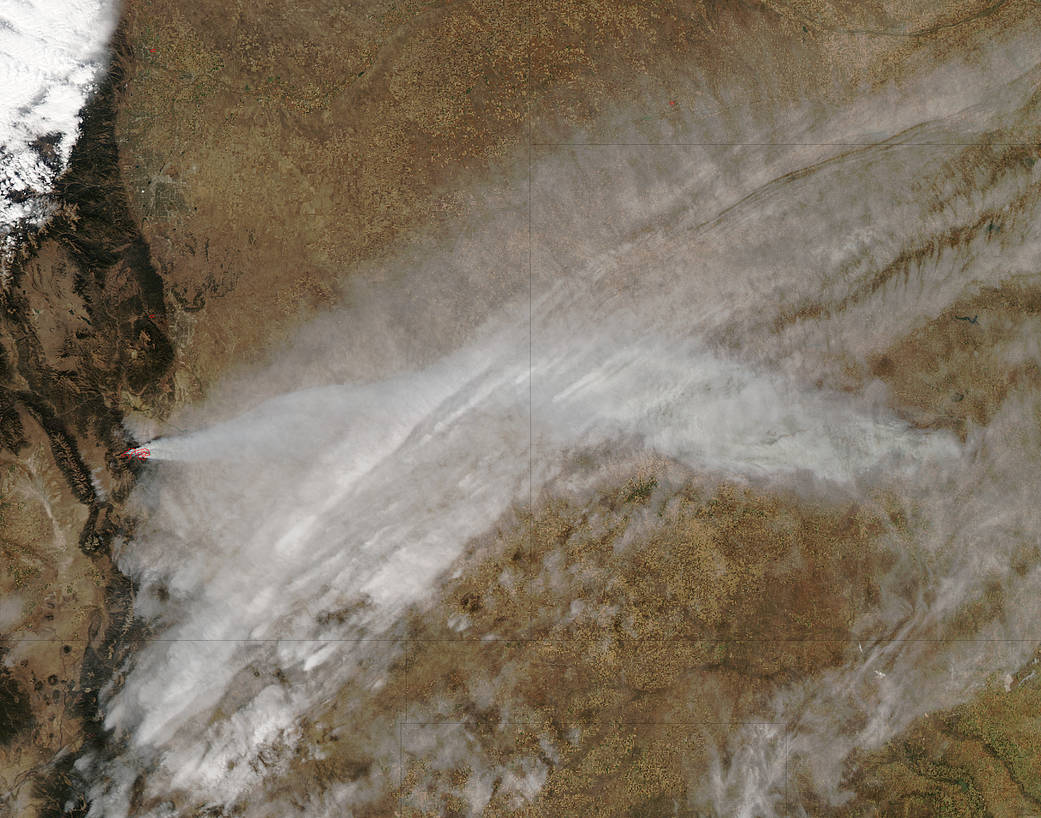
This natural-color image was captured by NASA’s Aqua satellite with the Moderate Resolution Imaging Spectroradiometer, MODIS, instrument on October 17, 2016 at 19:50 UTC (1:50 pm MT). Actively burning areas, detected by MODIS’s thermal bands, are outlined in red. NASA image courtesy Jeff Schmaltz LANCE/EOSDIS MODIS Rapid Response Team, GSFC. Caption by Lynn Jenner with information from the Colorado Division of Homeland Security and Emergency Management.