


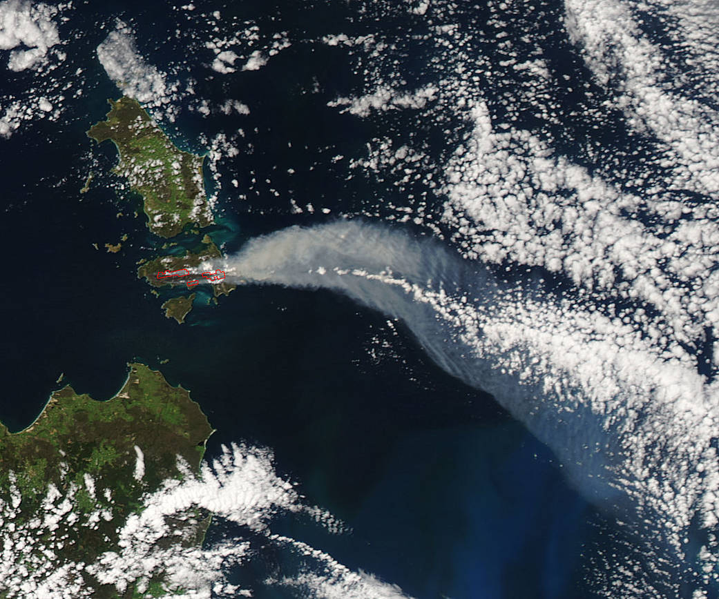
The Tasmanian Fire Service reported that a vegetation fire near Thunder and Lightning Bay, Cape Barren Island, Australia, started on Dec. 4, 2016, and was still blazing on Dec. 6. Smoke from the fire was seen from space by NASA’s Aqua satellite.
Cape Barren Island is one of a trail of islands between southeastern Australia and Tasmania, located in the Bass Strait.
This image was created from data obtained by the Moderate Resolution Imaging Spectroradiometer (MODIS) instrument aboard NASA’s Aqua satellite on Dec. 5 at 11:25 p.m. EST (Dec. 6, 2016, at 0425 UTC). Active fire locations that MODIS detected are outlined in red. A plume of smoke spreads east then southeast.
For information on current road closures, please visit the Tasmania Police website: http://www.police.tas.gov.au/community-alerts
NASA image courtesy MODIS Rapid Response Team. Caption: NASA/Goddard, Rob Gutro