


NASA's Suomi NPP satellite collected this natural-color image of bushfires in the Northern Territories of Australia using the VIIRS instrument on June 13, 2016.
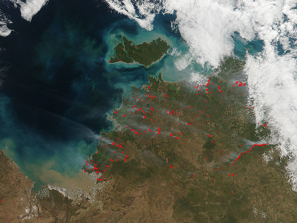
NASA’s Suomi NPP satellite collected this natural-color image of bushfires in the Northern Territories of Australia using the VIIRS (Visible Infrared Imaging Radiometer Suite) instrument on June 13, 2016. Actively burning areas, detected by thermal bands, are outlined in red. Each hot spot, which appears as a red mark, is an area where the thermal detectors recognized temperatures higher than background.
NASA image courtesy Jeff Schmaltz LANCE/EOSDIS MODIS Rapid Response Team, GSFC. Caption by Lynn Jenner