


Satellite Sees the End of Tropical Depression 11E
Tropical Depression 11E came to an end early today, Tuesday, August 18 when the National Hurricane Center noted that the storm degenerated into a remnant low pressure area. NOAA’s GOES-West satellite caught an infrared image of the fizzling system.
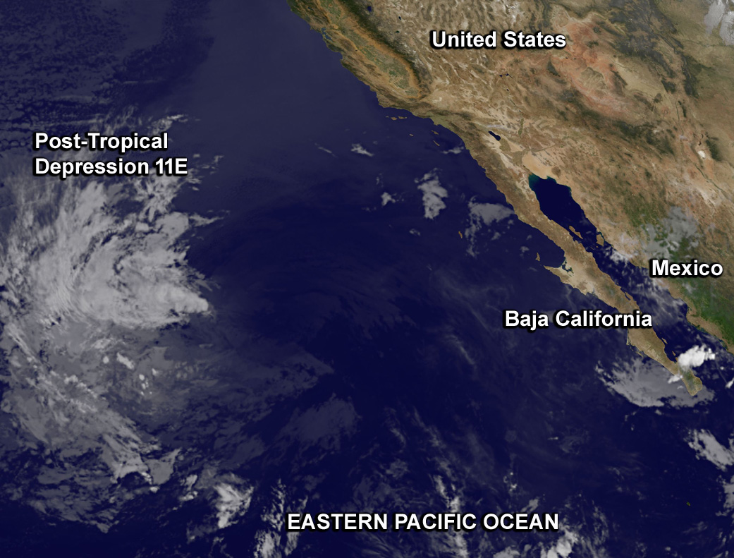
At 5 a.m. EDT (2 a.m. PDT/0900 UTC) the National Hurricane Center (NHC) issued the final bulletin on Post-Tropical depression 11E. At that time, the center of Post-Tropical cyclone 11E was located near latitude 24.9 North and longitude 125.6 West. It had fizzled about 1,000 miles (1,610 km) west of the southern tip of Baja California, Mexico. Maximum sustained winds were near 30 mph (45 kph). The post-tropical cyclone is moving toward the northwest near 16 mph (26 kph). The estimated minimum central pressure is 1005 millibars.
After the final bulletin by the NHC, the depression degenerated into a remnant low pressure area. The circulation center of the remnant low pressure area was difficult to find in the GOES-West infrared image taken at 12:45 UTC (8:45 a.m. EDT).
For additional information on the remnant low see high seas forecasts issued by the National Weather Service.
Rob Gutro
NASA’s Goddard Space Flight Center
Aug. 17, 2015 – Satellite Sees Short-lived Tropical Depression 11E
Tropical Depression 11-E appears to be short-lived as a result of strong vertical wind shear. A recent satellite image showed the clouds associated with the depression were being pushed northwest of the center.
At 0300 UTC on Sunday, August 14/11 p.m. EDT on August 13, the eleventh tropical depression of the season formed well west of Mexico near latitude 16.8 North, longitude 113.5 West.
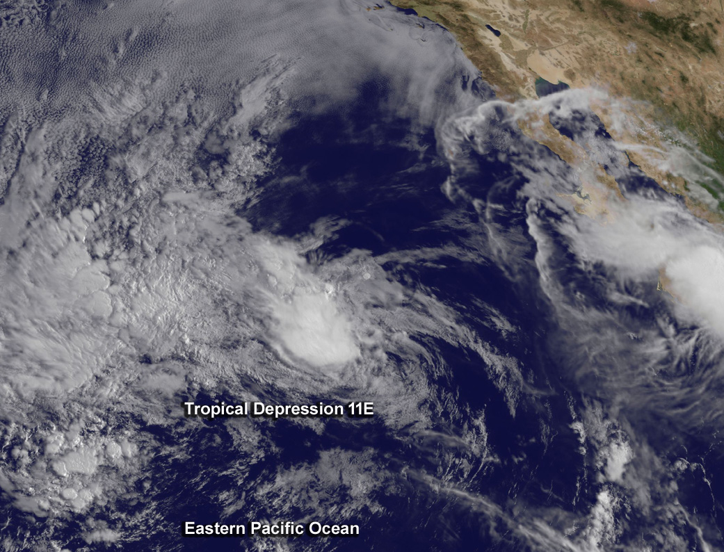
By 11 a.m. EDT on August 17, 2015, the center of Tropical Depression Eleven-E was located near latitude 21.8 North and longitude 120.9 West. That’s about 705 miles (1,135 km) west of the southern tip of Baja California, Mexico. The depression is moving toward the northwest near 16 mph (26 kph). Maximum sustained winds are near 35 mph (55 km/h) with higher gusts and gradual weakening is expected.
A satellite image from NOAA’s GOES-West satellite at 16:15 UTC (12:15 p.m. EDT) on August 17 showed that the clouds and convection (rising air that condenses and forms the thunderstorms that make up a tropical depression) associated with the depression are becoming sheared to the northwest of the low-level center. The National Hurricane Center noted that the center of circulation is becoming increasingly difficult to locate since the circulation is elongated northwest to southeast.
The depression is forecast to become a remnant low later today, August 17, 2015.