


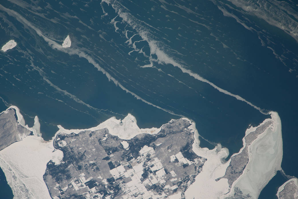
ISS038-E-057977 (22 Feb. 2014) — Snow-covered fields appear as geometric patterns on Washington Island, on Lake Michigan, in this photograph taken by the Expedition 38 crew of the International Space Station. The island is nine kilometers long (5.6 miles) and lies on the western shore of Lake Michigan, as a continuation of Door Peninsula (Wisconsin). Note that north is to the lower left in the image. White coastal ice hugs the shoreline and connects Washington Island with Detroit Island and Rock Island. Ice typically accumulates first near land, where cooling is more rapid than in deeper lake water. Two other snow-covered islands (image top left) are small enough and far enough from land to evade the collars of ice. On the day this image was taken, southwesterly winds were blowing ice into the lake in the form of long, coherent stringers. The thickness of a stringer is related to the length of coastline that feeds it. The smallest northern stringer (image left) is fed by the shortest section of upwind coastline, and the longest (image right) is supplied by the large amount of shore ice around Detroit Island.