


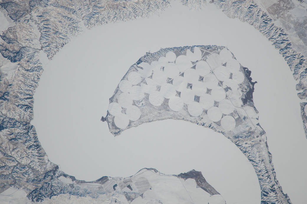
ISS038-E-023651 (26 Dec. 2013) — Lake Sharpe near Lower Brule, South Dakota is featured in this image photographed by an Expedition 38 crew member on the International Space Station. The Missouri River rises in the Rocky Mountains of western Montana, and flows generally to the southeast for approximately 3,767 kilometers (2,341 miles) to its confluence with the Mississippi River north of St. Louis, Missouri — making it the longest river in North America. The river does not follow a straight southeasterly course along this distance, but includes may meander bends such as illustrated in this photograph. This particular bend is occupied by Lake Sharpe, an approximately 130-kilometer (80 miles) long reservoir formed behind the Big Bend Dam on the Missouri River. The lake surface is frozen and covered with snow, presenting a uniform white appearance in the image. As meander bends develop, they tend to assume a distinctive U-shape when viewed from above. Over time, the river channel can continue to cut into the ends of the “U”, eventually bringing them so close together that the river then cuts across the gap to achieve a shorter flow path, essentially short-circuiting or cutting off the meander bend. When this happens and the meander ceases to be part of the active river channel, it may become an oxbow lake. The distance across the narrow neck of land (lower right) associated with this meander near Lower Brule, South Dakota is approximately one kilometer (0.62 miles); however, as the river flow is controlled by the Big Bend Dam downstream, the natural process of meander cutoff has been significantly slowed. The snow cover also highlights circular agricultural fields on the small peninsula within the meander bend. This type of field indicates center-pivot irrigation, where water is distributed from a central point radially outwards using sprinklers to cover the field area. Crops grown here include corn and soybeans according to data from the US Department of Agriculture’s CropScape database.
Photo credit: NASA