


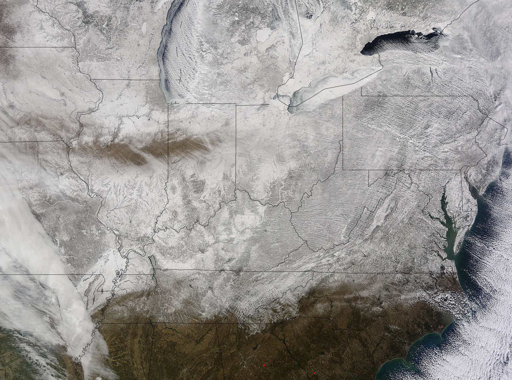
NASA’s Terra satellite captured an image of the snow-covered eastern U.S. that looks like the states have been sitting in a freezer. In addition to the snow cover, Arctic and Siberian air masses have settled in over the Eastern U.S. triggering many record low temperatures in many states.
On Feb. 19 at 16:40 UTC (11:40 a.m. EST), the Moderate Resolution Imaging Spectroradiometer (MODIS) instrument that flies aboard NASA’s Terra satellite captured a picture of the snowy landscape. The snow cover combined with the frosty air mass made the eastern U.S. feel like the inside of freezer. The MODIS image was created at NASA’s Goddard Space Flight Center in Greenbelt, Maryland.
On the morning of Feb. 20, NOAA’s Weather Prediction Center (WPC) noted, “There were widespread subzero overnight lows Thursday night (Feb. 19) extending from Illinois to western Virginia, and numerous record lows were set. Bitterly-cold arctic air is setting numerous temperature records across the eastern U.S. and will keep temperatures well below normal on Friday (Feb. 20).”
In Baltimore, Maryland, a low temperature of 1F broke the record low for coldest morning recorded at the Thurgood Marshall Baltimore Washington-International Airport.
In Louisville, Kentucky, temperatures dropped to -6F, breaking the old record low of 0F, according to meteorologist Brian Goode of WAVE-TV. Meanwhile, Richmond Kentucky bottomed out at a frigid -32F.
In North Carolina, a record low temperature was set at Charlotte where the overnight temperature bottomed out at 7F breaking the old record of 13F in 1896. In Asheville, temperatures dropped to just 4F breaking the old record of 10F in 1979. Temperature records for Asheville extend back to 1876.
Several records were also broken in Georgia, according to Matt Daniel, a meteorologist at WMAZ-TV, Macon Georgia, who cited data from the National Weather Service. Daniel said that Macon set a new record low when the temperature dropped to 18F, beating the previous record of 21F set in 1958. Athens broke a new record low, too dropping to 14F and beating the old record of 18F set in 1958/1928.
NOAA’s NPC noted that “Highs on Friday (Feb. 20) will struggle to get out of the teens from the Ohio Valley to the Mid-Atlantic region. After Friday, temperatures are forecast to moderate and get closer to February averages as a storm system approaches from the west.”
Rob Gutro
NASA’s Goddard Space Flight Center