


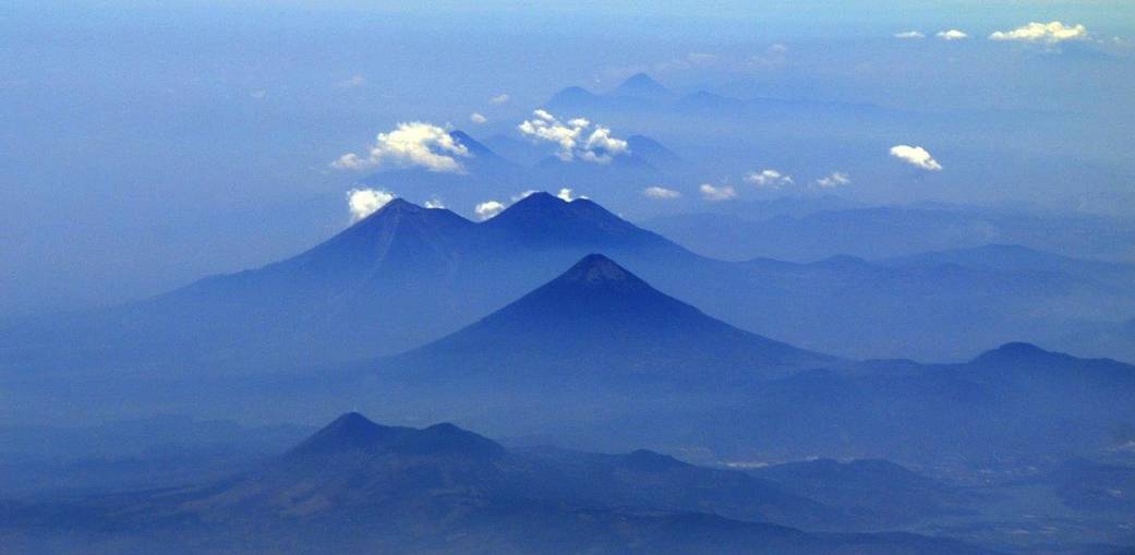
This photo of volcanoes in Guatemala was taken from NASA’s C-20A aircraft during a four-week Earth science radar imaging mission deployment over Central and South America. The conical volcano in the center is “Volcan de Agua.” The two volcanoes behind it are, right to left, “Volcan de Fuego” and “Acatenango.” “Volcan de Pacaya” is in the foreground.
The radar imaging mission got underway in early April when the C-20A departed its base in Palmdale, Calif., to collect data over targets in the Gulf Coast area of the southeastern United States. The aircraft, a modified Gulfstream III, is carrying NASA’s Uninhabited Aerial Vehicle Synthetic Aperture Radar (UAVSAR) instrument in a specialized pod. Developed by NASA’s Jet Propulsion Laboratory in Pasadena, Calif., UAVSAR measures ground deformation over large areas to a precision of 0.04 to 0.2 inches (0.1 to 0.5 centimeters).
The mission schedule calls for the aircraft to make stops in 10 international and U.S. locations, including the Gulf Coast. Research during the deployment is covering a variety of topics, including volcanoes, glaciers, forest structure, levees, and subsidence. It is also providing vegetation data sets for satellite algorithm development. The volcanoes of Central and South America are of interest because of the hazard they pose to nearby population centers. A majority of the research will focus on gathering volcano deformation measurements, with many flight lines being repeats from previous deployments. Surface deformation often precedes other signs of renewed volcanic activity.
Image Credit: NASA/Stu Broce