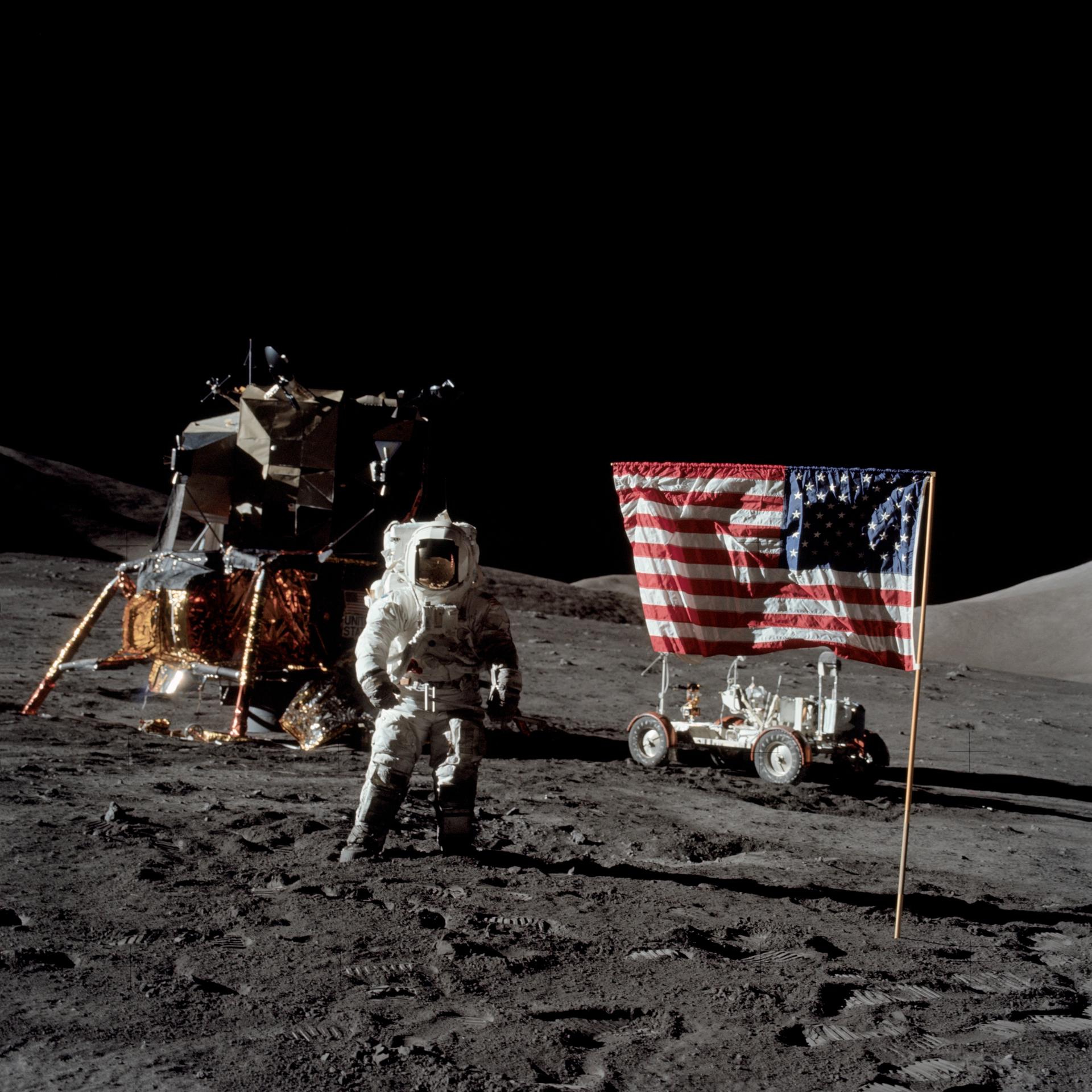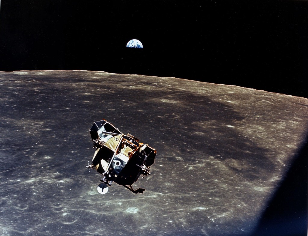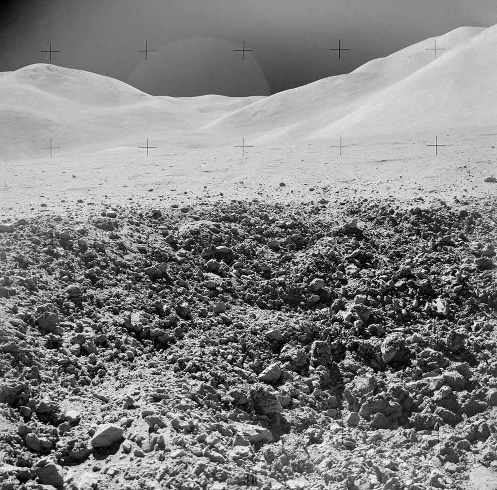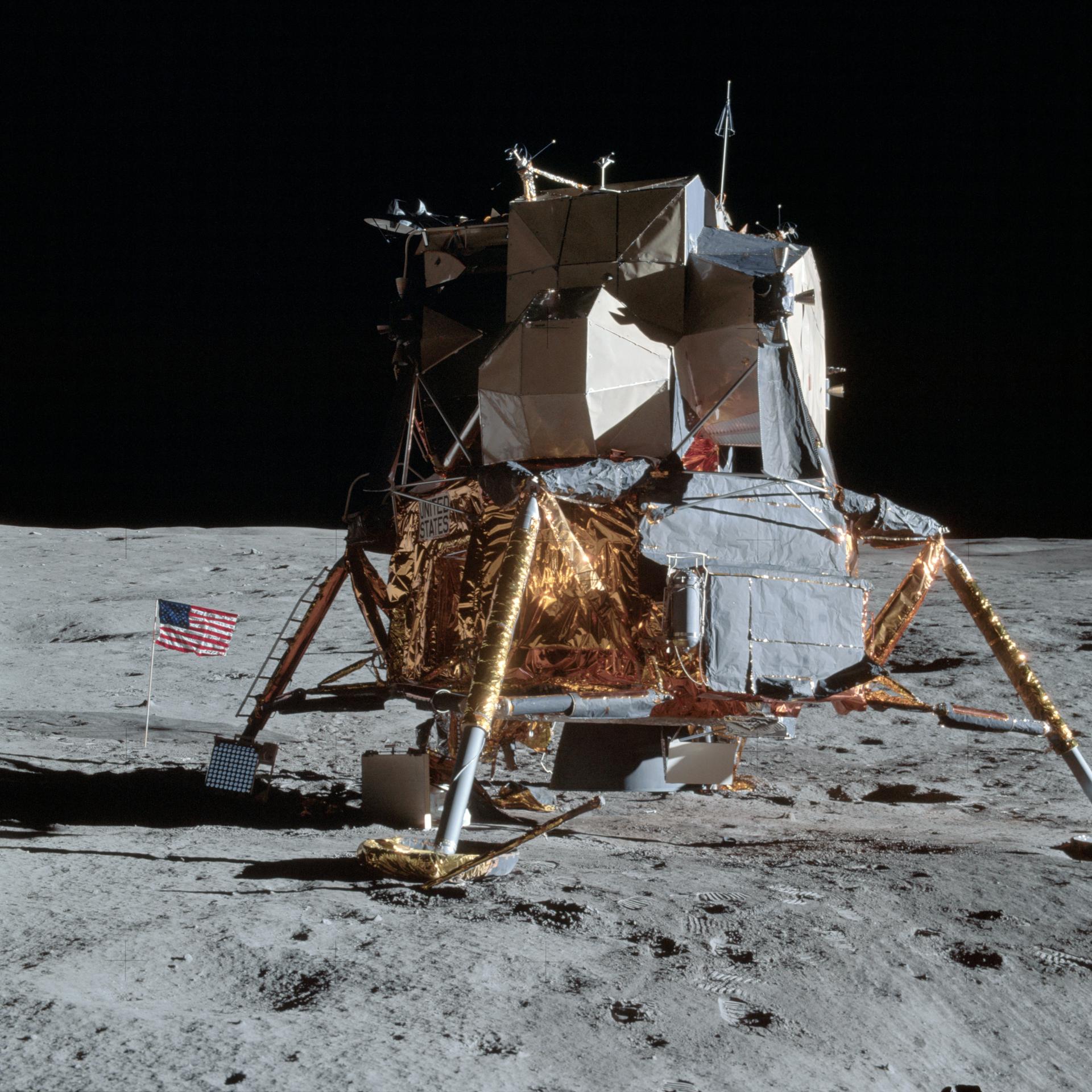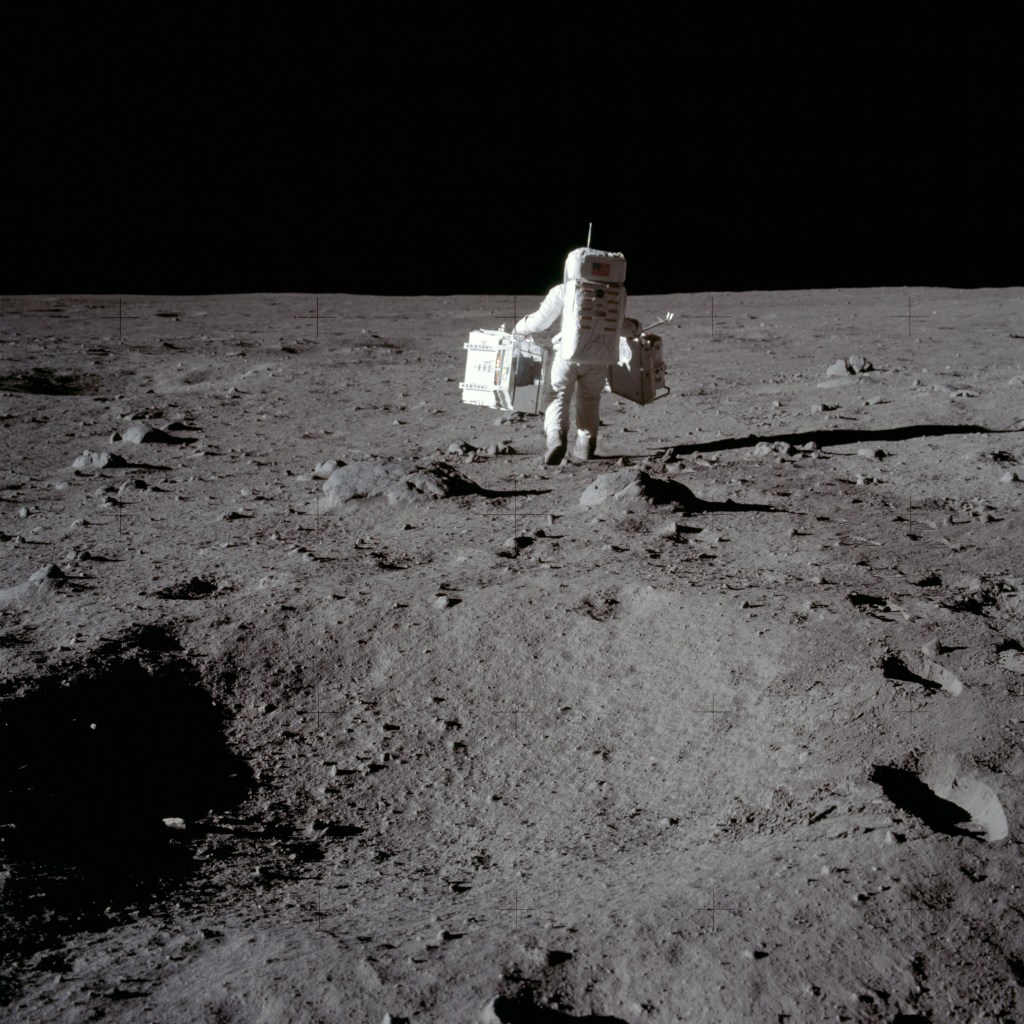
Preps for EVA-2 Traverse | Above the Rover at Station 6 |
MP3 Audio Clip ( 11 min 16 sec ) by David Shaffer
143:03:55 Allen: Okay, Dave. Once again, we want you to exercise the forward steering procedure here.
143:04:06 Scott: Okay. You want to try it first just the way it was and then we'll try the circuit breaker, right?
143:04:15 Allen: Roger. (Pause) The Forward Steering switch should be at Bus Charlie, and the Forward Steering circuit breaker should be finally closed, and then attempt forward steering.
143:04:34 Scott: You know what I bet you did last night, Joe? You let some of those Marshall guys come up here and fix it, didn't you?
[Design of the Lunar Rover was supervised by NASA's Marshall Space Flight Center, Huntsville Alabama. The vehicle was built by Boeing.]143:04:40 Allen: They've been working. That's for sure.
143:04:42 Irwin: (Laughing) It works, Dave?
143:04:43 Scott: Yes, sir. It's working, my friend.
143:04:49 Irwin: Beautiful.
143:04:52 Allen: Lot of smiles on that one, Dave. We might as well use it today.
143:04:56 Scott: Boeing has a secret booster somewhere to (send engineers to the Moon to) take care of their Rover! (Pause)
143:05:13 Scott: Oh, that's so much better. (Pause) See if I can find a level spot around here. (Long Pause) Okay Houston, I'm at the Nav site, and I'll reset here, and I'll give you the readings.
143:06:05 Allen: Roger, Dave. Standing by.
143:06:10 Scott: Okay. As a matter of fact, to make sure we're balanced, I'll hop off. (Pause) Okay, roll is one (degree) to the left; pitch is about, oh, one down; and bearing, distance, and range have recycled to zero and the heading on there now is 305; and the Sun shadow device is about, oh, a half to one (degree) to the right.
143:06:49 Allen: Roger, Dave. And when you are ready you can start torquing towards 285, and we'll modify that in a minute.
143:06:59 Scott: Okay. (Long Pause) Okay. Want to hop on Jim and see if you can get it...
143:07:17 Irwin: I was going to get cameras all adjusted. Okay, we wanted 12 frames per second.
143:07:33 Allen: Jim, while you are climbing on there, we're going to want you to start out towards course 160 for a distance of 1.9 clicks towards Checkpoint Number 1.
[The LM is at about map coordinate BS.4/73.3.]143:07 52 Irwin: Just a minute, Joe, I didn't...[The LM is clearly visible in a detail from Pan Camera frame 9377 provided by the Lunar and Planetary Institute.]
[Checkpoint 1 is at BL.3/75.9. The planned landing site is at BQ.0/74.0.]
143:07 54 Scott: Wait. You got to get up, Jim. You're leaning too far back. Grab the handle low. That a boy. Okay, now you can set down. You're in good shape.
143:08 04 Irwin: Yeah, if I can just get down.
143:08 07 Scott: See if you're hanging up in something. Watch your handcontroller.
143:08:10 Irwin: Yeah.
143:08:11 Scott: Oh, you wait, wait, wait, wait, wait, wait. (Pause) You've got to sort of bias it to the right.
143:08:23 Allen: And, Dave, your torquing angle, exactly, 283, over.
143:08:30 Scott: Okay, 283, Joe. Can you get your seatbelt, Jim?
143:08:33 Irwin: I'm doing that right now.
143:08:35 Scott: Huh? (Pause) Get it up and over the (strap-on thigh) pocket ( 153k ); let me have it here a minute. There, now; bet you can get it. (Pause) Let me get it.
143:08 53 Allen: Rover, did you copy 283 heading, and we're standing by for total Nav readouts before you depart the station.
143:09 01 Irwin: Okay, Joe. We'll park it at 283 (meaning that they will adjust the heading to read 283). Reading about 284 now. Bearing, distance, and range, of course, are zero; amps are 100, 108; (battery temperatures are) 68 (and) 78; and motor temps, forward and rear, are off-scale low.
143:09:28 Allen: Roger, Jim. Copy. And the motor temps are normal.
143:09:35 Irwin: Okay, you going to torque to 283 Dave.
143:09:37 Scott: Yeah, just hold on. That darn cannon plug again down there.
[Having helped Jim with his seatbelt, Dave is now trying to get his own belt on and is having the same trouble he had during EVA-1 with his belt catching on the cannon plug which is alongside the seat on the outside.]143:09:41 Irwin: You want me to hold it for you.
143:09:43 Scott: No. I have to get off and unhook this thing every time.
143:09:55 Irwin: That's bad because every time you bend over like that you put strain on that PLSS antenna.
143:10:01 Scott: Do I really?
143:10:02 Irwin: It bumps against this low-gain (antenna which is mounted on Dave's inboard handhold).
143:10:03 Scott: Oh, I have to be careful. (Pause) Okay. (Pause) Here we go. (Pause)
143:10:39 Scott: Okay, my seatbelt's on. Is your seatbelt on?
143:10:42 Irwin: Yes, sir.
143:10:43 Scott: Okay. (Pause) Here we go!
143:10:53 Irwin: You got to torque that 283...
143:10:54 Scott: Yeah, yeah, yeah.
143:10:55 Irwin: ...It's almost on 283. (Pause)
143:11:05 Scott: Okay, it's 283. Okay.
143:11:13 Irwin: Okay, we're off, Joe; we're moving.
143:11:16 Scott: What's the heading, partner?
143:11:17 Irwin: (To Joe) Give us that heading again.
143:11:20 Allen: Roger; and we're marking. We want you to proceed towards Checkpoint Number 1. Your general heading is 160 at 1.9 clicks and this may take you down between Salyut and Index Craters.
143:11:38 Irwin: Okay.
[Salyut is at BO.2/74.5 and Index is at BO.8/76.5 on the EVA-1,2 Part A map. A larger scale map shows the named features at the site and a map by Journal Contributor Ken Rattee shows an excellent approximation to the actual traverse. The latter can be compared with a traverse map from the Lunar Sourcebook, which has significant errors.]143:11:40 Scott: Okay 160. I'd like to go down there and see those (two craters), just for drill.[By chance, the bearing of the planned landing site from the actual site is about 160 degrees, so Dave and Jim actually are driving toward checkpoint 1.]
143:11:48 Allen: Roger, Dave. No one should come to Hadley Rille without seeing Index Crater, and we'll try to keep you posted on when you're coming up on that.
143:11:58 Scott: (Chuckles) Okay, fine.
143:12:00 Irwin: Joe, I'm going to start the (16-mm) camera here. Will you keep track of it? I'm on 12 frames per second.
143:12:04 Allen: Roger, Jim. We're marking it now. Thank you.
143:12:05 Scott: Wait a minute. Why don't you hold off for awhile, Jim?
143:12:08 Irwin: Okay. Never mind.
143:12:11 Scott: Hold off.
143:12:12 Allen: Roger.
143:12:13 Scott: Let me get squared away here.
143:12:14 Irwin: Okay.
143:12:15 Scott: Hey, Joe, the steering is a new task, Joe. It's really responsive now. I guess I got pretty used to quiet steering, and this thing really turns!
143:12:30 Allen: Roger, Dave. We don't want it to be too easy for you.
143:12:32 Irwin: Hey, look. We can always disengage the rear steering.
143:12:37 Scott: No, I'll get used to it, it's just a matter of getting used to.
143:12:48 Irwin: Okay, on our left, now, we have a very large subdued crater. I'd estimate 4- or 5-hundred meters across. It has a crater of about 25 meters (diameter) on its eastern, inner wall, about half way to the bottom. And on that smaller crater there's some rock exposed. Looks like some bedrock exposed, in that particular crater.
[The 'very large subdued crater' is Last Crater, which has an actual diameter of about 200 meters. The smaller crater on the eastern wall is readily visible in a detail from Pan Camera frame 9809 Journal Contributor David Harland notes that Last Crater is the large crater shown in Dave Scott's SEVA pan in the direction of Silver Spur. The smaller crater in the east wall is "prominent in the very-early-morning, SEVA view - the shadows are much less pronounced during the outbound EVA-2 traverse, 37 hours after the SEVA". During the drive back to the LM, Dave and Jim will keep an eye out for the bedrock exposure that Jim mentions here. That discussion starts at 147:01:30.]143:13:24 Scott: I'm going to hold up here.
143:13:30 Irwin: You want to disengage rear steering, maybe?
143:13:31 Scott: Yeah.
143:13:32 Irwin: Okay, we're stopping, Joe.
143:13:34 Scott: Just a minute.
143:13:35 Allen: Okay, Jim. Stopping.
143:13:40 Scott: Okay, try it that way.
143:13:41 Irwin: Okay, we're moving again.
143:13:42 Allen: Roger. And your description is remarkable, remarkably similar to Index. Perhaps you're looking at Index Crater.
143:13:56 Irwin: I guess it's the largest crater that I've seen, Joe, as far as (lost under Joe).
143:13:59 Allen: Roger. We'll reserve judgment on that, but keep describing, please. Sounds great.
[Based on the bearing and range they report at 143:15:30, they are now somewhere near the southern end of Last Crater, and are about a kilometer northwest of Index Crater.]143:14:07 Irwin: Okay, we're heading 155 and at our 1 o'clock position, there's a doublet. Gee, I think it's the doublet we drove across yesterday. I'll tell you in a moment when we see our tracks. Do you want to talk, Dave?
143:14:29 Scott: I just want to tell them I turned off the rear steering to see how she works with the front and it's really a lot better. The double Ackerman's a little too responsive when you have the lack of traction, especially on the slopes.
[Double Ackerman means having both front and rear steering.]143:14:46 Allen: Roger, Dave. Copy that. Why don't we save the double Ackerman for the rougher terrain later on.[Jones - "Does 'lack of traction' refer to the wheels being off the ground?"]
[Scott - "Yeah. Moving relatively fast on an irregular surface, you don't have much grip. And then, with both front and rear wheel steering, you oversteer because, if the wheel comes off and it's being turned, it comes down at angle and it's going to sort of whip you around. Double Ackerman's good when you're going slow, with all four wheels. It's pretty good."]
143:14:54 Scott: Yeah. I think that's a good idea.
143:14:58 Irwin: Okay, Joe. I mentioned those...It's really a triplet arrangement here that we just passed on our right. I did not see our tracks.
143:15:06 Allen: Roger.
143:15:07 Irwin: So we're definitely east of our track from yesterday.
143:15:14 Allen: Roger. We agree.
143:15:15 Irwin: We're heading 170. (Pause)
143:15:28 Allen: Okay, Jim. And you...
143:15:29 Irwin: And our range is 0.5.
143:15:30 Allen: ...may very well be coming up on Arbeit Crater.
[A range of 0.5 kilometers on a heading of 170 degrees puts them near BQ.4/73.6. Arbeit Crater is still a kilometer SSE of their current location.]143:15:34 Scott: I think we are.
143:15:35 Irwin: I think so, Joe!
143:15:36 Scott: Yeah.
143:15:37 Irwin: I think so. There's a fairly fresh one here with angular blocks on the rim.
143:15:43 Allen: Roger. Give us the size...
143:15:44 Irwin: Look at that one directly ahead, Dave.
143:15:45 Allen: ...on the largest, please.
143:15:46 Scott: Yeah, I see it.
143:15:47 Irwin: That's Pahoehoe (a Hawaiian term for the smooth, rope-like form of solidified lava). (Answering Joe) Yeah, the largest ones I would estimate 2 or 3 feet, angular. There's one on the southeast rim that has a flat top. In fact, it looks like a rectangular block. But there are several fragments down there that have the Pahoehoe texture that Dave mentioned yesterday.
143:16:10 Scott: However subtle, though.
143:16:12 Irwin: (Chuckles) Yes. However subtle.
[Jones - "You'd been out to Hawaii..."]MP3 Audio Clip ( 13 min 10 sec ) by David Shaffer[Scott - "Aa and Pahoehoe. We'd been schooled on that, extensively. And it's a good cue for the guys in the Backroom on what we're seeing. Aa is the jagged and Pahoehoe is the smooth."]
[Jones - "And everybody in the loop - at least you and Jim and Joe and the people in the Backroom - knows what Pahoehoe is."]
["What did you mean by 'however subtle'?"]
[Scott - "Well, it's not really a distinct Pahoehoe. It's got the characteristics of a pahoehoe, as differentiated from an Aa. And the only reason we use the terms is to say, 'gee, these really aren't rough. These are angular blocks, but the surface texture looks smoother.' So, 'however subtle' means it doesn't look like the classical Pahoehoe. But, in order to put a tag on it, to classify it quickly, you use that term and at least it puts it into some sort of boundary."]
143:16:15 Allen: Roger; copy.
[The cuff checklist pages covering the traverse are CDR-6, which is blank: CDR-7, which covers the to the now-deferred Station 4; CDR-8, which is a sketch map of Station 4; CDR-9 which lists features of potential interest on the way to Checkpoint 2; and CDR-10, which covers the traverse between Checkpoints 2 and 3. Jim has identical pages in his checklist. The decision to defer Station 4 was discussed at 139:43:48. The checkpoint locations are shown on the EVA-2 contour map.]143:16:21 Irwin: Okay, range is 0.6. We're heading 160.
143:16:29 Scott: And we're doing about 8 to 9 clicks.
143:16:32 Allen: Okay, Dave. Sounds good. Standing by for amps.
143:16:38 Irwin: Okay; amp reading is...Let me get my hand down there, Dave (to shadow the gauge). I want to put my hand down there to get the amps.
143:16:46 Scott: Okay, go ahead. (Pause) Let me get it.
143:16:50 Irwin: I got it. Okay, the max looks like about 10 amps.
143:16:57 Allen: Roger, good enough.
143:16:58 Irwin: Get no reading on 2. (Pause) Okay, coming up on our right is a very subdued crater again. No blocks at all on its rim, and it is about 50 meters in diameter.
[Jones - "In talking about crater sizes and the presence of blocks on rims, some people would use that as an indication of the depth of the regolith. Would that have been something you were thinking about?"]143:17:16 Scott: Okay. Let me stop and get the rear steering going.[Scott - "I think this is an observation, not a conclusion."]
[Jones - "But you're providing data for that kind of analysis."]
[Scott - "Sure. And subdued and old and rounded versus sharp, angular. And did it dig up bedrock? Well, bedrock could be the underlying lava beneath the regolith. So, yeah, this is giving cues as to whether or not the impact penetrated the regolith. Or it (meaning the blocks) could be part of the projectile or...there are a lot of options."]
[Jones - "Having the lava and then the regolith on top and having impacts punching through that is not like anything you have here on Earth. I mean, you certainly have exposed lava beds and you certainly have buried lava beds..."]
[Scott - "But you don't have the impacts. I mean, very seldom do we get impacts. Meteor Crater is an example, and there's nothing left of the meteor. The impacts on the Moon, in many cases, were not hypervelocity, so you probably had the projectile still intact (in those cases), so these blocks that we're seeing could have been excavated from beneath the regolith or they could be part of the projectile that came in to make the hole."]
[Jones - "But blocks, no blocks, subdued, sharp are the basic descriptors for crater morphology. Did it come fairly easily, naturally, that you'd describe things in those terms?"]
[Scott - "Sure. At one point (143:12:48), Jim said it looked like bedrock, which means that Jim's impression was that the rock was excavated from beneath the regolith. That's one of two choices. 'Cause I remember the one I took the picture of - 'cause I've seen the picture a lot - where there was a block of slightly less than a meter size downstream of a crater, which would lead one to believe that that made the crater. Or, the crater could have been made by something coming in much faster - 'cause there was glass in the crater - and the block was extraneous to the situation."]
[This photo is AS15-82- 11065 which Dave takes at about 164:53:35 during the outbound EVA-3 traverse. The crater in question is at the right side of the frame and is surrounded by clumps of compacted soil known, formally, as "regolith breccia" or, informally, as "instant rock". The presence of glass inclines me to think that Dave's second hypothesis is the correct one - that the crater was created by a relatively small, high-velocity impactor and that the rock is not related to the crater.]
[Jones - "And you have to ask if there's glass on the rock. If there is, then the rock was probably glass coated before it hit and left some in the crater."]
[Scott - "Do they match? So Jim's observations are not really conclusions."]
[Jones - "Which is an important distinction."]
[Scott - "I'm not sure that you could conclude that the blocks we're seeing were excavated. We've seen secondaries; and these could be secondaries."]
[Jones - "And what Jim's basically doing is describing what's notable, what's distinctive, what's characteristic of the forms he's seeing around him. And that's a kind of thing you learned how to do in the geology training. No matter what the particular setting, you learned to notice the characteristic things."]
[Scott - "And you could draw conclusions from that, but I don't think he was drawing any conclusions. I think he was only observing. And there were two choices (a high-velocity, primary impact that has dug up bedrock, or a low-velocity, secondary impact that left remnants of the impactor scattered in the crater). The South Cluster was considered a secondary."]
["And to follow up, if he saw what he thought was bedrock, he may have seen some exposure within the walls of that small crater that indicated that there was basalt that had been penetrated - like the side of the rille, where you can see the layering of the basalt. So he could have drawn the conclusion of bedrock. It depends on how much you get to see."]
[Jones - "Or some subtle clues like larger blocks close to the rim. Patterns of things that tell you it's primary ejecta rather than projectile remnants."]
143:17:17 Irwin: Okay. We stopped, Joe.
143:17:19 Allen: Roger. (Pause)
143:17:24 Scott: Now we're going again, Joe.
143:17:25 Allen: Okay.
143:17:27 Irwin: And I see a very large crater over at 1 o'clock.
[This may be Salyut.]143:17:32 Scott: Okay, let me just get the steering squared away here, Jim.
143:17:35 Irwin: Yeah. Okay, we've stopped.
143:17:37 Allen: Roger, Jim; and that might very well be Earthlight at 1 o'clock. And Domingo Crater should be on your left, now.
[Earthlight is at BJ.5/75.5 and Domingo is at BK.3/76.3. Houston still thinks Dave and Jim are a kilometer south of their actual location. See the EVA-2 map and the map showing feature names.]143:17:50 Irwin: Okay. We'll give you a little more report when we get a little closer to it.
143:17:54 Allen: Roger.
143:17:58 Irwin: I'm going to hold off too many comments here until Dave gets the steering squared away.
143:18:05 Allen: Roger.
[Scott - "There is so much to see up there, all of which is brand new - because, again, we had no photography at this resolution, whatsoever. So, old Jim is just having a ball! All this stuff to talk about, and it's all different and all new. And I'm trying to get the thing to steer. I can't wait! That was part of the excitement of the whole region, 'cause you could have just stopped there, and you could have looked around, and you could have spent several hours describing what you see, 'cause it's all so different."]143:18:06 Scott: Joe, it feels like the rear steering, when I turn it off, doesn't center. Feels like my rear wheels are drifting. So I guess I better turn it back on. (Pause)[Jones - "Even at the 17 site - where they had good overhead photography from 15 - there were still a lot of surprise on the ground, because even the pan camera doesn't give resolution better than about 10 meters. So things like the actual distribution of blocks on the rim of Camelot Crater and the nature of Shorty Crater were still surprises on the ground. From the orbital photographs, you get some information about lateral organization, but not so much vertical organization, and so on."]
143:18:34 Allen: Roger, Dave. We agree...
143:18:35 Irwin: And we're gradually increasing. A very gentle slope.
143:18:36 Allen: ...maybe you should turn it back on.
143:18:43 Scott: (To Joe) Yeah, I guess you might think about why they don't center for us.
143:18:45 Allen: Roger. That sounds like the Rover moves like Jim's sand crabs move. (Jim laughs)
143:18:53 Scott: Yeah, that's just exactly what it feels like too.
143:18:57 Irwin: Dave, if you could swing to the right here, we could go by the rim of Earthlight - what Joe is calling Earthlight (but is probably Salyut).
143:19:02 Scott: Good. Let's do that. Well, there's a big thing here in front of us, too.
143:19:05 Irwin: Yeah, but we could swing...Can you get around to the right? Maybe not!
143:19:09 Scott: No, let's go to the left. We're not going to stop at Earthlight. Let's go left.
143:19:12 Irwin: Okay.
143:19:14 Scott: Because that's a big excursion there. (Pause)
143:19:22 Irwin: Okay, now we're going downslope.
143:19:27 Scott: Well, we're going in and out of the craters.
143:19:29 Irwin: I get the impression, out to our left, that there is a shallow depression there.
143:19:35 Scott: Gee, over to the left there is a big hole. Huh? See that over there?
143:19:41 Irwin: Yeah.
143:19:42 Scott: A big subtle crater. Oops, and we're coming up on a sharp one!
143:19:50 Irwin: Hey, you got those two ahead of us there?
143:19:52 Scott: Yeah. See if we can find a reasonable path through here. (Pause)
[Scott, from a 1996 letter - "(The preceding dialog) is a pretty good indication of the irregularity of the surface. I have yet to see a photo that captures the many, local elevation changes. It would be great if somebody could do a surface model and then put the LRV on it, provide a driver's-eye view, and then 'IMAX' it!]143:20:08 Irwin: Okay, we're heading 140; we're out to 1.0 (km from the LM).
143:20:14 Allen: Roger; Jim, copy.
[What seems likely is that, in order to avoid Salyut, Dave has turned to a heading of 140, as indicated on Ken Rattee's map by the bend to the east immediately north of Salyut and directly west of Index. If they are 1.0 kilometers from the LM at a bearing of 160, they are near BO.6/74.7. The 'sharp' crater that Dave mentioned at 143:19:42 could be the raised-rim crater at about the 1:30 position just outside the rim of Salyut that is marked on a detail from Pan Camera frame 9809.]143:20:16 Irwin: Doing 9 clicks.
143:20:18 Allen: Beautiful.
143:20:22 Scott: I think we're going by a very large one here, over at the 9:30...9 o'clock, Jim, huh?
143:20:27 Irwin: Yes.
[On a heading of 140 passing northeast of Salyut, they would have Index would, indeed, be at a 9 o'clock with the near rim no more than 250 meters from them. Index is about 350m in diameter.]143:20:28 Scott: What do you suppose that is?
143:20:29 Irwin: It could be Domingo.
143:20:30 Scott: No, it's too big!
143:20:31 Irwin: Too big for Domingo?
143:20:33 Scott: Couple of hundred meters.
143:20:34 Irwin: Let's see, 1 out...Let's see, Checkpoint 1 is...You said 1.7.
143:20:51 Allen: Dave and Jim, that could be, possibly, Index Crater, if you started from where we thought. The distance is right on that. And continue on towards Checkpoint 1.
143:21:05 Scott: Okay, I would say that probably was Index. It was about that size.
143:21:14 Irwin: Okay, you've got the right bearing.
143:21:16 Scott: Yeah. That's nice, huh?
143:21:17 Irwin: Yeah. We're going for 1.7.
143:21:20 Scott: Going for. Yeah, okay, we're 1.2 now.
143:21:23 Irwin: Yeah.
[Houston suggested an average heading of 160 degrees and, as Dave indicates at 143:21:55, their average heading - corresponding to a bearing of 340 degrees - is very close to the suggested figure. At a range of 1.2 kilometers, they are near BN.9/74.9.]143:21:28 Scott: There's a nice deep one there that's smooth and rounded, about 30 meters across.
[The 'smooth, round' crater could be the one at about BN.4/75.1 which is also marked on the detail from Pan Camera frame 9809.]143:21:34 Irwin: You know, on one of these trips, we ought to stop at one of these very fresh ones and really sample it.
143:21:38 Scott: On the way back we'll get that one.
143:21:39 Irwin: Yeah. I mean these small ones, you know, just filled with...
143:21:48 Scott: Oh, yeah.
143:21:49 Irwin: ...rock debris and glass in the middle. Just do a systematic sampling on it.
143:21:53 Scott: Yeah.
143:21:54 Irwin: Like this one over here at 1 o'clock.
143:21:55 Scott: Yeah, I know what you mean. (Pause) Okay, bearing is now 339 and the range is 1.3. Look out, oh!
[Dave took his eyes off the "road" to look at the Nav readouts and didn't see a crater. They are now near BN.5/75.2. That location is on the rim of the 'smooth, round' crater. Note that, because the range is given by the nav system in tenths of a kilometer, the range uncertainty is at least plus or minus 50 meters, which corresponds to plus or minus 0.2 map units. That is, for this location more or less south of the LM, the indicated location is between BN.3 and BN.7.]143:22:09 Irwin: Ohhhh! Whoa baby![Rattee puts Dave and Jim about 150 meters east of the indicated location and on a path that will take them around the east side of Arbeit. His reasons for doing this are based primarily on evidence in the dialog during the return to the LM. See the discussion following 146:57:58.]
143:22:11 Scott: Okay. We're all right.
143:22:12 Irwin: Yup. (Pause) Great machine.
143:22:16 Scott: Yeah; does it good. (Long Pause)
143:22:46 Allen: Okay, Rover, Checkpoint 1 is 160 at 1.9 clicks, and there's no need to stop there. We can press on towards Checkpoint 2, if you're satisfied.
143:23:01 Scott: Yeah; Rog. I guess we're okay, Joe.
[Jones - "Would you have ever contemplated stopping at one of these checkpoints? It's just a distance/bearing point, isn't it?"]143:23:04 Irwin: Okay, we've got the right bearing. We're at 1.4 now, Joe.[Scott - "I don't recall. It was a feature, but it wasn't a station. But, if it was of interest, you might stop because you would think you knew where you were."]
143:23:07 Allen: Okay, Jim, and we're enjoying your description.
143:23:15 Scott: Why don't you just give them a running comment; I'll keep my eyes on the road.
143:23:20 Irwin: Okay, there's a...
143:23:21 Allen: Sounds like a good idea.
143:23:22 Irwin: (Lost under Joe)...a crater on our right now about 50 meters in diameter with a lot of gray fragments on its rim. And we're just passing one (rock) that's sitting right on the surface - about 2 feet, subangular. I can look out now and see the South Cluster and I get the impression of perhaps, some horizontal beds in the first mound in the South Cluster. I do see a lot of blocks over in that direction; particularly the second mound - the west side of the second mound that appears to be in the Secondary Cluster.
143:24:13 Allen: Roger, Jim. Copy.
143:24:14 Irwin: Probably over the area of Crescent.
[As indicated on the map showing feature names, Crescent Crater is the northwestern member of the South Cluster.]143:24:18 Irwin: Okay, we're 1.7. And, again, we have a very fresh crater on our left with several blocks.
[They left the LM at 143:11:13 and, therefore, have an average, straight-line speed - or range rate - of 7.8 km/hr.]143:24:36 Scott: The blocks (are) about a meter or so and the crater is probably about 15 meters, like it might have excavated or been a secondary, huh?
143:24:47 Irwin: Yeah, well, notice all the debris here, that the surface is covered with more debris in this particular area than what we've seen before.
143:24:53 Scott: Yeah, it sure is.
143:24:54 Irwin: Just around that particular crater.
143:24:56 Scott: Yeah, "more" being probably 2 percent (surface coverage).
143:25:00 Irwin: (Chuckles) Yeah.
143:25:01 Scott: It's noticeably more.
143:25:04 Allen: Roger. We copy that. And, Jim, you may want to start your (16-mm movie) camera, if you think this is a good area, and don't hesitate to fire off shots from the hip with your 70 millimeter.
[On Apollo 16 and 17, Charlie Duke and Jack Schmitt took traverse photos at regular intervals with their Hasselblad cameras during the traverses. They were wearing their cameras on their RCU brackets and had no trouble getting good horizon centering. Photo AS15-85- 11471, which Jim took at the start of the EVA, shows Dave seated on the Rover with his camera pointed virtually level.]143:25:19 Irwin: Okay, I'm going to start the...
143:25:21 Scott: Point it (meaning the 16-mm camera) down, Jim; it's pointed up a little too much, here.
143:25:24 Irwin: Okay. (Pause) About like that?
143:25:30 Scott: Yeah, that's dandy.
143:25:32 Irwin: Okay, I'm starting the camera, Joe.
143:25:35 Allen: Roger. We got the mark, and we'll watch it.
143:25:38 Irwin: Tracking...(Responding to Joe) Okay.
[Jones - "I wasn't aware that the vertical pointing of the 16-mm camera could be changed but, in AS15-85- 11471, it is definitely pointed up. In the picture, we can see that Jim's got a map mounted on the accessory staff. We can even see your OPS antenna. This was taken toward the west, so Bennett Hill is in the background. Its got good definition on the Rover wheels. TV camera pointed down and aft in its stowed position. We can see where you taped the cable to the high-gain antenna staff. There's your tongs on the back. And the penetrometer. It's a good Rover picture. And a handsome portrait of the Commander, as well."]143:25:44 Scott: Reckon we can get between those two there? Yeah. (Pause) It's a bridge between two, about 20 meters in diameter, a little doublet and the one on the left has got a bunch of debris, and the one on the right has got nothing, huh, or very little.[Scott - (Tongue-in-cheek) "All you can see is a suit and backpack. It's not clear I was there. You don't see me there, do you?"]
[Jones - "You're right. It could be an Inflatable Astronaut!"]
143:26:12 Irwin: Boy, there was a very large crater over on our 1 to 2 o'clock position.
143:26:17 Scott: Oh, yeah!
[They have been driving for two minutes since giving their last range readout of 1.7 km and, if Dave has been driving more or less away from the LM, they are now at a range of about 2 km and are somewhat north of Earthlight Crater. As Jim indicates in a moment, they are also somewhat east of Earthlight, perhaps near BL.1/76.5.]143:26:18 Irwin: That's the largest one...Oh, I guess it would be equal (to or) maybe larger than...Well, larger than Elbow, certainly.
143:26:26 Scott: Yeah, it looks like it. You can't see too much of it but it does...
143:26:29 Irwin: I don't see that on the map.
143:26:33 Allen: Dave and Jim, we think you might be looking at Earthlight now. It might be...Its long (meaning north-south) dimension is greater than the east-west dimension.
[The north-south elongation of Earthlight is not terribly obvious on Pan Camera frame 9809. On the north side, Earthlight appears to overlap a smaller, shallower crater which may have contributed to the apparent elongation shown in the pre-flight maps and may be visible from the ground.]143:26:44 Irwin: Okay, well that's certainly true. Certainly true. (Pause) Okay, you would have us east of Earthlight.
143:26:56 Scott: Hey, here's a big deep one here (lost under Joe)
143:26:57 Allen: That's exactly correct. And Arthur Clarke would be proud of you.
[Earthlight is a Clarke novel.]143:26:58 Scott: ...about 50 meters...(Stops to listen to Joe)[Journal Contributor Harald Kucharek calls attention to the following from Clarke's novel 3001: The Final Odyssey: "It gives me particular pleasure to pay this tribute to the crew of Apollo 15. On their return from the Moon they sent me the beautiful relief map of Falcon's landing site, which now has pride of place in my office. It shows the routes taken by the Lunar Rover during its three excursions, one of which skirted Earthlight Crater. The map bears the inscription: 'To Arthur Clarke from the crew of Apollo 15 with many thanks for your visions of space. Dave Scott, Al Worden, Jim Irwin.' In return, I have now dedicated Earthlight (which, written in 1953, was set in the territory the Rover was to drive over in 1971): 'To Dave Scott and Jim Irwin, the first men to enter this land, and to Al Worden who watched over them from orbit.' After covering the Apollo 15 landing in the CBS studio with Walter Cronkite and Wally Schirra, I flew to Mission Control to watch the re-entry and splashdown. I was sitting beside Al Worden's little daughter when she was the first to notice that one of the capsule's three parachutes had failed to deploy. It was a tense moment, but luckily the remaining two were quite adequate for the job."]
143:27:03 Irwin: Okay, and on the south...I can just barely see the western slope of Earthlight. But the southern slope of it, I can also see, has several blocks on it.
143:27:25 Scott: Hey, Jim. Check the camera. I don't think it's running. I don't see any change in the...
143:27:32 Irwin: Not changing?
143:27:33 Scott: ...the quantity indicator. Why don't you feel it?
143:27:36 Irwin: I did and...
143:27:39 Scott: The film apparently is not running through.
143:27:44 Irwin: Okay, it's stopped now.
143:27:45 Scott: Yeah; why don't you try it again. (Pause) Make a little turn here.
143:27:54 Irwin: Okay, it's trying to run, Dave.
143:27:57 Scott: Okay, point it to the forward and let's see if it will...I just noticed that the film counter wasn't going.
143:28:02 Irwin: Yeah. I hope we don't have another...
143:28:07 Scott: Yeah.
143:28:08 Irwin: ...film problem.
143:28:09 Allen: Dave and Jim, the film counter may not have dropped off the hard-stop yet. It's only been going a couple minutes. We need a range and bearing, if you'll give it to us, please. And continue on; we'll watch the camera.
143:28:21 Irwin: Okay, bearing is 358; range is 2.2.
143:28:28 Allen: Roger...
143:28:29 Scott: I think bearing's 338.
143:28:30 Allen: ...and let the camera run.
143:28:32 Irwin: Yeah, isn't that what I said? What did I say?
143:28:36 Scott: You said 358.
143:28:38 Irwin: Okay, 338.
143:28:39 Allen: Roger; copy. 338. (Long Pause)
[They are now near BK.2/76.6. On Ken Rattee's map, they are very close to that location, which is east of Earthlight and NW of Crescent, which is the large crater immediately NE of Dune..]MP3 Audio Clip ( 12 min 11 sec ) by David Shaffer
143:29:00 Scott: Get around this blocky area here. (Pause)
143:29:09 Irwin: Boy, it looks like we're coming down...have to go through a small valley.
143:29:12 Scott: Yeah, sure does.
143:29:15 Irwin: That valley off to the left.
143:29:18 Scott: Oh, yeah! And that's a north-south trending, isn't it?
143:29:23 Irwin: I hope we can get through this way.
143:29:25 Scott: Oh, the old Rover will make it - with a few little excursions.
143:29:31 Irwin: It looks more like a valley, you know, that runs east-west.
143:29:35 Scott: Yeah, sure does. (Quietly) Oh, come on. Easy does it. (Pause) Look at that big hole there, Jim! Are we up on Dune? Yeah, there's a rampart over there.
143:29:54 Irwin: I was wondering whether we could possibly be at Dune.
143:29:58 Scott: Could we be at Dune?
143:29:59 Irwin: Or Crescent?
143:30:00 Allen: Dave, I think you're probably...
143:30:01 Scott: Crescent? Boy, that's the biggest one we've seen.
143:30:02 Allen: ...looking into Crescent.
[As shown on the larger-scale, Apollo 15 Named Features map, Crescent Crater is the northwest member of the South Cluster.]143:30:05 Irwin: Yeah, I think it is.
143:30:06 Scott: Yeah, I guess you're right, Joe.
143:30:08 Irwin: 'Cause this little one, just to the right of us here, I see it on the map.
[The 'little one' may be a small feature east of Earthlight and northwest of the larger crater on the rim of Crescent at BJ.0/77.0. The 'BJ.0/77.0' crater is circled in yellow on Ken Rattee's map.]143:30:12 Irwin: So, yeah, that's Crescent.
143:30:15 Scott: Yeah, I guess you're right. That's a big fella isn't it?
[Scott, from the 1971 Technical Debrief - "When we went by the big craters, Crescent and Dune, they were really subdued. They sure weren't very obvious."]143:30:21 Irwin: In fact, Dune should be dead ahead, Dave; so we'll probably have to steer a little to the right to go around the western side of Dune.
143:30:29 Scott: Okay.
143:30:30 Allen: Exactly correct, Jim...
143:30:31 Scott: Here's a blocky area here.
143:30:32 Irwin: Oh, yes.
143:30:33 Allen: ...your thinking corresponds to ours. And you'll be wanting to head more towards the south...towards the numbers 334 and 3.3 clicks.
143:30:47 Allen: Jim, disregard...
143:30:48 Scott: You want a bearing of 334?
143:30:49 Allen: ...that's a bad number. You're heading towards checkpoint 2.
143:30:56 Irwin: Okay. Yeah, checkpoint 2. Okay.
[Checkpoint 2 is at BA.7/76.8.]143:30:59 Scott: Hey, we're in a debris field now, Joe, with fragments on the order of 6 inches to a foot, in general, and maybe, oh, I'd say almost 5, (to) 8 percent coverage. Wouldn't you, Jim?
143:31:10 Irwin: Yeah.
143:31:11 Scott: And there are some (rocks) that are up to a couple of feet that require some maneuvering.
143:31:20 Allen: Roger.
[The Rover has a 14-inch (0.36 m) clearance.]143:31:21 Scott: Let's see, I think I'll go left around this one, Jim, and then swing over to the right.
143:31:24 Irwin: Okay, yeah, that'll be good.
143:31:27 Scott: Lots of...The smaller ones are deeper here. Man, there's one (meaning a crater) and that's got direction to it (that is, a noticeable asymmetry). (The crater is) about 4-meters across and (it has) a big block in it on one side, on the south side.
143:31:44 Allen: Roger.
[Dave's observation strongly suggests that the crater was dug by the block and that the impacting object was coming in from the north at low speed and a relatively low angle.]143:31:45 Scott: (Lost under Joe) being about a meter.
143:31:46 Allen: ...just like a secondary impact from the north.
143:31:51 Scott: That's just exactly what it looks like, Joe.
143:31:54 Irwin: Okay, range is 2.7.
143:31:58 Scott: Okay.
[If the bearing to the LM is 340, they are near BH.3/77.0 or, possibly, a bit west of that point.]143:31:59 Irwin: Should be Dune straight ahead.
143:32:03 Scott: Yeah, which way do we want to go around? I'll tell you...
143:32:05 Irwin: To the right.
143:32:06 Scott: Right, yeah. Okay. Looks like the better way to go from here. (Pause) Up a little hill here, about, oh, I'd say this must be a 5 (to) 7 percent grade. The old Rover's going right up just like it knows what it's doing.
143:32:26 Irwin: A little more to the right, Dave.
143:32:28 Scott: Okay, coming right. Think I'll get up on the rim here where I can take a look.
143:32:33 Irwin: Yeah, I'm afraid the rim might be (lost under Joe)
143:32:34 Allen: Okay, Jim. And turn off the 16-millimeter camera, please. The film should be run through.
143:32:40 Irwin: Okay.
143:32:41 Scott: Not a single motion on the little ball on the indicator, Joe.
143:32:44 Allen: Okay, Dave. We copy that. We'll worry about it later.
143:32:50 Scott: Yeah, we tried running that through with our fingers last night and I guess it didn't do much good.
143:32:56 Allen: We'll get the next one; don't worry.
143:32:58 Scott: Let's see...
143:32:59 Irwin: Okay, we can definitely look down into Dune Crater.
143:33:05 Scott: Can we ever!
[They are on the north rim of Dune Crater, possibly at BG.5/76.6. They last reported a position at 143:28:21 which corresponded to BK.2/76.6. The implied speed is a reasonable 8.8 kph.]143:33:07 Irwin: Man, it sure likes a ray of blocks that run north and south on the southern slope of the crater.
143:33:20 Scott: Yeah, and there's no big rampart like we were thinking we'd see. (Pause)
[Scott, from the 1971 Technical Debrief - "I think we recognized Dune by the notch on the (south) side. Although it was more subdued (than they expected) and there was no rampart, I think it was quite recognizable by that notch on the south side."]143:33: Scott: Man, look at some of those big ones (referring to boulders, possibly on the far rim of Dune), Jim. They're like 3 meters across.[The "notch" is formed by a 100-meter crater located at about BF.2/77.4 on the south rim. See, also, Pan Camera frame 9430.]
[Jones - "What do you mean by 'rampart' in this context?"]
[Scott - "It's a bench. We thought there might be a bench on the internal part of the crater. Gosh, it's too bad we didn't have the (16-mm) camera (working). And it's too bad we didn't go back and review all this right after the flight, 'cause there's a lot of geology in here. It's too bad we didn't have the photos blown up and reviewed it, because we probably could have brought a lot more out of what we had seen, so the guys interpreting the photos could get more out of them."]
[Jones - "You're saying you did not do a post-flight geology debrief?"]
[Scott - "Yeah, we did one, but not like this (meaning the mission review done for the Apollo Lunar Surface Journal). We did the stations and the rocks, but not the drives. And, in relative terms, we didn't do very much. What did we spend? A couple of days? And, here, this drive alone is worth a week! I mean, if you took the (high resolution, pan camera) photo (taken from the orbiting Command Module) and you sat down with the Swanns and the Heads of the world and you went through the photo a tenth of a kilometer by a tenth of a kilometer, you probably could have extracted a lot of geological relationships. Morphology and whatever. We didn't do that. This is the first time I've ever read through this - or even remembered it. Now, I'm beginning to remember it. There's a lot of stuff out there."]
[One of the things that Dave and Jim did after the mission was to spend time at the Lunar Receiving Lab. Dave is shown herewith Gary Lofgren, holding the microphone, and Jim Head.]
[Jones - "I was just looking at a picture in the Prelim Science Report (Figure 5-2) showing South Cluster with a rough scale, and Crescent looks like it's big dimension is a half kilometer and Dune, which is the next one south, is 200 or 300 meters across. So they're a good deal smaller than Meteor Crater but, nonetheless, pretty impressive holes."]
[Scott - "I remember that one of the problems with the driving was that if we got over here (east of Crescent), we'd never get down to the Front."]
[Jones - "If you got too close to Crescent so that you wouldn't go around the west side of Dune."]
[Scott - "If you got into the South Cluster, you'd have to go way around to the east. So, trending right (west) of the South Cluster was a good move. And you couldn't really see all of this stuff. You could get into an area and you'd be lost...Well, not lost, but you could never get to the Front. That was one of the problems we discussed before the flight: not getting hung up in there. And of course, this photo is much better than any of the photos we had before the flight. And I remember in the drive, being aware of the need not to get hung up in that big bunch of craters, with a lot of debris."]
143:33:40 Irwin: Okay, we're heading now 250 to get over on the west side of Dune.
[This part of the traverse is the arc shown on the western rim of dune in Ken Rattee's rendition of the traverse map.]143:33:50 Allen: Roger; copy. (Pause) And, Jim, checkpoint 2 is out at 4.3 clicks...
143:34:00 Irwin: And we're doing 10 clicks (km/hr).
143:34:01 Allen: ...bearing 348.
143:34:08 Irwin: Okay, 348 at 4.3?
143:34:11 Allen: That's affirm. (Pause) And nothing magic about that number as you know.
143:34:22 Irwin: Understand. (Pause)
[Joe is reminding them that it is a crew decision as to where, exactly, they go on the Front. As indicated on the Pre-Flight Site Sketch, they had planned to make perhaps three stops in the hand drawn ellipse that contains provisional stations 5, 6, and 7: one at the east end of the ellipse, one in the middle, and one at the east end.]143:34:35 Irwin: Yeah, when we get clear of the west side here, Dave, we could just head about 180 (which is south).[The bearing and range of 348/4.3 for Checkpoint 2 indicate that Houston is using Dave's estimate of BS.4/73.3 for the LM location.]
[Scott - "I wonder if they have correlated our tracks (seen in blow ups of the pan camera photos) with our headings out of the transcript, so if they don't see the tracks on the photo and they have gaps, they could maybe correlate the heading. Now we're going 250, almost west, to get around Dune."]
[Jones - "I've gone through the exercise a little bit on 17 and found that the traverse routes given in the Preliminary Science Report and the Lunar Sourcebook are only approximations to reality."]
[Scott - "Another reason for doing this is that, because we're not going back to the Moon for many, many years, somebody may want to do a second-order analysis of all this data."]
["I didn't recall that there's so much going on here, in terms of geology. Size and shapes of craters, debris, and everything. I'd forgotten that there was a lot going on."]
[Jones - "And, while we've been talking, I just realized that you really haven't talked about the Front yet. You've been talking about things along the traverse route. Shortly Jim'll start talking about the craters on the Front and the big block."]
143:34:40 Scott: Okay.
143:34:41 Irwin: 170.
143:34:42 Scott: Okay.
143:34:44 Irwin: For the front. (Pause)
143:34:51 Scott: Lots of debris here. Wooee! Up again to about 5 to 7 percent. Very rough-textured, subangular blocks. Gray. Partially buried, some of them, and some of them are on the top (that is are sitting on the surface), huh?
143:35:11 Allen: Roger. And Jim, give us range and bearing, please.
143:35:12 Irwin: Boy, look up at Hadley Delta...(Stops to listen) Okay, bearing is 348 and range is 3.0.
143:35:20 Allen: Roger; thank you.
[They are near BF.7/75.8, almost due west of the center of Dune and, as indicated on Ken Rattee's map about 100m west of the rim. Ken puts them on the rim.]143:35:22 Irwin: Look up at that Hadley Delta, Dave. Don't you get the impression that those craters, (the) secondaries on the side there, are oriented, going right up the slope?
143:35:32 Scott: Oh, yeah, you called them right, I think. Secondaries. I think they just splattered right up the slope. Because they're the only craters on the side of the mountain.
[Jim's observation suggests that, like the craters of the South Cluster, the craters visible on the flank of the mountain show signs that they were dug by low velocity material coming from the north or, alternatively, by ejecta from the South Cluster.]143:35:39 Irwin: Yeah. And they're lined up so nicely! Good-sized one (meaning a crater) ahead, Dave.[Scott, from the 1971 Technical Debrief - "Driving down (to the Front), we discussed the secondary sweep up onto the Front. It's obvious that the only craters within the Front itself appear to be due to the secondaries, because it's a straight line right up to the side of the Front with maybe a dozen craters up there on the slopes, in line with what is expected to be the direction (north to south) of secondaries (due to ejecta from Autolycus/Aristillus). I didn't see any other craters anywhere."]
143:35:46 Scott: Yes, sir. Avoid that fella. [Hate to get] stuck in there. (Pause) Okay, we're going south. (Pause)
143:36:09 Allen: Okay, Jim, and please continue. (Pause)
143:36:16 Irwin: (Dave laughs) Okay, we're on about the southwest side, now, of Dune Crater. As Dave mentioned, we're heading, oh, 155 now. A very fresh crater at our 1 o'clock position with a lot of angular blocks; very slight raised-rim about 2 feet above the general surface; but a very fresh crater. It seems like the albedo was lighter around that one than others that we've seen. In fact, you might be able to see that on your map, Joe. The lighter albedo in the southwest side of Dune. It's a fresh crater...
143:37:02 Allen: Roger, Jim. We have it; thank you.
[This may be the small, fresh crater marked on the detail from Pan Camera frame 9809.]143:37:07 Scott: And what's the bearing and range to the next checkpoint, Joe? (Pause)
143:37:20 Irwin: It was 348 at 4.3.
143:37:22 Allen: That's affirm, Jim. And you'll want to continue heading south.
143:37:30 Scott: Okay, that bearing now is 348 at 3.3.
[They are near BE.5/76.0 or, more likely, about 200 meters east at the location labeled 'Rest Stop' on Ken Rattee's traverse map.]143:37:36 Irwin: Wouldn't it be nice, Dave...
143:37:37 Allen: Roger.
143:37:38 Irwin: ...if we could line up with that chain of secondaries...
143:37:43 Scott: Yeah, that's right.
143:37:44 Irwin: ...going up the side of Hadley Delta. But now, look up the slope there at...if you can take...
143:37:50 Scott: Yeah, I can...
143:37:51 Irwin: ...your eyes off the road there for a moment.
143:37:54 Scott: As a matter of fact, I'm going to stop right here and take a little break.
[Jones - "For some reason, I had forgotten that you stopped here. Was it basically to take a look around?"]143:37:56 Irwin: Okay. Look at 12:30. See that large block sitting up about...I'd guess it's a quarter of the way up Hadley Delta. One of the few...Well, probably the only large block on the side of Hadley Delta.[Scott - "I don't remember. I might have just been tired."]
[Jones - "From concentrating on the road?"]
[Scott - "Yeah. It's hard work driving that vehicle. You really have to concentrate. You can't look way out there and plan your track. You're going cross-country and you keep seeing things show up - bang, bang, bang - and you've got to maneuver around them. Yet you've got to keep pressing forward. So, probably I was tired. Stop for a minute and take my hand off the stick. You're running all the time."]
[Dave started driving at 143:11:13 and, therefore, has been driving for 26 1/2 minutes. He will stop at Station 6 at 143:53:56, after a total trip time of 42 minutes. The longest drive done during Apollo was a 1 hour 12 1/2 minute traverse from the Apollo 17 LM to Station 2 at the base of the South Massif at the start of the second EVA. During the drive, Gene Cernan got a few brief opportunities to rest when he made stops so that Jack Schmitt could deploy a seismic charge, take pictures of Camelot Crater, and collect samples with a long handle scoop. Cernan did not get off the Rover at any of these stops but, at each of them, did get a minute or two when he didn't have to watch the road.]
143:38:14 Scott: Yeah. Hey, by the way, we're stopped now, Joe.
143:38:16 Allen: Roger, Dave. We copy.
[This may be the Station 6a boulder, which is near AY.5/78.3. If so, they have stopped with the Rover heading about 160 in order to have the boulder at 12:30. In a detail from Pan Camera 9809, the boulder can not be reliably identified. It is somewhere between the Station 6 crater and Spur Crater. The fact that it can not be picked out is not surprising given that a much larger object, the LM, can not be unambiguously identified in another detail from the same Pan Camera frame.]143:38:21 Scott: (To Joe) I just wanted to take a little break for a minute. Jim, why don't you pull your camera off and swing it around and get a pan? Let me hold the maps for you. (Long Pause) I'll bet you can get, you know, almost 90 or 100 degrees of pan there. (Pause)
[Jones - "John and Charlie came up with a marvelous procedure for getting pans during the traverses. When they got to an interesting place, John drove in a small, slow circle while Charlie took pictures, without having to take the camera off his RCU bracket. And Gene and Jack did some Rover pans, too, on 17."]143:38:07 Scott: And, Joe, I just put my diverter to Min; and I'd never tried it on the Rover before, but the controls are very easy to reach.[Scott - "Good idea. If you have time to turn the Rover. That's interesting, 'cause we're working on this little (unmanned) Rover and I told them, 'Here's what you need to do, guys. Put software in there so it'll do a pan.' And they said, 'A what?' They're Rover people, right? 'It's got TV on it, right? Put software in so that it'll take pictures all the way around, in a circle. Have it walk around in a circle' And they found out that they can program this six-legged device so some legs go forward and some legs go backwards and it can rotate on a central axis and take a pure, 360-degree pan, without going anywhere."]
[Jones - "That's nice!"]
[Scott - "Isn't that neat?"]
[Jones - "Yeah, I like that!"]
[Scott - "It's really cool. You look at that, and you say, 'Wow!' But that's sort of the idea of the Rover driving in a circle. You don't have to go anywhere"]
[Jones - "And, with the double Ackerman steering, you can turn a pretty tight circle."]
[Scott - "Yeah, that's a good idea."]
143:39:15 Allen: Roger, Dave. Interesting. (Pause)
143:39:25 Irwin: Okay, we got about a 90-degree (pan) there, Dave.
143:39:27 Scott: That's very good. Okay, put your camera back on, and I'll give you your maps back. (Pause)
143:39:34 Irwin: Okay.
[Jim's pictures are AS15-85- 11472 to 11480.]143:39:35 Scott: Got 'em?[Frame 11472 is almost up-Sun toward the Swann Range.]
[Frame 11473 is to the right and shows the Swann Range, Silver Spur, and the northeastern flank of Hadley Delta. This pictures gives us a suggestion of the trough that runs along the base of Mt. Hadley Delta.]
[Frame 11474 is further to the right and shows Silver Spur and some of the craters on the flank of Mt. Hadley Delta.]
[Frame 11475 shows the view to the south while 11476 and 11477 are blurred.]
[Jim then pointed the camera up-Sun to get 11478 and 11479.]
[Jim finished the sequence with 11480 which shows the view across the low-gain antenna and is about as far to the left as Jim could get while seated.]
[The f-stop settings used relative to the direction of the Sun are shown on decals mounted on the tops of the film magazines. 'HBW' is High-Speed Black-and-White and 'HCEX' is High-Speed Color Exterior.]
143:39:36 Irwin: Yes.
143:39:37 Scott: Okay, ready to go?
143:39:39 Irwin: Yes.
143:39:40 Scott: Okay. A drink of water and a little bite of food stick. We're on our way! (Long Pause)
[Scott - "That's what I probably did when I stopped: get a bite to eat and a drink. I was probably thirsty. That little device (meaning the drink bag) worked like a charm."]143:40:10 Scott: Okay, we're moving, Joe, by the way.[Jones - "But you had to think about it to use it. Right? Had you used that a lot in training?"]
[Scott - "Oh, yeah. It was easy. I mean, like with most things, you had to think about it. You had to think about pulling the straw up so it disengaged and sucking on the water bag so that you got some water. But it was really a neat system. And very refreshing! I mean, VERY refreshing. It wasn't much in substance; but, boy, did it recharge your batteries."]
[Jones - "And, of course, one of the problems for Jim was that his didn't work."]
[Scott - "That's right."]
[A detail from training photo 71-HC-724 shows Jim's drink valve.]
143:40:14 Allen: Copy.
143:40:17 Irwin: I think one of those craters there dead ahead, Dave, would probably be Spur.
143:40:21 Scott: Up on the side.
143:40:23 Irwin: Yeah.
143:40:24 Scott: Yeah. I think you're right.
143:40:26 Irwin: Probably the large one at 12 o'clock.
[Spur Crater, where they will do Station 7, is at AZ.2/77.9.]143:40:34 Allen: Okay, Dave and Jim, thinking downstream a little bit, we want to drive past Checkpoint 2 (at BA.7/76.8); continue on towards Checkpoint 3 (at AY.8/80.8), and this is a reconnoiter run along the boudinage of the Front.
143:40:49 Scott: Okay, understand, Joe. (Pause)
[Details of the planned traverse eastward to Window Crater are on cuff checklist pages CDR-10 to CDR-13 and, also, on the EVA-2 contour map in the Final Lunar Surface Procedures volume. See the discussion at 1394724 of Joe's use of the word "boudinage".]MP3 Audio Clip ( 14 min 09 sec ) by David Shaffer
143:41:00 Allen: We're looking in particular for fresh craters, lots of frags, good sampling drill holes into the Front and mare.
[That is, they are looking for fresh craters that would have "drilled" into the Hadley Delta bedrock.]143:41:11 Scott: Roger. (Pause) And a sweep, and the high water lines and all those good things. (Pause)
[Jones - "High water lines?"]143:41:24 Scott: Incidentally, Joe, thinking back on something we saw yesterday (from Station 2 at St. George) down towards Mount Hadley, we saw three sort of suggestions of beddings or horizontal linear lines at the base of Mount Hadley (as shown in AS15-84- 11315, which Dave will take at Station 6). And I got to thinking last night, maybe that was the high water mark for the basin at one time, because there are only three of them down there, and they were unique at the base of that mountain.[Scott - "Well, there was conjecture, I think, before we went, that the basin had filled with lava which subsided due to cooling, and that there would be high water marks on the sides of the mountain, which there were."]
[Jones - "Especially on Mt. Hadley."]
[Scott - "That's where we saw it. So, I guess I'm referencing here that we should look for that."]
143:41:50 Allen: It might just be. (Pause)
143:42:02 Scott: I think we're arriving at the Front here pretty soon. And the debris (from the South Cluster) has sort of diminished quite a bit. Sort of like we're out of the secondaries.
143:42:17 Allen: Dave or Jim, could you give us an estimate of the numbers of rock types you're looking at. Have you seen two populations so far?
[Rock types they might expect to see are mare basalts, breccias and/or anorthosites from the mountain, and pieces of the impactors that dug the South Cluster.]143:42:30 Irwin: Oh, it looks like breccia as far as I can tell, Joe, just driving along.
143:42:37 Scott: Yeah, I sort of agree, Joe. It's really...The sun is about 45 degrees to us right now, and it's sort of tough to see any differences in the rock types. They all look relatively the same.
143:42:52 Allen: Roger. We copy. And press on, troops, with the description. It's beautiful.
143:43:01 Irwin: Okay, we're moving at 10 clicks; we're at 347 on bearing and 3.9 on the range.
143:43:11 Allen: Okay.
[They are now near BC.2/76.8 or, as indicated on Ken Rattee's map, slightly east of that position. A comparison with a pre-flight EVA-2 contour map indicates that they were expected to reach the base of Hadley Delta near this point. For reference, note the location of Slide Crater on the contour map, on the Rattee map, and on a detail from Pan Camera frame 9809.]143:43:13 Irwin: And I'd say the terrain is good for driving, isn't it, Dave?
143:43:18 Scott: Yeah, it's a lot better here.
[They may have just driven onto a layer of talus from the mountain, soil that has been transported off the mountain - either as ejecta or by downslope motion - by numerous small impacts. Alternatively, they may have driven off a South Cluster ejecta blanket as is implied by Dave's observation at 143:42:02.]143:43:23 Irwin: (We'll) make better time here along the Front.[Scott - "We just drove across a contact, essentially."]
143:43:24 Scott: Yes, sir. In fact, I bet you we just went by...You know, we just changed terrain type almost distinctly there, Jim.
143:43:33 Irwin: Yeah.
143:43:34 Scott: You know, we don't have the deep craters anymore. The deepest around here may be half a meter or so, and we don't have the rocks, the debris on the surface; just a few. As a matter of fact, right here at 347, range 4.0, it's pretty smooth! (Pause) There's a crater. A subtle depression; no debris. We can navigate that one all right.
143:44:03 Irwin: There are some fairly good blocks sitting up by themselves there...
143:44:06 Scott: Yeah.
143:44:07 Irwin: ...at 11:30. But I guess our primary objective is the crater.
143:44:13 Scott: Yeah. We'll hit that first. Boy, that's a big mountain when you're down here looking up, isn't it? My oh my! That's as big a mountain as I ever looked up. (Pause)
143:44:29 Allen: Dave, do you see Spur as you look up there?
143:44:30 Scott: Hey, look at the little chain of craters in that one directly ahead.
143:44:35 Irwin: Oh, yeah, I see what you mean, Dave.
143:44:36 Scott: You see it?
143:44:37 Irwin: Yes, there are...Let's see 1, 2, 3, 4 - at least 4 - lined up going upslope.
143:44:43 Scott: Yeah, right in the wall of the crater!
143:44:45 Irwin: Yeah.
143:44:46 Scott: Just perfectly linear and perfectly uniform craters, little ones, maybe...
143:44:49 Irwin: Yeah, but look there's a rock just below those. I wonder if it could have bounced down (laughing)...
143:44:53 Scott: (Laughing) No! It couldn't have made that many. (Pause)
[Scott, from a 1996 letter - "Maybe in one-sixth g it could!"]143:45:01 Scott: At the base of the front, we're going down into a little depression that runs along the front. We came over another north-south trending ridge, and we're going down a little bit, and then we're going to start up again.
[There are two theories which have been advanced to explain the trench at the base of Hadley Delta. One is that the trench is the result of shrinkage of the mare lava, pulling away from the mountain and then partially filling with debris. The other is that mountain has subsided, dragging down a trough which, later, became partially filled with talus.]143:45:16 Irwin: Be interesting to see what happens to the Rover speed here as we start upslope.[Jones - "I am puzzled by your statement about a 'north-south-trending ridge'."]
[Scott - "I am too."]
[Jones - "'Cause it sounds like, driving south, you come to the ridge, you go over it, and then you go down into the depression, which would make it an east-west trending ridge."]
[Scott - "I wonder if we've turned parallel to the Front, but I don't think so."]
[Jones - "Not yet. You're still going south, headed toward Spur."]
[Scott - "I don't understand that one, either."]
143:45:20 Scott: Yeah, because we're starting upslope. (Pause)
143:45:26 Irwin: I'd estimate 3 to 5 degrees.
143:45:30 Scott: Yep. Okay, gonna take a little lean to the left here (perhaps as he turns to head diagonally up slope toward Spur). No, those weren't very big holes at all were they? I guess the shadow made them look...
143:45:43 Allen: Dave and Jim, what was the bearing...
143:45:45 Scott: Okay, we're 348 for 4.3, Jim.
143:45:46 Allen: ...on that chain of craters you described?
[They are near BA.6/76.9. Ken Rattee puts them closer to BB.0/77.7.]143:45:50 Scott: Joe, it was just a very subtle, little, maybe half-foot craters of the side of a 4-meter crater that showed up very well in the shadow.
143:46:03 Allen: Okay.
143:46:04 Scott: And that was just in our 348 for 4.3 where we are right now. And we've stopped, and let's take a gander around and see which way we ought to head.
143:46:18 Irwin: Do you know, Dave, if we could make it out that far directly ahead of us...Look at those large blocks.
143:46:23 Scott: You mean...
143:46:24 Irwin: ... come down slope. Yeah. At 12 o'clock.
143:46:27 Scott: No, the (high-gain) antenna is in my way. Okay, that's as good a way as any. We'll head 140 from here.
143:46:36 Allen: That sounds good, and can you see Spur as you look up the slope?
[Spur is at AZ.2/77.9 and, from their present location, roughly BB.0/77.7, is on a bearing of about 173 degrees at a distance of about 450 meters.]143:46:41 Scott: Yes, sir. Dead ahead. It's very visible. And right up on the side, about, oh, 5 percent up the slope of Hadley Delta, is a very large block on the surface all by itself. "Very large" being...Gee, it must be 5 meters. Huh, Jim?
143:47:01 Irwin: The one at 12 o'clock?
143:47:02 Scott: Yeah.
143:47:03 Irwin: Oh, I bet you that's...I'd say 5 times that size; because that's another 3 kilometers down there.
143:47:11 Scott: All right. I'd buy anything. It sure looks big.
143:47:14 Irwin: Yeah.
143:47:15 Scott: I was trying to be conservative.
[Jones - "Are you talking about the 6a boulder?"]143:47:24 Irwin: ... want to go out to this ... point of this...[Scott - "I don't think so. We're looking way downstream. And Jim's got the map. Why does he say '3 kilometers'? I don't know. I mean, you have the problem with estimating distances. But, if we saw Spur and we knew about the size of Spur, 'cause we'd studied it, and we saw another block downstream, beyond Spur, then you might be able to make a fairly good judgment on how far away it was and how big it was. Again, it's tough, with nothing else to scale it."]
[Scott, from the 1971 Technical Debrief - "There was a large block down in the vicinity of Front Crater, up on the slope."]
[Irwin, from the 1971 Technical Debrief - "It must have been a huge one."]
[Scott, from the 1971 Technical Debrief - "It was really big. I got a 500 of it (from Station 6), so maybe we'll get a chance to see what it looks like."]
[This photo may be AS15-84-11347. the promient block in the photo has a maximum apparent size of about 0.28 times the spacing the Reseau crosses. In Dave's photo of the LM, AS15-84-11325, the apparent height of the spacecraft is about 0.066 spacings. The LM is about 7 meters tall and about 4.9 kilometers from Station 6. Front Crater is about 2.2 kilometers from Station 6. Consequently, if the block really is near Front Crater, it is about 13 meters in size.]
143:47:25 Allen: And, Rover, we're standing by for your mark when you roll.
143:47:30 Scott: Oh, I'm sorry, Joe. We rolled about a minute ago.
143:47:36 Allen: No problem.
143:47:40 Scott: And we're right now 347 for 4.4. Okay, a little depression here, Jim. (Pause) I get the feeling we're leaning left.
143:47:55 Irwin: Each time we stop, you want to take a look to the left there and see how the slope rises abruptly up to Hadley Delta.
143:48:01 Scott: You're right.
143:48:03 Irwin: Like we're driving in a valley.
143:48:10 Allen: Dave and Jim, what would you think...
143:48:11 Scott: Yeah, that's hard work to the old Rover, too.
143:48:12 Allen: ...of the suggestion of going to Spur directly from your present position and use that as your first station?
143:48:21 Scott: Yeah, I think that might be a good idea, Joe. Let us get out and do a little geology and take a look around. I think, Jim, wouldn't Spur be right about 12:30 to us?
143:48:35 Irwin: Yeah. (Pause) Do you have some coordinates for Spur, Joe? (Pause) Because there's a large block...
143:48:52 Scott: Yeah.
143:48:53 Irwin: ...on the slope of the Front that we could sample. That Spur should be in that vicinity. (Pause) We're doing 8 clicks.
[Dave's statement at 143:50:15 suggests that, here, they are discussing the Station 6a boulder. The "very large block" they discussed at 143:46:41 is probably another, distant rock.]143:49:03 Allen: Okay, Dave and Jim. Spur is at bearing 346, range 4.6.
143:49:12 Irwin: Oh, we're at Spur then.
143:49:13 Scott: We're at Spur. But I don't see it.
143:49:18 Allen: Okay, by that, really...
143:49:19 Scott: Do you see it?
143:49:20 Irwin: No.
143:49:21 Allen: ...we just mean an equivalent crater. I guess continue your reconnoiter along the Front. Sounds good.
143:49:30 Scott: Okay.
143:49:32 Irwin: I don't know how high we want to go on the Front.
143:49:33 Scott: I don't either. But we don't want to go too high. I don't think. We're...Hey, that must be - maybe to the right there - Spur. Huh, Jim?
143:49:40 Irwin: Okay, I'll buy that. Yes.
143:49:41 Scott: Yeah. That's Spur.
143:49:42 Irwin: Yeah.
143:49:43 Scott: Okay, let's head over to this ridge at 11 o'clock. I think that's Spur right over there.
143:49:47 Irwin: You don't want to hit Spur now?
143:49:48 Scott: No, let's go on down to this rise right in front of us. Okay?
143:49:53 Irwin: Okay, we know where Spur is. We're passing it. It's at our 3 o'clock position. And we're [at] bearing 346, 4.7, Joe.
[These coordinates would put them at AZ.2/77.8, or, virtually, in Spur. Clearly, the Nav system errors are quite small. When Dave and Jim return to Spur later in the traverse and park on the north rim to do the Station 7 activities, the bearing and range will be 349/4.7, equivalent to a map location of AY.9/76.9. The Station 7 parking place is actually at about AZ.4/77.8 and the indicated error, as shown in Ken Rattee's map is about 260 meters. Rattee suggests that a somewhat smaller error applies at this point.]143:50:03 Allen: Roger.[Scott, from a 1996 letter - "This is great stuff! It's too bad we didn't have VCRs hooked up to our eyeballs."]
143:50:06 Irwin: And we're moving along the Front now.
143:50:12 Allen: Roger.
143:50:15 Scott: I think we can do a little contour travel here, Jim. And on the way back pick up that big block up there.
143:50:24 Irwin: Okay. In other words...I see what you mean: angle uphill.
143:50:27 Scott: Yeah, angle uphill here...
143:50:28 Irwin: Yeah...
143:50:29 Scott: ...a little bit.
143:50:30 Irwin: Okay. That'll be better. We can probably...(Pause)
143:50:36 Scott: Boy, it's bright into the Sun, isn't it?
143:50:40 Irwin: Yeah; you want a map to hold over your eyes?
143:50:43 Scott: No, that's okay.
143:50:50 Irwin: (Talking slightly louder to Houston than he has to Dave) Now, as we drive up-Sun here, I'm looking to the left, and I can see Mount Hadley. And the linear patterns in it are really remarkable. Dipping to the northwest. And the pattern runs from the very top...Well, the whole mountain has the same linear pattern.
143:51:19 Allen: Roger, Jim....
143:51:20 Irwin: Very closely spaced. And it has the same direction as the dipping beds that I mentioned yesterday that intersected the horizontal beds or high-water marks that Dave just talked about, when we looked at the spur on Mount Hadley.
143:51:41 Allen: Okay! (Pause)
[The original transcription of Jim's last phrase was 'the spur on High Hadley', which doesn't make any sense in the context of the 'high-water mark'. In listening carefully to the tape, I think I hear Jim get tongue-tied for a fraction of the second after 'spur on' and that the word he says next is 'Mount Hadley'. The high-water mark that Dave photographed from Station 6 is certainly on a toe or 'spur' at the southwest base of Mount Hadley. See frame AS15-84- 11315.]143:51:47 Scott: Okay, see this little crater up on the ridge line here at 1 o'clock? I think that's where I'll head, Jim. We'll call that something or another. And you know, I can see an inflection point (meaning a slope change) here as we go upslope. Another inflection point.[Frame AS15-85- 11511 is a 70-mm frame showing the linear pattern on Mt. Hadley, and AS15-84- 11320 is a 500-mm frame showing details of the pattern at the summit of Mt. Hadley. Both pictures were taken from Station 6. See the Apollo 15 Preliminary Science Report for a discussion of the pattern, which is probably a lighting effect.]
[Scott - "That was incredible! Boy, seeing that mountain with the lines across it, it was like somebody had drawn ruler lines. Very, very distinct. And the pictures don't do it justice. And, yeah, they were lighting artifacts, we found out later on. It was something we had never, ever seen, anywhere. And, not knowing what it was...I mean, it was just like the whole mountain was small bedding, laying on it's side. I mean, we had seen the San Gabriels and stuff like that (with) blocks that had been uplifted and tilted, but not with the uniformity and parallelism of the lines. Boy, was it spectacular! It was one of the most spectacular sights on the whole trip."]
[Jones - "And if you'd stayed there another 72 hours, you would have seen the orientation shift?"]
[Scott - "No, the shadows would have disappeared. I think. But this is only hearsay, from occasional conversations. But, boy, the visual impact of that thing, because it's such an enormous mountain...All the way across it, from top to bottom. It's amazing."]
[Jones - "Is there anything down here that you can compare those mountains with?"]
[Scott - "Nothing. Absolutely nothing."]
[Jones - "Earlier, when you were driving up to Hadley Delta, you commenting on how big it is."]
[Scott - "Yeah. It is. When you're sitting at the base of it...relatively steep. What is it? 14,000 feet from the base? No trees to get in your way. There aren't any mountains on the Earth where you can stand at the base and look up at the top, 'cause the trees are in the way."]
[Jones - "And damn few places where you can find 14,000 feet of vertical rise."]
[Scott - "Or whatever it was. I think Hadley was 15,000 and this was 13,000, or something like that. It was amazing. And it was Jim who saw this, when he looked over. It was a show stopper."]
143:52:03 Irwin: Just above us here?
143:52:04 Scott: Yeah.
143:52:05 Irwin: Yeah.
[There was a clear slope change when they left the trough at the base of the mountain and began to climb and Dave is saying that, just above there present location, the slope of the mountain increases further.]143:52:06 Irwin: (To Joe, distinctly louder) How far east do we want to go?
143:52:08 Scott: I think this ought to do it.
143:52:11 Allen: Dave and Jim, the first thing we need is just a good sampling stop...
143:52:13 Irwin: A lot of debris (lost under Joe)
143:52:14 Allen: ...to get a general look around, and we want a crater like Spur or anything similar. But one that's provided a lot of frags for us and perhaps a lot of rock types to sample.
143:52:27 Irwin: Well, we haven't seen any the size of Spur just yet.
143:52:30 Scott: There aren't any like that, Joe! Just aren't any! They're all very subtle up here.
143:52:37 Allen: Okay, Dave. I guess we want to continue on towards the east, and keep your eyes open.
143:52:45 Scott: Well, we're up on a little ridge here. And I think it would do well for us to stop here and sample the rocks we can see in this area, and then head over to that boulder, there. See how we do, okay?
143:53:02 Irwin: Okay.
143:53:04 Scott: What do you think about that, Joe?
143:53:07 Allen: Okay, Dave. That sounds good. However, we're interested now in typical rock types and hopefully, an area that's going to have a lot of fragments around it, not necessarily just one boulder.
143:53:21 Scott: Yeah, we have a number of fragments in our local area, none having really been excavated from a particular crater. There is no crater up here which has excavated a lot of debris. They're all very subtle and old, but there are rocks on the surface. So, I think, our best shot here is to hop off and gather up a number of these rocks in our vicinity. I bet we can get, oh, 10 (to) 12 very easy, and then think about that.
143:53:46 Allen: Okay, that sounds great. Let's press on.
143:53:49 Irwin: There's one of those very fresh craters over at 11 o'clock.
143:53:54 Scott: Yeah, you're right.
143:53:55 Irwin: There are several of those around.
[Scott, from the 1971 Technical Debrief - "(The terrain along the Front east of Spur) all looked the same, except for that very large boulder down there. Other than that, it all looked the same. I didn't think we would gain anything by going (farther) in that direction that we couldn't expect to see at Spur. It just didn't seem fruitful to head off to the same type of surface that we'd been seeing all along. We had three things is this area that we could sample which were representative: a young, fresh crater which we were on (at Station 6), the (Station 6a) boulder which was upslope (from Spur), and Spur. It appeared to me that to go any further would have really compromised the sampling at the other places (by eating into the timeline)."]143:53:56 Scott: Okay. Rover power is off and our bearing is...
143:54:01 Irwin: I'll give them that.
143:54:02 Scott: Okay.
143:54:03 Irwin: Okay, Joe; here's some readings. (Heading) 195, (bearing to the LM) 343, (distance driven) 06.5, (range to the LM) 05.0; (amp-hours remaining) 92, and 100; (battery temperatures) 75 (and) 81; and motor temps are both off-scale low.
143:54:32 Allen: Roger. Copy cool motors.
[With the LM on a bearing of 343 at a range of 5.0, they are near AY.3/79.1. They are actually closer to AY.7/79.2.][Rattee - " I've attached a three-image montage made from details from two Pan Camera frames and a portion of Jim Irwin's first Station 6 pan. I've labeled the common features in all three (as best as I could figure for the pan portion). If my interpretation of the Station 6 location is correct, the Pan Camera frames show what appears to be a roughly 40m crater about 80 m to the ENE of the Station 6 crater. This is what I call crater 'b'. Irwin's pan appears to show this feature, though distance and therefore crater size is near impossible to nail down from the moderate resolution jpg's. In Irwin's second pan taken west of the Rover, crater 'b' is not evident because I figure crater 'b' is hidden behind crater 'a'. It is possible that crater 'b' is the one Scott to refers at 144:38:42: 'I'd suggest that we drive on down to that white crater and take the 500's from there.'? As well, crater 'd' could be the crater Irwin refers to at 143:53:49, just seconds before stopping during the drive north around the east side of the sta. 6 crater: 'There's one of those very fresh craters over at 11 o'clock'. I can't identify crater 'd' in Irwin's first pan because it is up-Sun and beyond the Rover and, therefore, difficult to spot."]
Preps for EVA-2 Traverse | Apollo 15 Journal | Above the Rover at Station 6 |