


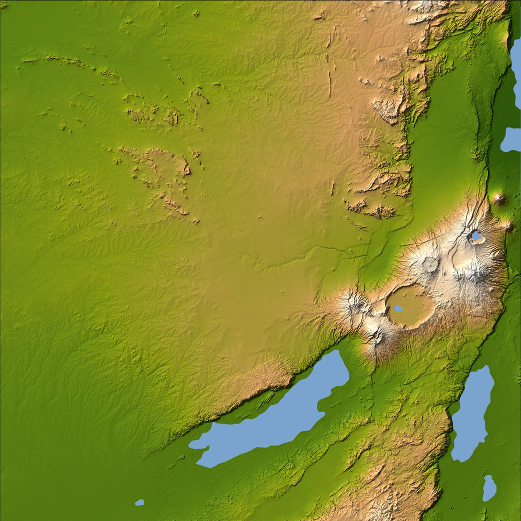
Three striking and important areas of Tanzania in eastern Africa are shown in this color-coded shaded relief image from the Shuttle Radar Topography Mission. The largest circular feature in the center right is the caldera, or central crater, of the extinct volcano Ngorongoro, which is surrounded by smaller volcanoes, all associated with the Great Rift Valley, a geologic fault system that extends for about 4,830 kilometers (2,995 miles) from Syria to central Mozambique.
Ngorongoro’s caldera is 14 miles across at its widest point and is 2,000 feet deep and has a level floor that holds a lake fed by streams running down the caldera wall. It is part of the Ngorongoro Conservation Area and is home to over 75,000 animals. Lakes Eyasi and Manyara south of the crater are also part of the conservation area.
The relatively smooth region in the upper left of the image is the Serengeti National Park, which encompasses the main part of the Serengeti ecosystem, supporting the greatest remaining concentration of plains game in Africa including more than 3,000,000 large mammals. The faint, nearly horizontal line near the center of the image is Olduvai Gorge, made famous by the discovery of remains of the earliest humans known to exist.Image Credit: NASA