


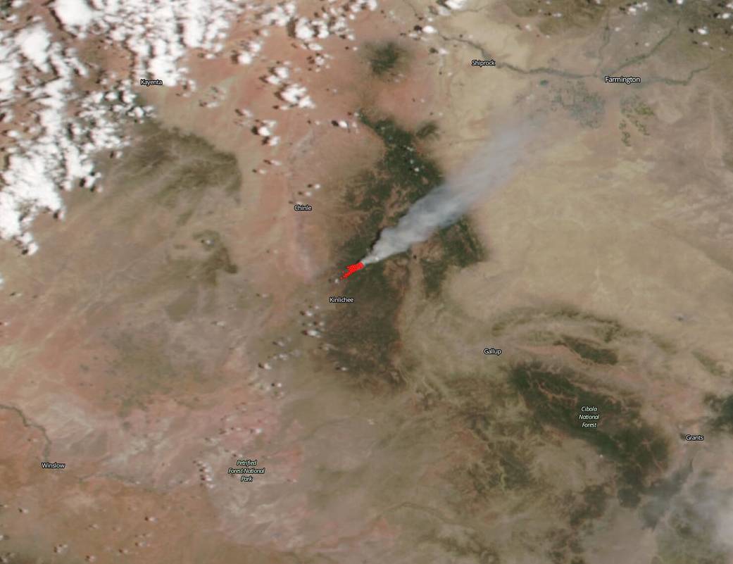
NASA’s Suomi NPP satellite used its VIIRS (Visible Infrared Imaging Radiometer Suite) instrument to capture this image of the Wood Springs 2 fire in Arizona on June 29, 2020. According to Inciweb, this fire began on July 27, 2020 with a lightning strike. The fire is 5,816 acres as of today, June 30, and is 0% contained. It is located approximately 5 miles from Sawmill, Ariz. and as such the communities of Sawmill and Muted Rock are on high alert and should be prepared to evacuate. The fire is mostly being fueled by pinon juniper and pine and its growth yesterday can be attributed to winds gusting up to 45 miles per hour throughout the day. The local weather forecast for the area is not favorable for firefighters, although it will be slightly better than yesterday (June 29). Winds are expected to be lighter today compared to yesterday, but still gusting to 10-15 miles per hour. Temperatures will be in the mid-70s with relative humidity levels at 8-13 percent. No rain is forecast.

NASA’s satellite instruments are often the first to detect wildfires burning in remote regions, and the locations of new fires are sent directly to land managers worldwide within hours of the satellite overpass. Together, NASA instruments detect actively burning fires, track the transport of smoke from fires, provide information for fire management, and map the extent of changes to ecosystems, based on the extent and severity of burn scars. NASA has a fleet of Earth-observing instruments, many of which contribute to our understanding of fire in the Earth system. Satellites in orbit around the poles provide observations of the entire planet several times per day, whereas satellites in a geostationary orbit provide coarse-resolution imagery of fires, smoke and clouds every five to 15 minutes. For more information visit: https://www.nasa.gov/mission_pages/fires/main/missions/index.html
NASA’s Earth Observing System Data and Information System (EOSDIS) Worldview application provides the capability to interactively browse over 700 global, full-resolution satellite imagery layers and then download the underlying data. Many of the available imagery layers are updated within three hours of observation, essentially showing the entire Earth as it looks “right now.” Actively burning fires, detected by thermal bands, are shown as red points. Image Courtesy: NASA Worldview, Earth Observing System Data and Information System (EOSDIS). Caption: Lynn Jenner with information from Inciweb.