


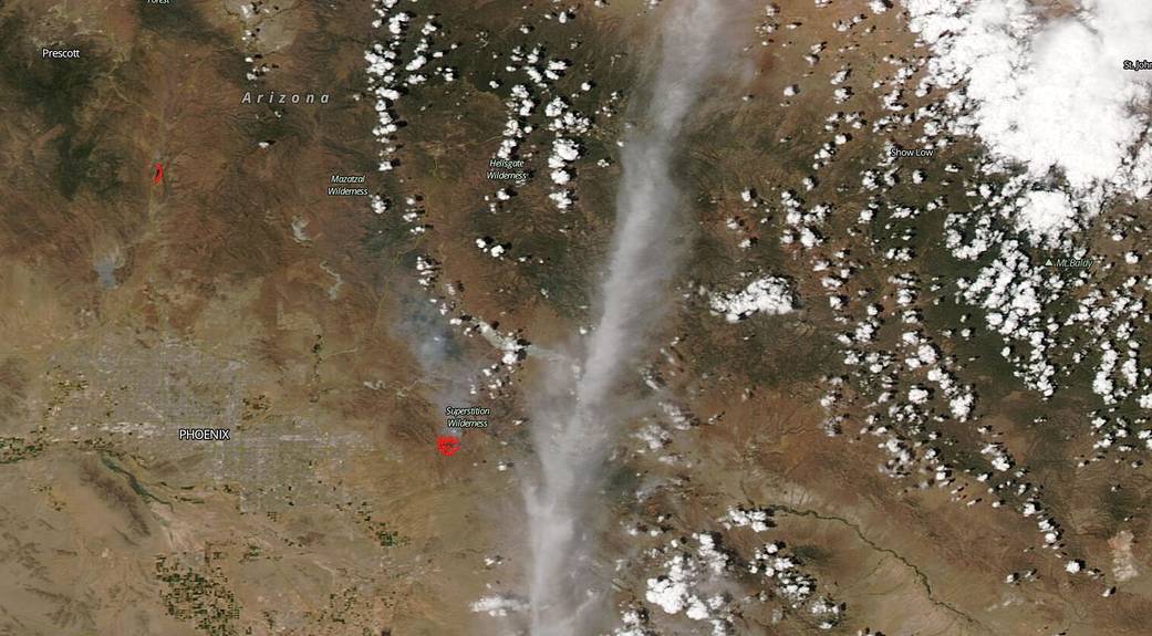
From the U.S. Forest Service-Tonto National Forest’s Facebook page: “The Sawtooth Fire is burning in the Superstition Wilderness area of The Tonto National Forest. This is a lightning-caused wildfire that started last night. The fire started approximately 2 miles northeast of the Peralta Trailhead. The fire is burning actively in grass and brush, near the area of the Woodbury Fire from last year. The fire is estimated to be 2,500 acres and 0% contained. ‘We are assessing the situation at this time, and doing our very best,’ said Forest Service District Ranger Matthew Lane. No structures are threatened at this time, and no evacuations are in effect. Fire officials are asking everyone to avoid the Peralta Trailhead and general fire area, to allow crews to safely begin building containment lines around the Sawtooth Fire.” On May 31, 2020, NOAA-NASA’s Suomi NPP satellite captured this image of the fire in the Superstition Wilderness area of the Tonto National Forest in Arizona.
NASA’s satellite instruments are often the first to detect wildfires burning in remote regions, and the locations of new fires are sent directly to land managers worldwide within hours of the satellite overpass. Together, NASA instruments detect actively burning fires, track the transport of smoke from fires, provide information for fire management, and map the extent of changes to ecosystems, based on the extent and severity of burn scars. NASA has a fleet of Earth-observing instruments, many of which contribute to our understanding of fire in the Earth system. Satellites in orbit around the poles provide observations of the entire planet several times per day, whereas satellites in a geostationary orbit provide coarse-resolution imagery of fires, smoke and clouds every five to 15 minutes. For more information visit: https://www.nasa.gov/mission_pages/fires/main/missions/index.html
NASA’s Earth Observing System Data and Information System (EOSDIS) Worldview application provides the capability to interactively browse over 700 global, full-resolution satellite imagery layers and then download the underlying data. Many of the available imagery layers are updated within three hours of observation, essentially showing the entire Earth as it looks “right now.” This satellite image was collected on May 31, 2020. Actively burning fires, detected by thermal bands, are shown as red points. Image Courtesy: NASA Worldview, Earth Observing System Data and Information System (EOSDIS). Caption: Lynn Jenner