


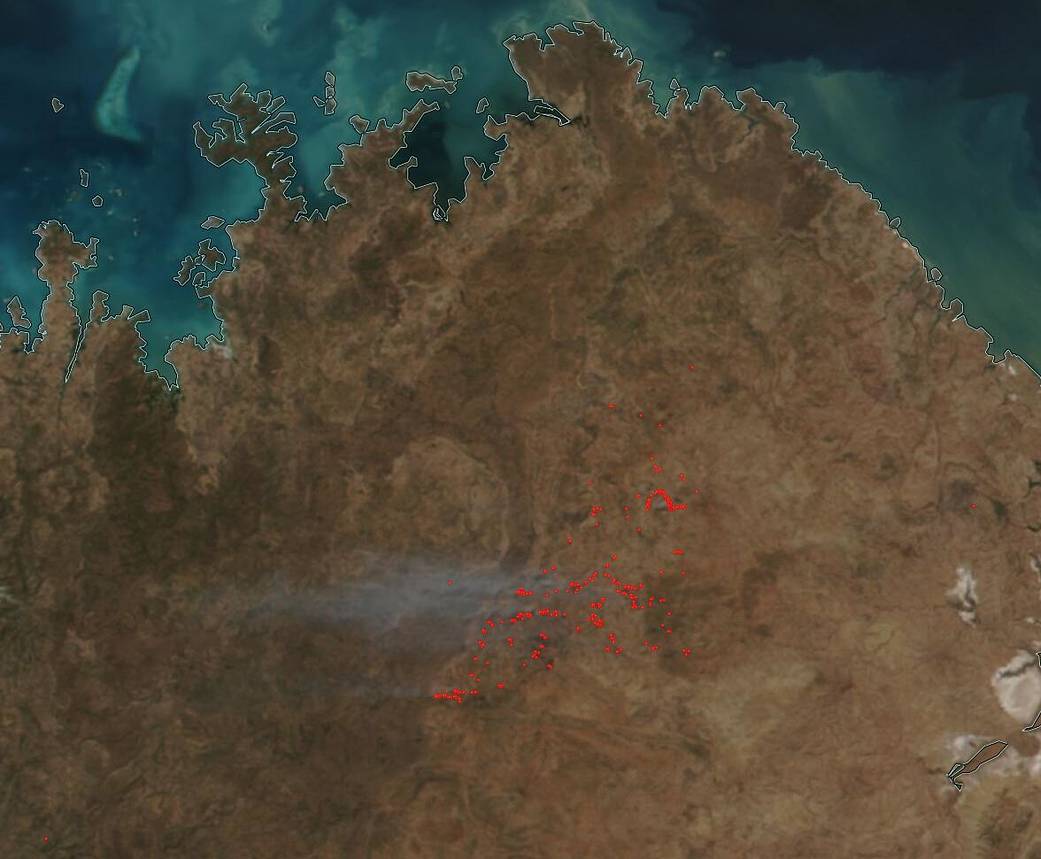
NOAA/NASA’s Suomi NPP satellite captured this image of prescribed fires in Western Australia on July 06, 2020. Emergency WA (Western Australia) has listed the site seen in the satellite image as an area where prescribed fires have been lit by fire officials. The area is near Drysdale River National Park, 150 km (93.2 miles) northwest of Wyndham. The burn was set on July 06, 2020.
Prescribed fires are fires that are deliberately set by fire officials for a whole host of reasons.There are ecosystems that actually require fires for further growth. After many years of fire exclusion, an ecosystem that needs periodic fire becomes unhealthy. Trees become stressed by overcrowding; fire-dependent species disappear; and flammable fuels build up and become hazardous. The right fire at the right place at the right time can:
- Reduce hazardous fuels, protecting human communities from extreme fires;
- Minimize the spread of pest insects and disease;
- Remove unwanted species that threaten species native to an ecosystem;
- Provide forage for game;
- Improve habitat for threatened and endangered species;
- Recycle nutrients back to the soil; and
- Promote the growth of trees, wildflowers, and other plants;
Both fires set deliberately and even some wildfires that are left to burn out naturally benefit natural resources and reduce the risk of unwanted wildfires in the future. Fire officials also use hand tools and machines to thin overgrown sites in preparation for the eventual return of fire.
NASA’s satellite instruments are often the first to detect wildfires burning in remote regions, and the locations of new fires are sent directly to land managers worldwide within hours of the satellite overpass. Together, NASA instruments detect actively burning fires, track the transport of smoke from fires, provide information for fire management, and map the extent of changes to ecosystems, based on the extent and severity of burn scars. NASA has a fleet of Earth-observing instruments, many of which contribute to our understanding of fire in the Earth system. Satellites in orbit around the poles provide observations of the entire planet several times per day, whereas satellites in a geostationary orbit provide coarse-resolution imagery of fires, smoke and clouds every five to 15 minutes. For more information visit: https://www.nasa.gov/mission_pages/fires/main/missions/index.html
NASA’s Earth Observing System Data and Information System (EOSDIS) Worldview application provides the capability to interactively browse over 700 global, full-resolution satellite imagery layers and then download the underlying data. Many of the available imagery layers are updated within three hours of observation, essentially showing the entire Earth as it looks “right now.” Actively burning fires, detected by thermal bands, are shown as red points. Image Courtesy: NASA Worldview, Earth Observing System Data and Information System (EOSDIS). Caption: Lynn Jenner with information from Emergency WA