


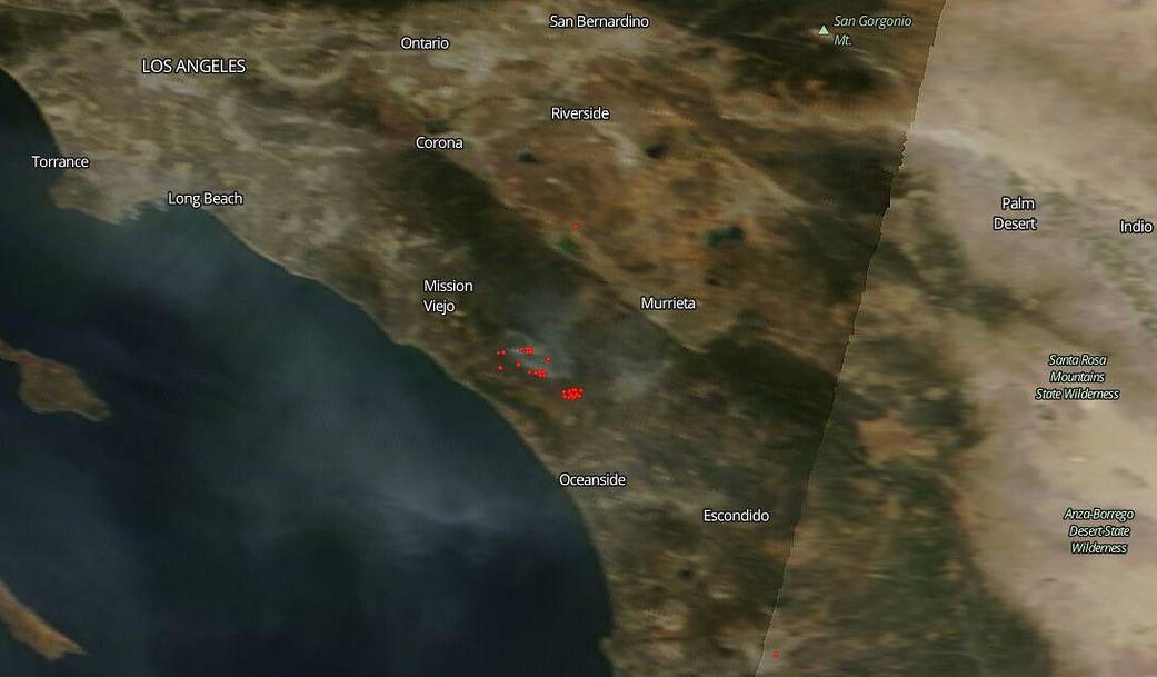
According to the Twitter feed for Camp Pendleton. a Marine Corps base, in Southern California the base is dealing with three large fires on the base apparently after a live-fire drill may have spread out of control due to high winds. The Twitter feed reports for the base reports this: “#Woodfire 7,000 acres burned 20% contained, #IndiaFire 1,100 acres burned 20% contained, Range 706 Yankee impact area 500 acres burned. All fires remain in impact/training areas & will produce smoke the rest of the day w/CPFD [Camp Pendleton Fire Department] & partner agencies engaging. No threats on/off base.” However, in this satellite image taken by NASA’s Terra satellite on June 10, 2020, it appears that smoke from the fire has been impacting regions around the base.
NASA’s satellite instruments are often the first to detect wildfires burning in remote regions, and the locations of new fires are sent directly to land managers worldwide within hours of the satellite overpass. Together, NASA instruments detect actively burning fires, track the transport of smoke from fires, provide information for fire management, and map the extent of changes to ecosystems, based on the extent and severity of burn scars. NASA has a fleet of Earth-observing instruments, many of which contribute to our understanding of fire in the Earth system. Satellites in orbit around the poles provide observations of the entire planet several times per day, whereas satellites in a geostationary orbit provide coarse-resolution imagery of fires, smoke and clouds every five to 15 minutes. For more information visit: https://www.nasa.gov/mission_pages/fires/main/missions/index.html
NASA’s Earth Observing System Data and Information System (EOSDIS) Worldview application provides the capability to interactively browse over 700 global, full-resolution satellite imagery layers and then download the underlying data. Many of the available imagery layers are updated within three hours of observation, essentially showing the entire Earth as it looks “right now.” Actively burning fires, detected by thermal bands, are shown as red points. Image Courtesy: NASA Worldview, Earth Observing System Data and Information System (EOSDIS). Caption: Lynn Jenner with information from the Camp Pendleton twitter feed.