


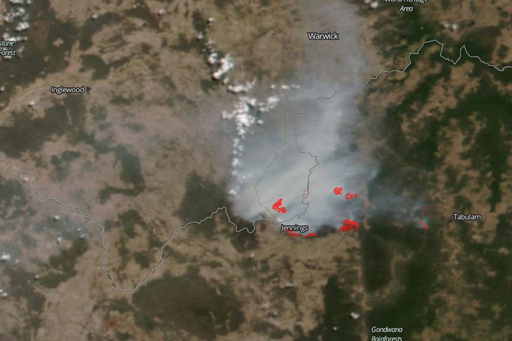
The Wallangara bushfire that was highlighted on NASA’s Fire and Smoke page February 15, 2018, has now burned at least 43,800ha (108,232 acres) in Queensland (QLD) and New South Wales in Australia. Smoke from the fire (seen in the satellite photo) is affecting the towns of Wallangarra, Tenterfield, Stanthorpe, and Jennings. The New South Wales Rural Fire Service is reporting that that the fire continues to burn west of the Bruxner Highway in the Girraween, Bald Rock, Boonoo areas but is now under control. Fire crews are conducting backburning operations during the night which did increase fire activity and also produced additional smoke which is likely to settle around the areas of Tenterfield, Jennings, Wallangarra and Stanthorpe (QLD), but will begin to clear late Tuesday morning. Backburning is an integral part of firefighting. Back burning involves starting small fires along a man-made or natural firebreak in front of a main fire front. This reduces the amount of fuel that is available to the main fire by the time that it reaches the newly burned area. Back burning is utilized in both controlled burning (to prevent the outbreak of fires) as well as during wildfire events.
NASA’s Earth Observing System Data and Information System (EOSDIS) Worldview application provides the capability to interactively browse over 700 global, full-resolution satellite imagery layers and then download the underlying data. Many of the available imagery layers are updated within three hours of observation, essentially showing the entire Earth as it looks “right now. This satellite image was collected on February 18, 2019 by NOAA/NASA’s Suomi NPP satellite using the VIIRS instrument onboard. Actively burning fires, detected by thermal bands, are shown as red points. Image Courtesy: NASA Worldview, Earth Observing System Data and Information System (EOSDIS). Caption: Lynn Jenner with information from the New South Wales Rural Fire Service site