


The Milepost 97 fire which is located about one mile southeast of Canyonville, Oregon was first reported on Wednesday, July 24th at approximately 10:00 p.m PDT. The fire is burning in steep, rocky terrain that is difficult to access making fire suppression arduous. Burning in an old fire scar from 1987 the fire has been classified as human-caused and fire officials have speculated that it was caused by an illegal campfire. Currently 1,482 fire personnel are engaged in fighting the 13,070 acres blaze which is 35 percent contained at present. Milepost 97 fire is at this time the largest active fire in Oregon.
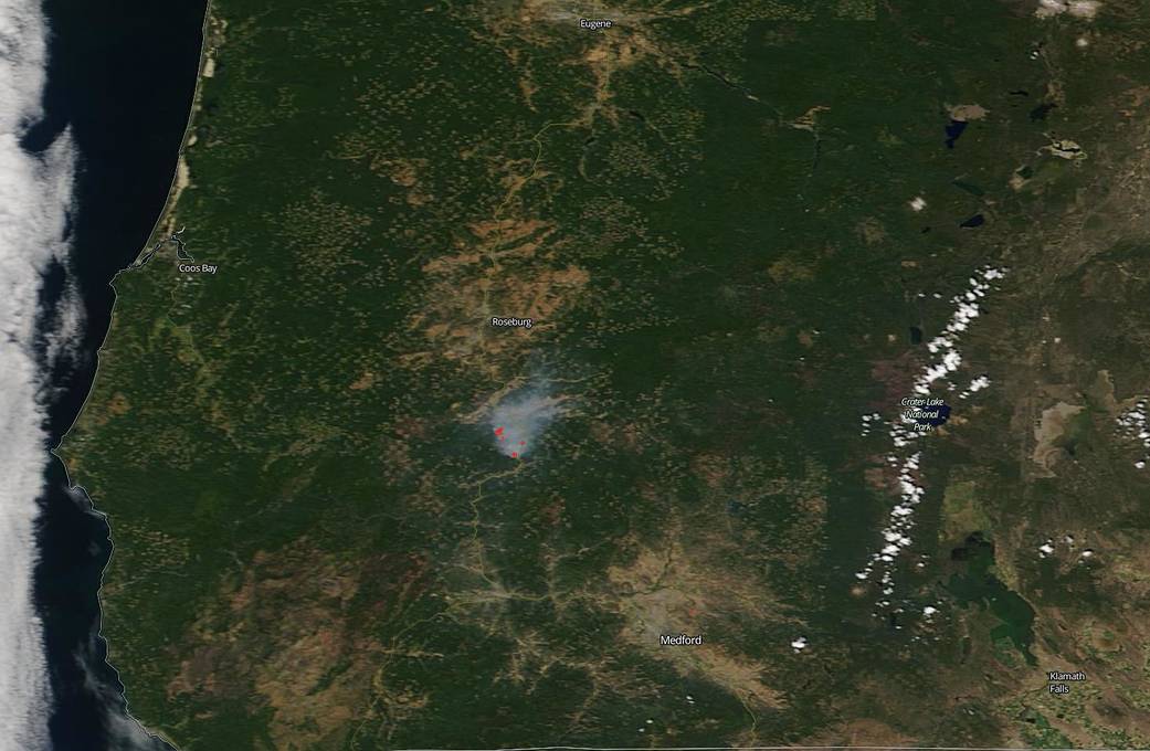
NASA’s Earth Observing System Data and Information System (EOSDIS) Worldview application provides the capability to interactively browse over 700 global, full-resolution satellite imagery layers and then download the underlying data. Many of the available imagery layers are updated within three hours of observation, essentially showing the entire Earth as it looks “right now.” This natural-color satellite image was collected by the Moderate Resolution Imaging Spectroradiometer (MODIS) aboard the Terra satellite on August 01, 2019. Actively burning fires, detected by thermal bands, are shown as red points. Image Courtesy: NASA Worldview, Earth Observing System Data and Information System (EOSDIS). Caption: Lynn Jenner with information from Inciweb.