
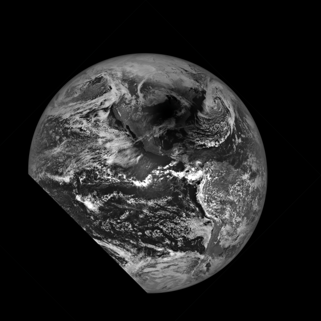


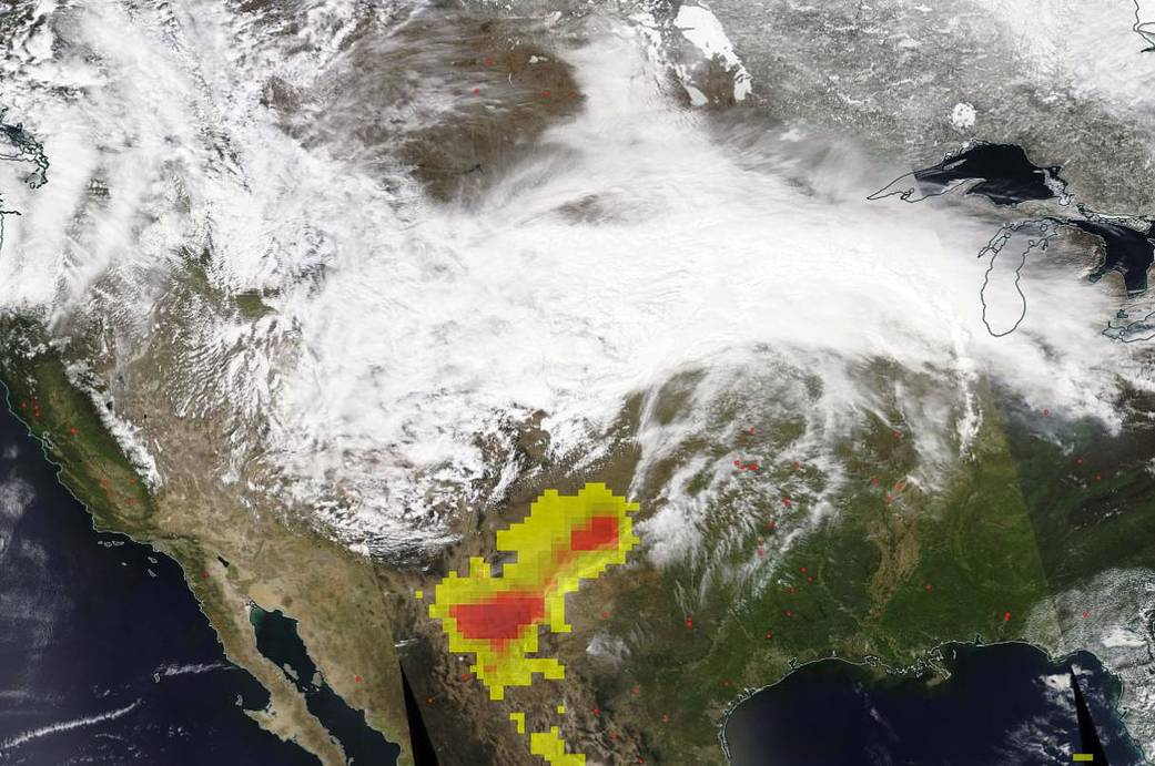
A massive spring storm dubbed a “bomb cyclone” by weather forecasters rolled across the United States on Wednesday, April 10, 2019, dropping over two feet of snow in the Dakotas and Minnesota and kicking up dust in New Mexico, Texas, and across the border. This is the second such storm in the space of one month. The snow wasn’t the only dire weather forecast from this system. There was also a risk of wildfires in parts of the Southwest due to the wind gusts from the storm which could take a spark and push it into an inferno with the extremely dry conditions in that area.
In this NASA/NOAA’s Suomi NPP satellite image, the clouds across most of the United States are quite evident. The spring storm produced a swath of snow that in northern parts of the U.S. was a blinding blizzard but in the Southwest was a huge wind storm. The OMPS (Ozone Mapping and Profiler Suite) instrument on the Suomi NPP satellite measures aerosols in the atmosphere. The aerosol index which is overlaid on this satellite image (seen in the image as yellow and red pixels) shows both the thickness and height of the atmospheric aerosol layer [the index goes from 0 (white) to 5 (red)]. The reason the value is so high in this image (the red pixels) is due to the incredibly high winds in the area kicking up dust and causing the Southwest to have to guard against wildfires. So to high aerosol values can also reduce visibility and impact health.
NASA’s Earth Observing System Data and Information System (EOSDIS) Worldview application provides the capability to interactively browse over 700 global, full-resolution satellite imagery layers and then download the underlying data. Many of the available imagery layers are updated within three hours of observation, essentially showing the entire Earth as it looks “right now.” This image was captured by the Suomi NPP satellite on April 10, 2019. Image Courtesy: NASA Worldview, Earth Observing System Data and Information System (EOSDIS). Caption: Lynn Jenner