


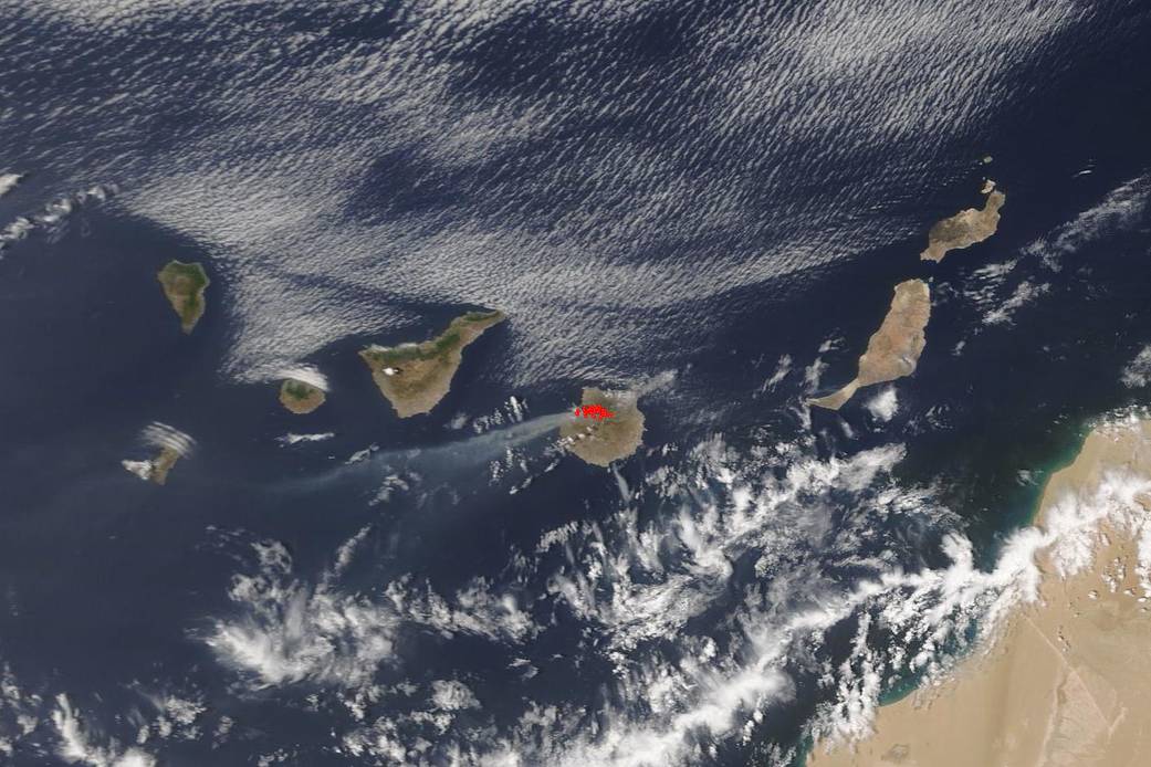
On the island of Gran Canaria, the second most populous island in the Spanish archipelago’s Canary Islands, is currently experiencing a large wildfire whose origins are still under investigation. The 25,000 acre wildfire has burned though parts of the Tamadaba Natural Park which is home to the some of the island’s oldest pine forests. Due to this fire, approximately 9,000 people have been evacuated, both residents and tourists. The fire began on Saturday, August 17, 2019 near the town of Tejeda and is still continuing. Officials are calling this fire “an unprecedented environmental tragedy.” The fire is advancing on at least two fronts and the mountainous terrain is making firefighting efforts increasingly difficult. Spain and other European nations have been experiencing a difficult fire season this year mostly due to rising temperatures, drier conditions and low humidity. The fire on Gran Canaria is as yet uncontained. NASA’s Terra satellite was able to capture this natural-color image with the Moderate Resolution Imaging Spectroradiometer (MODIS) instrument. Actively burning areas, detected by MODIS’s thermal bands, are outlined in red.
The second satellite image below from NOAA/NASA’s Suomi NPP satellite on August 19, 2019 shows the outline of the fire using Suomi NPP’s IBand fire detection product. Red pixels denote active burning (hottest temps) through yellow pixels (coolest temps within the fire). More information can be found in the image caption.

NASA’s Earth Observing System Data and Information System (EOSDIS) Worldview application provides the capability to interactively browse over 700 global, full-resolution satellite imagery layers and then download the underlying data. Many of the available imagery layers are updated within three hours of observation, essentially showing the entire Earth as it looks “right now.” The main satellite image was collected by NASA’s Terra satellite on August 18, 2019. Actively burning fires, detected by thermal bands, are shown as red points. Image Courtesy: NASA Worldview, Earth Observing System Data and Information System (EOSDIS). The second image was taken on August 19, 2019 by the NOAA/NASA’s Suomi NPP satellite using the I-Band fire detection product on the VIIRS (Visible Infrared Imaging Radiometer Suite) instrument. Caption: Lynn Jenner with information from BBC news.