


The West and Northwest are experiencing very difficult fire seasons this summer and there seems to be no end in sight for the fires that are plaguing Oregon and California.
There are several fires burning right over the Oregon state line including the Garner complex, the Natchez fire, the Klondike fire, Taylor Creek fire, and Hendrix fire. The smoke from these fires seems to be drifting north eastward and is obliterating parts of Oregon. Information about each of these fires is located at the Inciweb site.
The largest fire of this group is the Klondike fire that is currently at 21,352 acres and is only 5% contained. It began on July 15, 2018 with a lightning strike. This fire has a huge store of tinder and fuel is can use to continue to grow. Firefighters are having issues with both terrain and weather. The smoke is also having an effect on weather patterns making firefighting even more difficult.
The Mendocino Complex in California has grown to 110,618 acres with the fire 39% contained. Weather concerns for this fire include poor overnight humidity recovery, breezy winds on ridges all day 8-12 mph with gusts up to 20 mph. Max temperatures have been in the 85-95 region and relative humidity is quite low in the teens. Both the Ridge and the River fires, the two fires that make up this complex continue to exhibit extreme torching, flanking and spotting. Both fires continue to have rapid growth with the contributing factors of fuels, topography, and wind.
The Carr fire in California as well has now grown to 125,842 and is 35% contained. A total of 1,060 residences, 18 commercial structures, 477 outbuildings have been destroyed in this blaze. A Red Flag Warning is in effect for today through Saturday. Light southeast winds are expected for today with hot and dry conditions and will continue to help the growth of the fire. Steep terrain has also thwarted firefighting efforts to contain this fire. Over 4,200 personnel are currently assigned to assist in fighting this blaze.
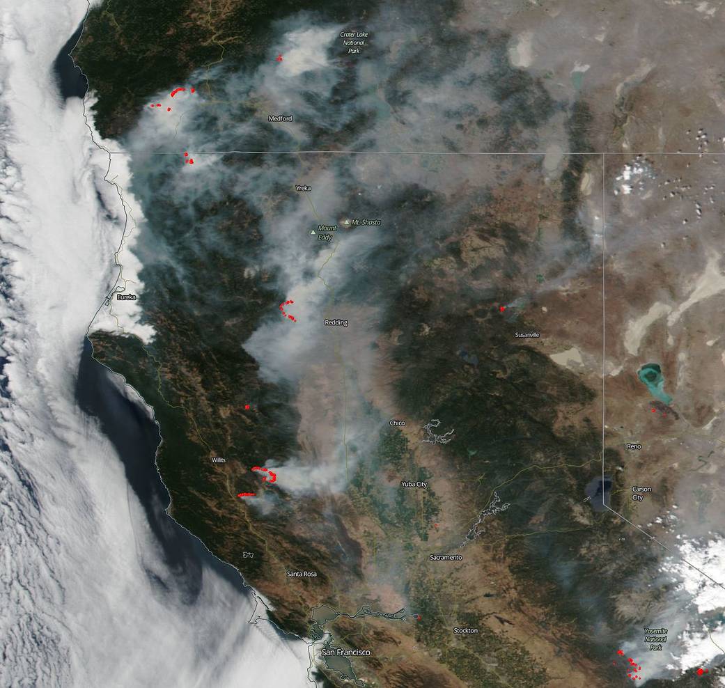
NASA’s EOSDIS provides the capability to interactively browse over 600 global, full-resolution satellite imagery layers and then download the underlying data. Many of the available imagery layers are updated within three hours of observation, essentially showing the entire Earth as it looks “right now”. This natural-color satellite image was collected on Aug. 01, 2018. Actively burning areas, detected by thermal bands, are outlined in red. NASA image courtesy NASA/Goddard Space Flight Center Earth Science Data and Information System (ESDIS) project. Caption: Lynn Jenner with information from CAL fire and Inciweb.