


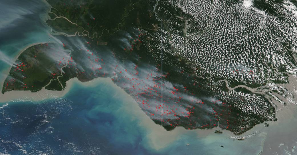
Both the northernmost province of Indonesia of Papua, and the country of Papua New Guinea are experiencing a very high number of wildfires. The cause of these fires is readily apparent as the preferred method for clearing land in this area of the world is fire. The clearing often occurs in drained peatlands that contain past plant life which has been submerged for centuries. The burning of this peat releases greenhouse gases making Indonesia the third largest greenhouse gas emitter in the world. In a season with an extended dry period, the peat dries out and then catches fire when storms and lightning occur. Coupled with a lack of rainfall, thesefire can continue for months. This satellite image was collected on October 09, 2018. Actively burning fires, detected by thermal bands, are shown as red points.
NASA’s Earth Observing System Data and Information System (EOSDIS) Worldview application provides the capability to interactively browse over 700 global, full-resolution satellite imagery layers and then download the underlying data. Many of the available imagery layers are updated within three hours of observation, essentially showing the entire Earth as it looks “right now.” Image Courtesy: NASA Worldview, Earth Observing System Data and Information System (EOSDIS), Diane Davies. Caption: NASA/Goddard, Lynn Jenner