


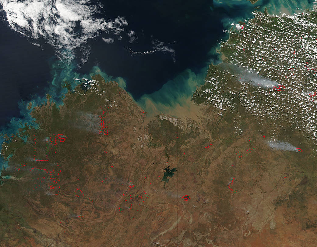
A combination of both bushfires and prescribed fires dot the landscape in the Northern and Western Territories of Australia in this Suomi NPP satellite image from April 17, 2018. Since the region where these fires are located is mostly free of large towns and cities, firefighters will usually just monitor the fire to make sure it does not grow too large. Most of the fires seem to be prescribed, that is, set by firefighters for many diverse reasons some of which are:
- Reduce hazardous fuels, protecting human communities from extreme fires;
- Minimize the spread of pest insects and disease;
- Removesunwanted species that threaten species native to an ecosystem;
- Provide forage for game;
- Improve habitat for threatened and endangered species;
- Recycle nutrients back to the soil; and
- Promote the growth of trees, wildflowers, and other plants;
This satellite image was captured by the Suomi NPP satellite using the VIIRS (Visible Infrared Imaging Radiometer Suite) instrument on April 17, 2018. Actively burning areas, detected by MODIS’s thermal bands, are outlined in red. NASA image courtesy Jeff Schmaltz LANCE/EOSDIS MODIS Rapid Response Team, GSFC. Caption by Lynn Jenner with information from the Northern Territory Fire and Rescue Service incident map and the Emergency WA (Western Australia) website.