


NASA’s Terra satellite detected heat signatures from the Tinder Fire, burning in northern Arizona.
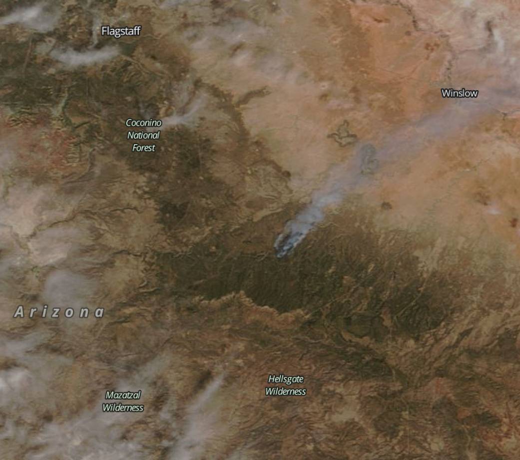
This natural color image from the Moderate Resolution Imaging Spectroradiometer that flies aboard NASA’s Terra satellite was taken on April 30. The red areas indicate hot spots, or fires. Smoke appears as a light brown color. In the image, a large plume of smoke extended to the northeast and the town of Winslow, Arizona.
The U.S. Forest Service in the Coconino National Forest, Flagstaff, reported that the Tinder Fire forced evacuations and as May 1, the fire covered an estimated 11,420 acres (based on infrared data).
The Coconino County Sheriff’s Office evacuation for all Blue Ridge Tinder Fire affected communities north, east and west of Highway 87 remains in effect. The evacuation will remain in effect until firefighters are able to contain the west and north flanks of the fire and are confident there is no longer a threat to communities.
For updates on the Tinder fire, visit: https://inciweb.nwcg.gov/incident/5763/
For updates on Facebook: https://www.facebook.com/TinderFireInfo/ and Twitter: https://twitter.com/TinderFireInfo
NASA image courtesy: NASA Goddard Rapid Response Team. Caption by Rob Gutro, NASA’s Goddard Space Flight Center, Greenbelt, Md.