


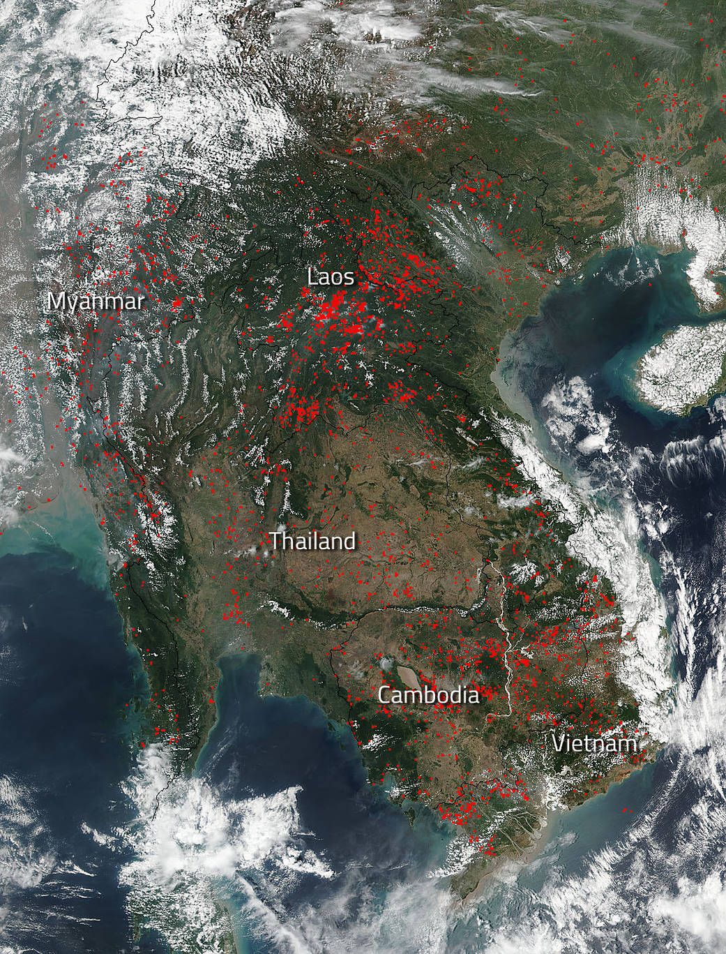
The VIIRS active fire global map detected over 2,000 fires throughout Indochina on April 09, 2018 when this image was taken by the Suomi NPP satellite. The Visible Infrared Imaging Radiometer Suite (VIIRS) sensor was launched aboard the Suomi National Polar-orbiting Partnership (NPP) satellite and has the capability of sensing heat signatures on land that are higher than those nearby and are indicative of fires. For April 9, 2018, VIIRS was able to detect 2,370 separate hotspots throughout Indochina. In particular, the most fires were seen in Laos which had 1,053. Second highest totals were in Myanmar where 498 fires were detected. Vietnam had 441 fires and Cambodia has 226. Thailand had the least number of fires at 152. Most likely these fires are agricultural in nature and have been set to clear fields for the new planting season, but some of these fires could also be wildfires that may have been started by lightning or could be fires set intentionally that got out of control.
NASA image courtesy Jeff Schmaltz LANCE/EOSDIS MODIS Rapid Response Team, GSFC. Caption by Lynn Jenner with information from the VIIRS active fire global map.
Suomi NPP is managed by NASA and NOAA.