


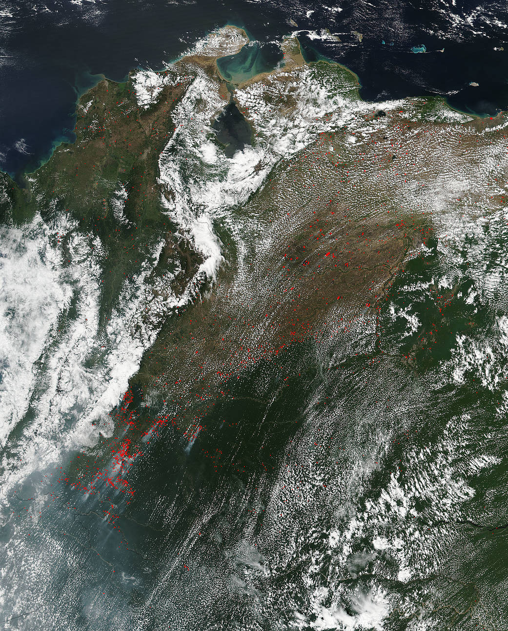
The VIIRS (Visible Infrared Imaging Radiometer Suite) instrument on the Suomi NPP satellite collected this natural-color image which detected hundreds of fires burning in Colombia and Venezuela, South America, on February 09, 2018. The location, widespread nature, and number of fires suggest that these fires were deliberately set to manage land. Farmers often use fire to return nutrients to the soil and to clear the ground of unwanted plants.
Of course, naturally occurring fires are not uncommon in the drier forests and grasslands of South America, so some of these fires could also certainly be a product of human activities. In addition, landscapes that have been disturbed by logging, fragmentation, or previous accidental fire are more prone to catch fire accidentally. In these situations, planned (or prescribed) fires (such as brush clearing fires on already cleared land) can easily get out of control and invade other areas.
While fire helps enhance crops and grasses for pasture, the fires also produce smoke that degrades air quality. Each hot spot, which appears as a red mark, is an area where the thermal detectors recognized temperatures higher than background.
NASA image courtesy Jeff Schmaltz LANCE/EOSDIS MODIS Rapid Response Team, GSFC. Caption by Lynn Jenner