


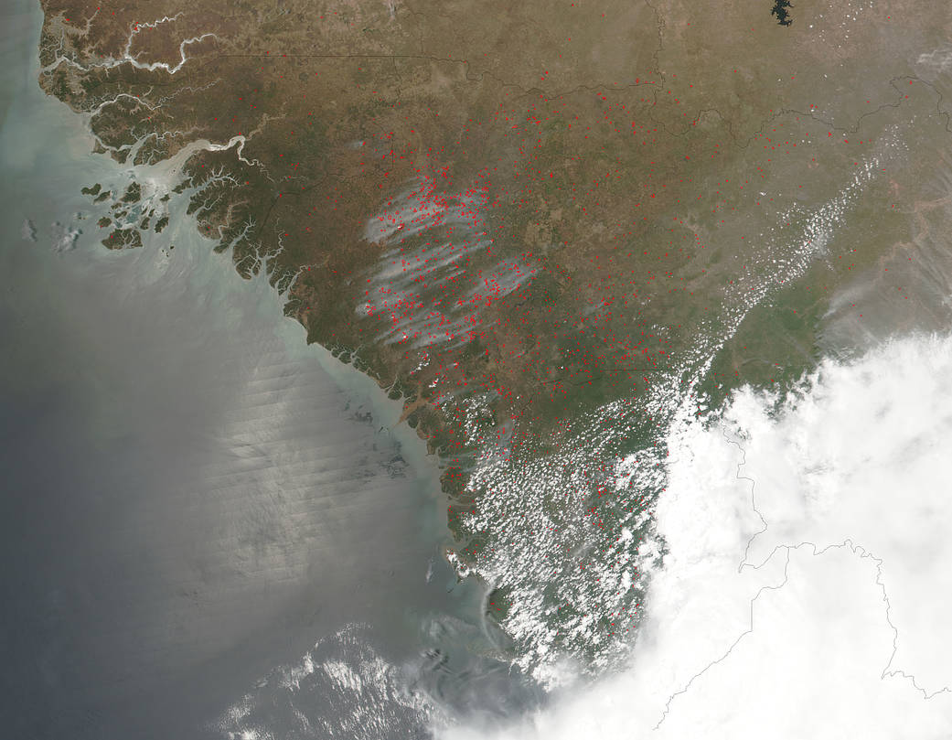
The VIIRS instrument (Visible Infrared Imaging Radiometer Suite) on NASA’s Suomi NPP satellite collected this natural-color image which detected many fires burning in northwestern Africa on April 26, 2018, at 10:12 a.m. EDT (1412 UTC). Fires were evident in Guinea, Guinea-Bissau and Sierra Leone.
Most likely these fires are agricultural in nature as farmers often use fire to return nutrients to the soil and to clear the ground of unwanted plants. Each hot spot, which appears as a red mark, is an area where the thermal detectors on the VIIRS instrument recognized temperatures higher than background. When accompanied by plumes of smoke, as in this image, such hot spots are diagnostic for fire.
NASA image courtesy Jeff Schmaltz LANCE/EOSDIS MODIS Rapid Response Team, Goddard Space Flight Center
Caption by Rob Gutro, NASA’s Goddard Space Flight Center