


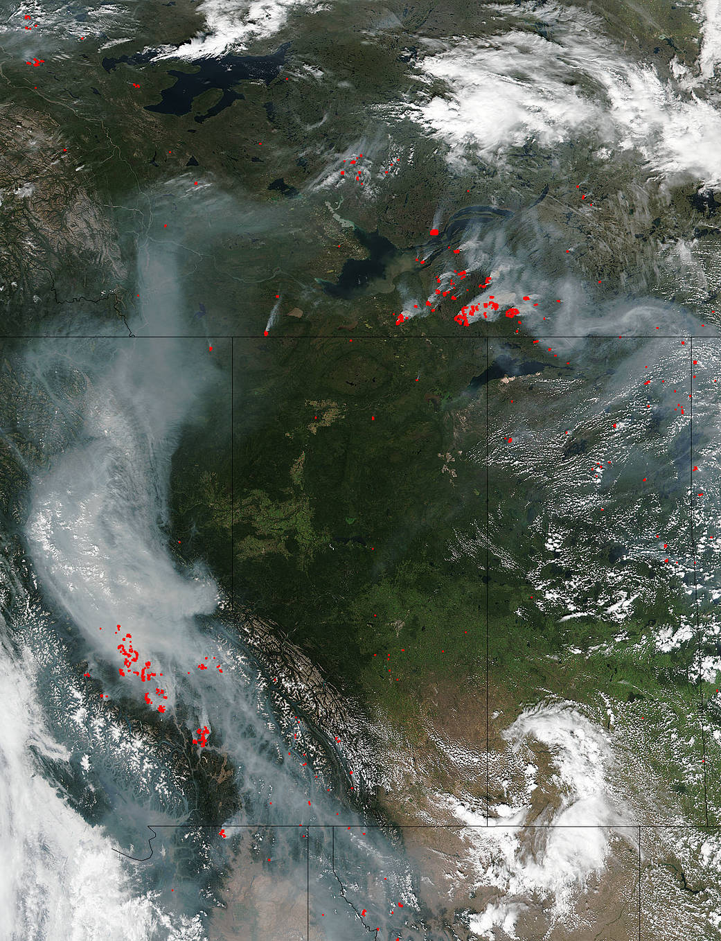
Canadian wildfires continue across all provinces although the National Preparedness Level is highest in British Columbia at 5 out of 5. There are six “fires of note” in British Columbia with active fires threatening infrastructure and private property. Evacuation orders and alerts are in effects in several areas. A total of 503,907 hectares (over 1,245,000 acres) have been affected in the province of British Columbia. There are three “fires of note” in National and Provincial Parks of Canada affecting 16,615 hectares (over 41,000 acres). The fires in British Columbia and the Northwest Territories are accounting for most of the area burned this week according to the Canadian Wildland Fire Information System.
Canada has recorded 3,849 fires so far this year, which have burned 1,523,321 ha. (over 3,764,000 acres). Most of the 320,675 hectares (792,405 acres) burned over the last week was in British Columbia (43.9%) Northwest Territories (40.7%). Lightning accounted for about 60% of the new fires. Seasonal fire occurrence and area burned remain significantly below the 10-year average (76% and 66% respectively), although these percentages are higher than last week’s.
Weather reports do not offer any reprieve from the warm, dry conditions which will continue in British Columbia. Light winds will prevent rapid fire spread but will not disperse smoke well. As for the Northwest Territories, the South Slave area in the Northwest Territories may have a few thundershowers and remains prone to lightning fires.
The Suomi NPP satellite’s Visible Infrared Imaging Radiometer Suite (VIIRS) instrument captured a look at multiple fires and smoke burning in Canada on August 12, 2017. Actively burning areas, detected by VIIRS are outlined in red. When they are accompanied by smoke, as in this image, they are indicative of fire.
The Suomi NPP satellite is a joint mission between NASA and NOAA.
NASA image courtesy Jeff Schmaltz, MODIS Rapid Response Team. Caption: NASA/Goddard, Lynn Jenner