


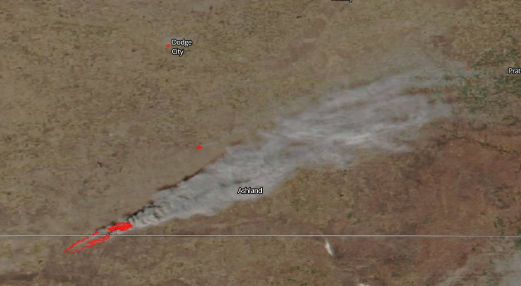
A stream of smoke from grass fires near Ashland, Kansas was spotted by the Visible Infrared Imaging Radiometer Suite (VIIRS) instrument that flies aboard NASA-NOAA’s Suomi NPP satellite at 1924 UTC (2:24 p.m. EST) on March 6. The VIIRS instrument can detect the heat signatures from the fires, and actively burning areas are outlined in red in the image. Smoke appears as a light brown color and was blowing to the northeast.
Red Flag warnings are in effect throughout much of Kansas and Oklahoma because of dry conditions and winds that will fuel fires. The atmosphere over western Kansas remains extremely dry on March 7. The National Weather Service (NWS) in Dodge City, Kansas issued a Fire Message at 2:21 a.m. CST on Tuesday, March 7 2017 and noted that critical fire weather conditions expected again today. The NWS Fire Message says “Winds are expected to increase again with daytime heating. Strongest winds are expected along I-70 with weaker but still significant winds farther to the south near the Oklahoma border. The winds and low relative humidity will create critical fire weather conditions again this afternoon and may exacerbate ongoing firefighting operations. Winds will diminish again by late afternoon.” Evacuations have been ordered in Ashland and Englewood and the Clark State Lake areas in Clark County.
NASA image courtesy NOAA/NASA MODIS Rapid Response Team. Caption: NASA/Goddard, Rob Gutro