


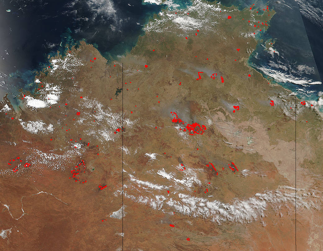
The Suomi NPP satellite’s Visible Infrared Imaging Radiometer Suite (VIIRS) instrument captured a look at multiple fires and smoke in the Northern Territory of Australia on November 02, 2017.
Global Forest Watch keeps track of the hot spots that are recorded by Terra, Aqua and Suomi NPP satellites. During the two day period between October 31 and November 01 the site detected and reported 11,105 bushfires burning in Australia’s Northern Territory. Global Forest Watch uses NASA Fire Information for Resource Management System (FIRMS) near real-time (NRT) active fire data from the MODIS and VIIRS instruments on the Aqua, Terra, and Suomi NPP satellites to map fire locations. The sensors on these satellites detect the heat signatures of fires from the infrared spectral band. When a fire is detected, the system indicates the area where the fire occurred with an “alert.” Because each satellite orbits the earth twice per day, these alerts can be provided in near-real time. Actively burning areas are outlined in red. When they are accompanied by smoke, as in this image, they are indicative of fire.
The Suomi NPP satellite is a joint mission between NASA and NOAA.
NASA image courtesy Jeff Schmaltz, MODIS Rapid Response Team. Caption: NASA/Goddard, Lynn Jenner with information from Global Forest Watch