


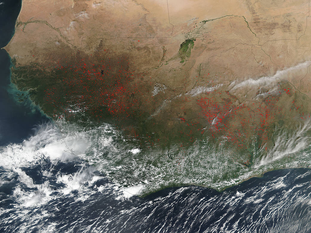
The Suomi NPP satellite’s Visible Infrared Imaging Radiometer Suite (VIIRS) instrument captured a look at multiple fires and smoke burning in western Africa on December 01, 2016.
Actively burning areas, detected by VIIRS are outlined in red. The fires stretch from west to east in a line across Africa. It is interesting to note the color change from the area that is more desert (light brown) to the area that is agricultural in nature (green in color). Each hot spot, which appears as a red mark, is an area where the thermal detectors on the MODIS instrument recognized temperatures higher than background. In western Africa, the agricultural burning season usually runs from December, after the year’s primary crops are harvested, through April or May, when the next growing season begins. Farmers often use fire to return nutrients to the soil and to clear the ground of unwanted plants. While fire helps enhance crops and grasses for pasture, the fires also produce smoke that degrades air quality.
The Suomi NPP satellite is a joint mission between NASA, NOAA and the U.S. Department of Defense.
NASA image courtesy Jeff Schmaltz, MODIS Rapid Response Team. Caption: NASA/Goddard, Lynn Jenner