


NASA and Virginia-based Psionic, LLC, signed a licensing agreement for the use of a NASA 3D light detection and ranging (lidar) technology called Kodiak originally developed for a cutting-edge mission to robotically refuel a satellite in orbit. The commercial license will allow Psionic to combine the technology’s capabilities with existing lidar developments to enhance the overall design and incorporate it into future missions.
Psionic previously licensed a Navigation Doppler Lidar (NDL) from NASA’s Langley Research Center in Hampton, Virginia.
Lidar is a critical component of a sophisticated relative navigation system for rendezvous and proximity operations, which are required for docking a spacecraft to a satellite for servicing or assembly purposes. A relative navigation system also has applications for landing on planetary bodies such as the Moon, or providing the situational awareness needed to capture pieces of orbital debris without affecting nearby satellites.
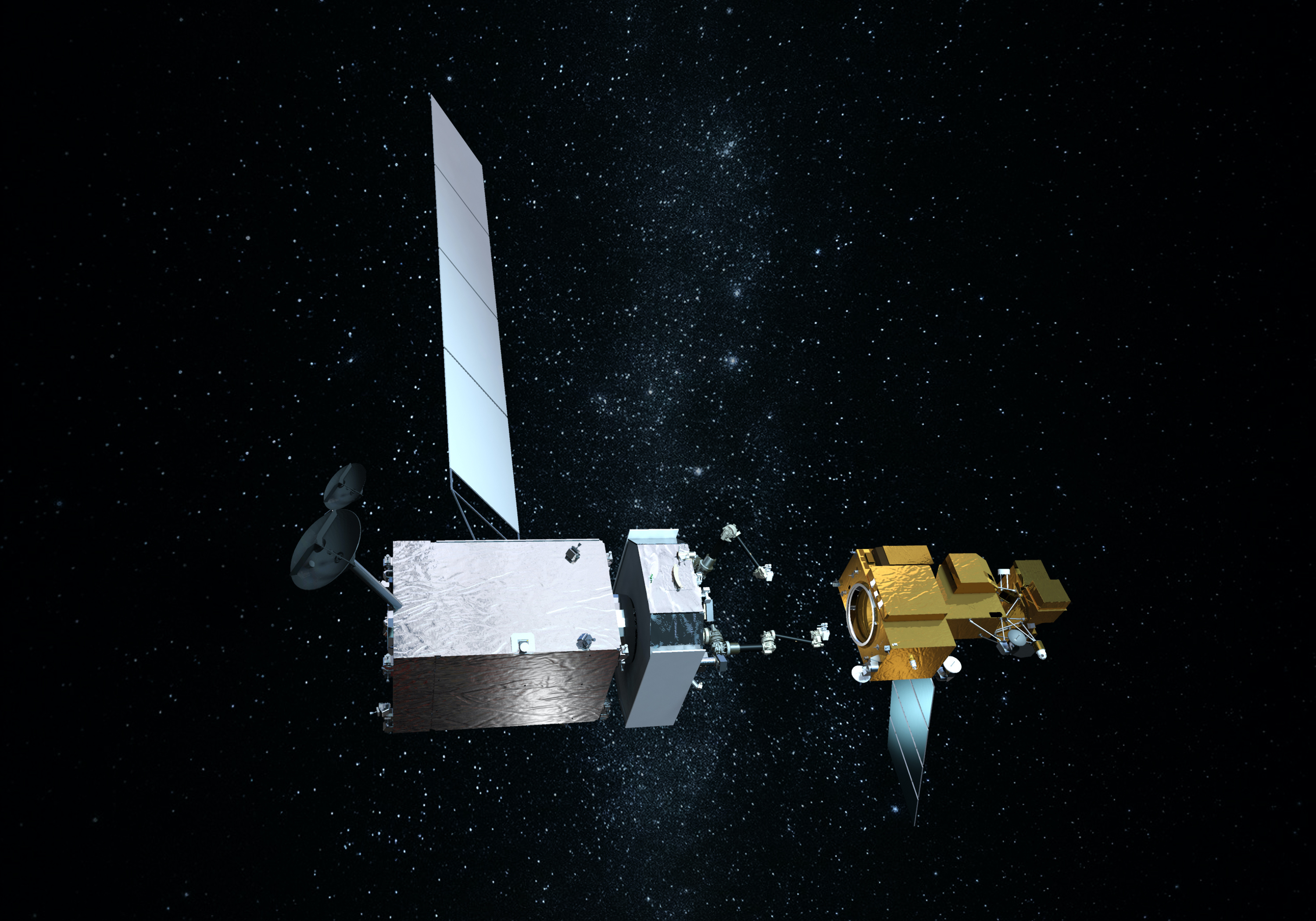
NASA’s Goddard Space Flight Center in Greenbelt, Maryland, developed Kodiak to be used for space detection and ranging, proximity laser ranging, and autonomous vehicles. The Kodiak 3D lidar will be used by the On-orbit Servicing Assembly, and Manufacturing 1 (OSAM-1) mission which will robotically refuel Landsat 7, a government-owned satellite.
The lidar provides low cost and highly reliable 3D lidar images in nearly any lighting condition, which increases the flexibility in timing servicing activities in different orbits. Lidar counts the amount of time that elapses between sending a laser pulse and receiving it back. Because the speed of light is known, this technique lets scientists and engineers approximate the distance to any given object. Kodiak is unique in that it employs high-speed scanning and takes very accurate measurements. The lidar creates a realistic 3D reproduction of the object, which allows data collectors to produce precise measurements of the target’s relative attitude and position.
“Anything that flies up to something else can use this system,” said Nathaniel Gill, principal investigator for the Kodiak lidar on OSAM-1. “It’s flexible to be tuned to different missions, and every mission is different.”
Before OSAM-1 can refuel Landsat 7, the servicing spacecraft must first match speed with and grapple the satellite that was not designed to be serviced while it is moving at thousands of miles an hour. For this operation, NASA will use a relative navigation system that consists of the Kodiak lidar, two wide field-of-view cameras, and two narrow field-of-view long-range cameras. The lidar system works in conjunction with visible and infrared cameras to sense the location, range, and orientation of Landsat 7 and its angle relative to OSAM-1. This allows the OSAM-1 servicer to rendezvous with and dock to the satellite autonomously, or without humans involved.
NASA is actively transferring OSAM-1 technologies, such as Kodiak, as they are developed to any interested U.S. company via Space Act Agreements, licenses, and other agreements to jumpstart new commercial industries and services centering on servicing, assembly, and manufacturing.
“It’s been a long road for this, we’ve been working on it since 2012,” Gill said. “It’s really nice to see it go out in the world and stand on its own two feet, like raising a kid.”
OSAM-1 is funded by the Technology Demonstration Missions program within NASA’s Space Technology Mission Directorate (STMD). STMD also manages the agency’s Technology Transfer program. To license a NASA technology, visit: https://technology.nasa.gov/license
By Kathryn Cawdrey,
Goddard Space Flight Center