


Tropical Cyclone Idai barreled down on Mozambique on March 14, 2019 — leaving a path of destruction in its wake and triggering devastating floods.
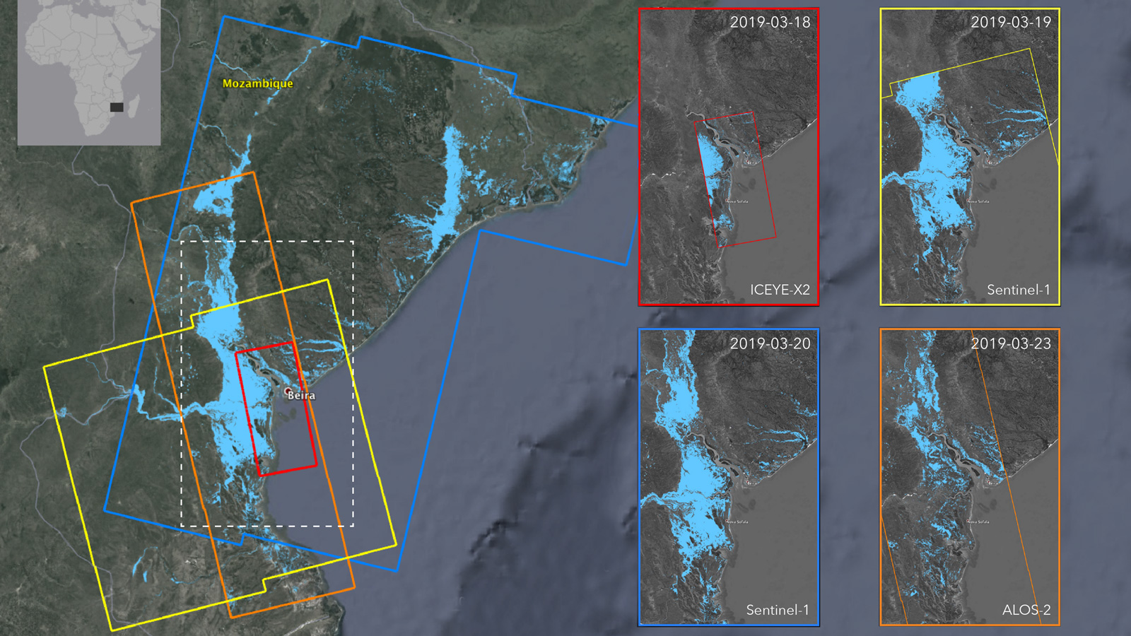
NASA’s Advanced Rapid Imaging and Analysis (ARIA) team combined images from several Earth-observing satellites to create flood proxy maps that show the progression of the post-cyclone flooding from March 18, 2019, through March 23, 2019. The spread of flooding is evident in the blue pixels that increase through the several-day period.
Although the data may be less reliable over urban and vegetated areas, these flood proxy maps can be used as guidance by first responders, aid providers and others to identify the most impacted areas.
The maps were derived from synthetic aperture radar (SAR) images from the ICEYE-X2 (March 18), Sentinel-1(March 19-20), and ALOS-2 (March 23) satellites operated by Finnish satellite manufacturer ICEYE, the European Space Agency (ESA), and Japan Aerospace Exploration Agency (JAXA) respectively. This product contains modified Copernicus Sentinel data (2019), processed by ESA and NASA. The images were analyzed and compiled by NASA’s ARIA team at NASA’s Jet Propulsion Laboratory in Pasadena, California, and the work was funded through NASA’s Disasters Program.
More information on ARIA and NASA’s Disasters Program is available at the following links:
The Mozambique flood proxy map and other maps also available on the NASA Disasters Mapping Portal at:
https://maps.disasters.nasa.gov/
Esprit Smith
Jet Propulsion Laboratory, Pasadena, Calif.
818-354-4269
esprit.smith@jpl.nasa.gov
2019-054