


The Bald Hill Prescribed Fire was set on October 20, 2018 by the Krassel Ranger District in the Bald Hill area 7 miles west of Yellow Pine, Idaho. The plan is to burn 2,000 acres over two days with the primary objective to restore fire-adapted ecosystems. These prescribed fire (set on purpose by fire professionals) maintains desirable vegetation conditions and reduces potential negative effects from future wildland fire to both agency and adjacent private lands.
Prescribed burning also improves the ability to manage wildland fires, restores or enhances wildlife habitat, improves forest and grassland resiliency, improves water carrying capacity in soils and recycles nutrients. Fire is the greatest change agent in forest and grassland systems. These systems have evolved with fire and must have fire to remain resilient and productive. Fire can also be the most economical means in reducing community risk to wildland fire. Accumulated dead vegetation on the ground and fuels occurring between ground fuels and the upper areas of trees will be reduced within prescribed burn areas, making future fire suppression efforts safer. Healthy forests provide a safer environment for wildland firefighters and residents when wildfires inevitably occur.
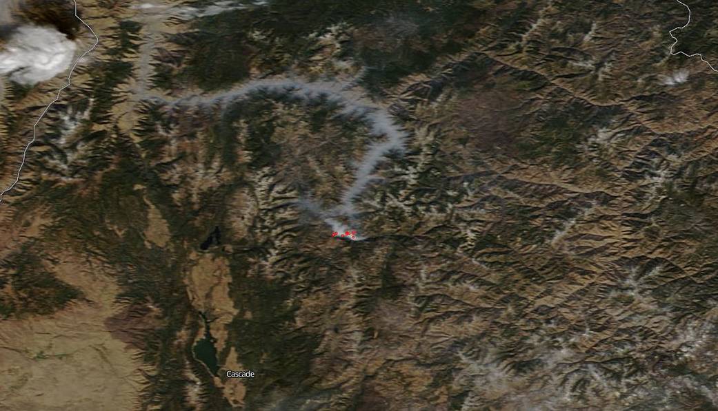
This particular prescribed fire created an interesting pattern of smoke that seemed to follow the lines of the valley and created a “river of smoke” in the wake of the fire.
NASA’s Earth Observing System Data and Information System (EOSDIS) Worldview application provides the capability to interactively browse over 700 global, full-resolution satellite imagery layers and then download the underlying data. Many of the available imagery layers are updated within three hours of observation, essentially showing the entire Earth as it looks “right now.” This satellite image was collected on October 21, 2018. Actively burning fires, detected by thermal bands, are shown as red points. Image Courtesy: NASA Worldview, Earth Observing System Data and Information System (EOSDIS). Caption: Lynn Jenner with information from Inciweb.