


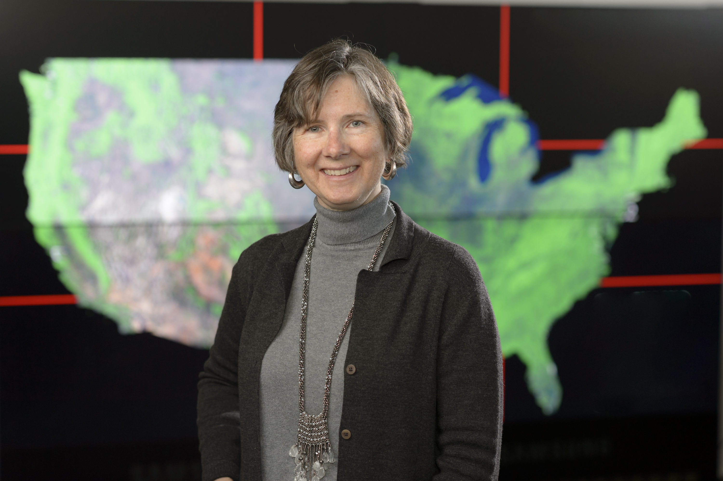
A conversation with Jennifer Dungan, a research scientist at NASA’s Ames Research Center and project manager for the big-data Earth science initiative, the NASA Earth Exchange.
Transcript
Abby Tabor:Hey, everybody! You’re listening to a bonus episode of the NASA in Silicon Valley podcast.
A little while back, we got to sit down with Jennifer Dungan. She’s a scientist here at NASA Ames who helps researchers study the Earth from above using satellites. Jennifer is the project manager for the NASA Earth Exchange, a big data initiative that uses NASA’s supercomputers here at Ames.
The NASA Earth Exchange makes it possible for Earth scientists to work with very large data sets covering very large areas of the globe. One part of NASA’s mission is to study the Earth as a whole system – to look at many different aspects and how they work together – and people like Jennifer help make that possible.
But I’ll let her tell you all about it. Let’s get into this episode with Jennifer Dungan.
Music
Host (Abby Tabor):Hey, Jennifer. It’s good to see you in here.
Jennifer Dungan:Hi, Abby. Good to see you again.
Host:Great. So, we like to start off learning about our guests. Where do you come from? How did you get to NASA?
Jennifer Dungan:I came to NASA, believe it or not, 30 years ago.
Host:Oh, really?
Jennifer Dungan:I suppose in my teens, I set this idea that, oh, I would love to work with . . . I loved Star Trek and those sorts of things. I decided on a science career when I got to college. And after my master’s degree, I had the opportunity to come out here as a research assistant.
Host:So, first job out of –
Jennifer Dungan:First –
Host:– grad school, basically?
Jennifer Dungan:First job out of grad school. Before grad school, I was at the Ecosystem Center in Woods Hole, Massachusetts, so I started working in the research community then. At that time, I actually worked on some of the earliest global carbon cycle models. Back then they were written in Fortran. Some of them still are.
Host:Early models.
Jennifer Dungan:Very early models, yes. So, then I had the opportunity – while I was there, I was looking for where I would go to graduate school. And I heard a presentation by someone who was doing work on Landsat imagery of Amazon rainforests. And he showed the patterns of deforestation, and I was very concerned about tropical deforestation. And I thought, “Wow, this is the way to really see the big picture. How do you look over very large areas to see what’s happening on the Earth’s surface?”
Host:This is the Landsat satellite, right?
Jennifer Dungan:Yeah. The Landsat satellite series started back in 1972.
Host:Wow.
Jennifer Dungan:This was in the ’80s that I was learning about this. I was very impressed, and I thought, “That’s what I want to go to grad school in.” So, I got a –
Host:Cool.
Jennifer Dungan:– master’s degree in remote sensing. There are very few jobs in the world that you can spend all your time doing remote sensing and NASA is one of those places.
Host:Is that really what the degree was called? Was it –
Jennifer Dungan:It was called Environmental Monitoring.
Host:And remote sensing means that, right?
Jennifer Dungan:Yeah.
Host:You use satellites to remotely view and study the Earth?
Jennifer Dungan:Uh-huh.
Host:And, so, you knew that NASA was a place you could probably use that degree?
Jennifer Dungan:Yeah, so I had two possible research jobs, and one was at Ames. So, I came out here, moved from New York, and became a Californian.
Host:Did you continue working on the same kind of thing, or did your career really evolve from there?
Jennifer Dungan:My career evolved very much so, because when I first got here, there was a professor on sabbatical who was interested in geostatistics, which is a way of applying statistics to spatial data, to geographical data, to map data. And he had come from England, and he was researching this. And we both learned at the same time that one of the world’s foremost authorities on that topic was at Stanford University.
Jennifer Dungan:So, I began learning about that. Then he offered me the opportunity to do a PhD degree at the University of South Hampton.
Host:Oh, in England?
Jennifer Dungan:Yes, in England. So, that’s where I got my PhD, eventually. So, the research that I worked on through my career here at Ames gradually evolved over that period of time.
Host:I guess so! And you’re bouncing from one coast to the other and then to the UK and back again?
Jennifer Dungan:Yeah, so that gives me a regional view. Not quite a global view.
Host:But pretty broad, not bad. Okay, so after your PhD, I guess you ended up back at Ames?
Jennifer Dungan:Yeah, I actually was here doing the research at Ames while I was working on my dissertation, and reporting back to my advisor, and getting to know all of his other graduate students who I remain friends with today.
Host:That’s another neat thing about studying science. It’s quite international.
Jennifer Dungan:Yeah. Shout out to my UK colleagues. A couple of them have come and visited Ames to do research as well. That’s a nice connection.
Host:Yes, absolutely. So, then, tell us what your work turned into from there, maybe more recently — closer to today, what have you been working on?
Jennifer Dungan:Well, I guess, most generally, my work has to do with what remotely-sensed data can tell you about vegetation. So, it’s –
Host:Like the rainforests, right?
Jennifer Dungan:– rainforests –
Host:That first inspired you.
Jennifer Dungan:– crops, the forests of the temperate zone, and plants. When you look at plants from space, they just look like . . . one model calls it “the green slime.”
Host: Covering the surface of the Earth.
Jennifer Dungan:Yeah, so, from space, it looks green. And you can’t necessarily tell exactly what kind of vegetation it is. You have to have good spatial resolution. And we have some sensors that have good spatial resolution to be able to tell what kind of plants are growing. But even without knowing exactly what kind of plants are growing, you can infer certain things about what plants are doing, how they’re greening up in the spring and senescing in the fall. And how green they are might tell you something about the amount of vegetation and number of leaves.
Host:How thick they’re growing?
Jennifer Dungan:Mm-hmm, mm-hmm.
Host:Okay. Is it only visual like that, the data that you’re collecting? Or can you sense other things like the oxygen the plants might be producing?
Jennifer Dungan:Well, all of that, like oxygen production and carbon dioxide uptake, and things like that, are inferred from models. So, we use the values that we get in remotely-sensed data at every pixel or picture element. We can either use that information to label the pixel and say, “This pixel is urban.” It represents urban land or represents a crop, or it represents desert or ocean or –
Host:Classifying it.
Jennifer Dungan:– all sorts of classification schemes. Or it can be used to quantify something, like the amount of vegetation. One index we use is called Leaf Area Index. Which is the number of leaves per unit on the ground and other things like that. And then we use models to make inferences about what that means for carbon dioxide uptake. Or for evapotranspiration, which is the amount of water plants release.
Host:So, we talk a lot about models. And I just want to make sure I understand how they work. It’s like you’ve established this is a dense patch of vegetation and knowing how dense it looks, you can calculate probably how much oxygen it’s producing?
Jennifer Dungan:Mm-hmm, mm-hmm.
Host:So, you plug that number into a formula?
Jennifer Dungan:Uh-huh.
Host:That’s what I was imagining.
Jennifer Dungan:That’s a good way to summarize it.
Host:So, you’ve worked with lots of models, understanding vegetation on Earth. Did you focus on a specific area or type of ecosystem, type of vegetation?
Jennifer Dungan:I’ve worked on different ecosystems at different times, mainly forest ecosystems. But these days, I’m working a lot with others on what their models are. So, there are a lot of different types of models that our current project, which is the NASA Earth Exchange, works with.
Host:Tell us about the NASA Earth Exchange.
Jennifer Dungan:NASA Earth Exchange is a project that started about six years ago now, which tries to leverage the NASA supercomputing facilities to enable the application of models over very large areas, over very large data sets. NASA has a lot of data that it collects with the satellite resources, and works with other agencies like USGS with the Landsat series.
Here at Ames – and we’ve heard it on other podcasts about Ames’ supercomputing facility – using that facility, we can stage the datasets that we need to model with, we’re not as limited in terms of the amount of data we can handle at one time. And since NASA’s remit is to look at the Earth as a system, to look at the whole globe, we like to, as much as possible, use all the data at once in a model. So, we use multiple sensors and try to cover the Earth or cover large continents to be able to make inferences about what’s going on regionally, or hemispherically, or globally.
Host:I see. And covering as many aspects as you can at once. You must collect a ton of data then.
Jennifer Dungan:Yes. We’re in the, what they call the big data realm. We have terabytes and petabytes of data. I guess one statistic I heard was: For Landsat there are three trillion pixels for the globe. And there are many billions of pixels covering the conterminous U.S.
Host:This is where numbers start…stopping having meaning, right?!
Jennifer Dungan:Right.
Host:They are so huge. That is big data, okay. So, you’re using –
Jennifer Dungan:So, the size of the data is one thing, and then applying models. If the models are at all computationally complex, it becomes quite a problem in terms of how do you get it done. We can get it done here with the supercomputing facility that NASA has at Ames, and Goddard [NASA’s Goddard Space Flight Center] also has a supercomputing facility that’s used for this purpose. And then we’re also exploring the use of commercial clouds or public clouds. Several companies have staged NASA data that people can get access to and do modeling with.
Host:Cool. I can imagine all of those might be necessary with that quantity of data – the complexity, the demands and the calculations, right?
Jennifer Dungan: Mm-hmm, mm-hmm.
Host:Pretty impressive. Cool. So what kinds of studies are being done, using those models and the crunching power of the supercomputers?
Jennifer Dungan:Well, with the NASA Earth Exchange, we’ve worked with a number of different collaborators on different topics. One is on climate projections into the future. How is the climate going to change as carbon dioxide and other greenhouse gases increase in concentration in the atmosphere? There are several dozen models that have been used to infer what’s going to, project what’s going to happen in the future. But those models tend to work with very large pixels. And, so, the Earth can be represented in a very small area when you actually make a picture of it. But –
Host: It’s not a very fine resolution?
Jennifer Dungan:Right, not a very fine resolution and therefore it’s difficult to understand how things might affect our town or the Bay Area, or things like that, because the pixels are so large. So, one of the tasks that we’ve done is to use statistical models to disaggregate those pixels or to downscale them, so that we can understand the projections on a finer scale. And we’ve produced, in collaborations with the scientists at NOAA and elsewhere, we’ve produced several different datasets for use on what’s happening with the climate and the future.
Host:How far out in the future does that look?
Jennifer Dungan:Well, this effort goes to 2100.
Host:So, the rest of the century.
Jennifer Dungan:We also keep checking back on, given the projections, how is that matching what we’re actually seeing. As we proceed.
Host:Yeah.
Jennifer Dungan:And then another project, several of the projects do use the Landsat data. Because, since that series of satellites have been up since ’72, we’re now getting a nice picture of how things have changed since the 1970s.
Host:Wow, that’s a long time.
Jennifer Dungan:So, we can track things like crop lands and forests. One of the forest projects is how have forests been harvested, or burned by fire, or affected by insects. Or have they remained the same during that period of time? Another dataset that has been generated using the NASA Earth Exchange is a forest disturbance data set. And that’s now our general pattern with these projects is, the collaborators come on, we work with them on staging the data, the data they need to do the project; and help with the algorithms and running the models; and then generating the output data and then those datasets get moved off to one of the NASA archive centers. And then it’s available for anyone to download.
Host:Of course. Because all of the data is open.
Jennifer Dungan:Yes, all the data’s open.
Host:That’s a great resource.
Jennifer Dungan:That dataset is available.
Host:Yeah, very cool.
Jennifer Dungan:And there are a number of others.
Host:Excellent. You just gave a couple of examples of destruction by forest fire – Right? – or insects or something. Have you seen examples where, from the point of view of the satellites, you can see recovery in the ecosystem?
Jennifer Dungan:Yes. That’s one of the other things you can observe. The recovery of forests or changing patterns of crops. Another project we looked at: how much land was fallowed or left idle during the drought in California that we had in 2012 to 2016. So farmers, both small farmers and industrial farmers, made decisions to leave areas idle, because there wasn’t enough water to grow anything that year. And, so, using Landsat, another project mapped how much land was fallowed in each year. And that’s something that can be done with high-resolution imagery.
Host:Would you say that some of the studies being done with the NASA Earth Exchange can inform that this strategy is working, we should do more of this after, I don’t know, after a forest fire? If we behave this way, we might see more recovery or changing land-use patterns?
Jennifer Dungan:Yes, it can help. It’s one source of information for that kind of policy-making or decision-making. So, the data sets that are available in archive centers can be used for people who make those kinds of decisions. NASA actually has a whole applied sciences program that funds people who do those kinds of studies, on how to use these results to inform decisions both by agencies or by other stakeholders.
Host:That’s really great. Because you need the basic research to understand the fundamentals, right? And then next step is having other people apply it.
Host:Did you say that these days you’re working less on your own research and more on coordinating with partners?
Jennifer Dungan:Yeah, coordinating all these projects. There, we have about 30 projects that we support at various levels. And each one of those projects has one or two or three people working on the supercomputers. So, there are a lot of things to keep track of, but also to look out for synergies or relationships between projects where one group’s efforts can be utilized by another group.
Host:You want to maximize the sharing, right? Information, data, knowledge. Are you enjoying that?
Jennifer Dungan:Yeah, I really like that part, very much.
Host:Do you have any projects coming up that you’re excited to be working on? Or any new paths?
Jennifer Dungan:Well, the latest Landsat, Landsat 8, which was launched in 2013 . . . There was a period of time when Landsat 7, which was up for 25 years, was still cranking along and producing data. But it wasn’t the highest quality data anymore. One of the parts of the Landsat sensor had failed about four years into the mission. So, we were struggling along with those data. Then, in 2013, when the new sensor launched, it was actually a new architecture. And it was providing great imagery. It just knocks your socks off.
Host:Wow. It must have been awesome to see.
Jennifer Dungan:Now that it’s been up for several years, we’re being able to understand the time series of those data and how we can use that well with the older data. As well as the European Space Agency launched a pair of satellites, Sentinel-2A and B, recently. Those data are very similar to Landsat data. And, so, we’re working with a group at Goddard to do a harmonized product that brings Landsat and Sentinel together, so that we can get more looks at the surface per unit time. Instead of every 16 days getting a Landsat chance, we now have Sentinel-2 coming in. So, we can get more frequent looks. And that’s helping with the times series analyses.
Host:Can you remind me about Landsat? It’s orbiting the Earth and, you just said, every 16 days it’ll pass over the same spot?
Jennifer Dungan:Yup. And, so, if it gets a clear shot, which is not in many places, not every 16 days, because of cloudiness, then you get to see each pixel, which is about 30 meters across – the size of a tennis court. That’s what a Landsat pixel is. It has seven spectral bands, so it looks in the blue, the green, the red, and the near infrared.
Host:Different colors of light, yeah.
Jennifer Dungan:There’s a thermal band that looks at the skin temperature of the surface.
Host:The skin of the Earth?
Jennifer Dungan:The skin of the Earth, right.
Host:Nice visual. So, how long has the oldest Landsat satellite been up there?
Jennifer Dungan: ‘72 was the first one. That died after a few years. And then there was Landsat 2, 3, 4, and 5. And then 6 failed. It launched and then went into the Pacific Ocean. And then 7 was the workhorse that lasted over 25 years. And then Landsat 8. Landsat 9 is on the schedule, so we’re looking forward to that launch in the early 2020s.
Host:That’s exciting. That should bring new things. Because I was wondering about 25-year-old sensors. Are they still providing, at the end of the life of that satellite, it would still be providing useful data?
Jennifer Dungan:Yeah, absolutely. And it’s testament to people behind the scenes that work hard to keep the data quality up. They have to look at calibration, they have to adjust calibration, and they also have to do things on the spacecraft that are pretty impressive. They bring in the redundant electronics, and they do things with the burn to keep the orbit as close as possible to what it needs to be. And they do heroic things, but they don’t get sung in the media very often, because it’s just very technical work. But, it’s thanks to people like them that we can have a 25-year record from one satellite.
Host:One satellite.
Jennifer Dungan:It’s really amazing.
Host:That’s incredible. I guess we do just imagine it launches and it gets in orbit, and it’s all good and it just fires back its data. But there’s somebody driving it that whole time?
Jennifer Dungan:Yeah, there are people that – dedicated armies of people that keep these things running.
Host:That’s amazing.
Host:I keep hearing of things that last three times longer than they were intended to. That’s always nice to see.
Jennifer Dungan:Yeah, it is. The way it gets engineered, in the first place, is to make sure that the satellite and the sensors last during their design life. So, they get designed for a certain amount of time, but then it turns out there are other constraints on it such that if it makes it past that time, it’s likely going to continue working. Because space is a vacuum.
Host:I see. I have a general question about Earth science from space. What actually happens to the data after it’s taken by the satellite? Where does it send it? Who receives it?
Jennifer Dungan:Good question. So, there are receiving stations all around the world for Earth-observing data. For the Landsat mission, for example, because it is for the United States, we make sure to cover all the United States every chance we get. We have receiving stations around the United States to get those data while the satellite is passing overhead. Also, the satellites tend to have recorders on board so that they can send data after, even if the satellite isn’t over the target.
And then from the receiving stations, they get sent to data archives or processing centers to do the preprocessing. Landsat is a USGS mission so it gets sent to the USGS from which it gets distributed. The EROS Data Center. It’s actually just called the EROS Center in Sioux Falls, South Dakota, is where the Landsat data get initially stored. And then for the NASA Earth Exchange, we grab it from there.
Host:I realize we’ve been talking a lot about satellites from NASA, European Space Agency, NOAA, USGS; these are all different agencies – the Europeans, but then also the U.S. federal agencies. So, you really work together a lot, don’t you?
Jennifer Dungan:Yeah, and that’s another reason for the NASA Earth Exchange to exist is because, from an individual researcher’s point of view, they have to go to all these different places to get the data. And the data come in different formats. There are sometimes different transfer protocols and things like that. It can take a while to assemble all the data you need for an analysis. So, we stage it here in the supercomputing facility so that it saves time for the researchers that are working these common datasets. They just jump onto the computer and start working.
Host:That must have been a blessing for them when the Earth Exchange came on.
Jennifer Dungan:Some projects wouldn’t have been able to be done at the time that they were done without it.
Host:I can imagine. Excellent.
Host:Well, this has been really interesting. It was great to learn more about your work.
Jennifer Dungan:Thanks a lot, Abby.
Host:Thanks for coming in. And for those of you listening, if you have questions for Jennifer about the NASA Earth Exchange or observing the Earth with satellites, you can get in touch with us online. We are @NASAAmes. And we are using the hashtag #NASASiliconValley. So, send us your questions or comments and we’ll get them to Jennifer and get back to you. Thanks for joining us.
End