


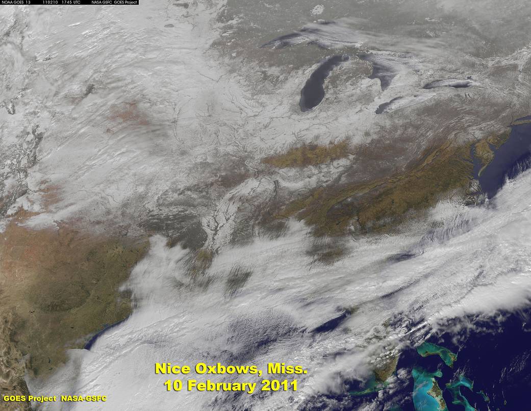
The Geostationary Operational Environmental Satellite called GOES-13 captured the aftermath of a snowstorm in the southern U.S. that set records this week and provided a fascinating view of the topography.
A GOES-13 image from February 10 showed the snowfall from record-setting storm that moved across Arkansas. The snowfall outlines the oxbow bends in the lower Mississippi River, along with the riverine landscape of Tennessee. The broad white snow-covered plain south of the junction of the Ohio River with the Mississippi reveals the extent of the great flood plain that the central U.S. rivers combined to cover with mud in many a spring until late in the 19th century, when the federal government started building dams to control the flow.
GOES-13 is operated by the National Oceanic and Atmospheric Administration, and images are created by NASA’s GOES Project, located at NASA’s Goddard Space Flight Center, Greenbelt, Md.
Text credit: Dennis Chesters, NASA’s Goddard Space Flight Center, Greenbelt, Md.