


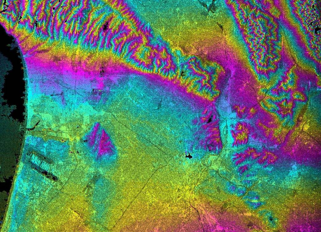
Looking more like the map of another planet than a view of this world, this topographic radar image of Los Angeles shows the relationships of the dense urban development and the natural contours of the land, including the Pacific Ocean on the left, the flat Los Angeles Basin and the steep ranges of the Santa Monica and Verdugo Mountains.
Looking more like the map of another planet than a view of this world, this topographic radar image of Los Angeles shows the relationships of the dense urban development and the natural contours of the land, including the Pacific Ocean on the left, the flat Los Angeles Basin across the center and the steep ranges of the Santa Monica and Verdugo Mountains along the top. The two dark strips near the coast at lower left are the runways of Los Angeles International Airport. For more information on the image, visit JPL’s Planetary Photojournal.Image Credit: NASA/JPL/NIMA