


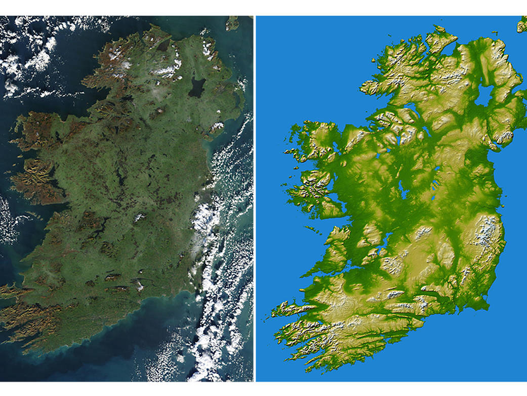
Pictured at Left: Even winter’s icy grip can’t contain the lush green hues of Ireland in this January 2003 photo from the Moderate Resolution Imaging Spectroradiometer on NASA’s Terra spacecraft.
The rugged cliffs that mark the island’s west coast are showing their red-brown rocky surface, but the low-lying interior region is still wearing the island’s signature green. Ireland’s largest city, Dublin, makes a purplish-gray patch peeking out from the clouds about halfway down the east coast. Belfast is more clearly visible on the coast in the northeast, due east of large Lake Neagh. One Ireland’s few other large cities, Cork, is located at the mouth of the Lee River, at the mid-point of the southern shoreline.Image Credit:NASA/MODIS Rapid Response TeamPictured at Right:Two visualization methods were combined to produce this image: shading and color coding of topographic height. The shade image was derived by computing topographic slope in the northwest-southeast direction, so that northwest slopes appear bright and southeast slopes appear dark. Color coding is directly related to topographic height, with green at the lower elevations, rising through yellow and tan, to white at the highest elevations.
Elevation data used in this image were acquired by the Shuttle Radar Topography Mission aboard the Space Shuttle Endeavour, launched on Feb. 11, 2000. SRTM used the same radar instrument that comprised the Spaceborne Imaging Radar-C/X-Band Synthetic Aperture Radar (SIR-C/X-SAR) that flew twice on the Space Shuttle Endeavour in 1994.Image Credit: NASA/JPL/NGA