


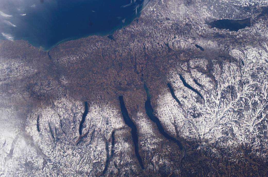
New York’s Finger Lakes region is seen in this December 2004 image from the International Space Station. Shapes of the snow-covered hills are accented by the low sun angles, and contrast with the darker, finger-shaped lakes filling the region’s valleys. Scientists believe the steep, roughly parallel valleys and hills of the Finger Lakes region were shaped by advancing and retreating ice sheets that were as much as 2 miles deep during the last ice age. River valleys were scoured into deep troughs; many are now filled with lakes. The two largest lakes, Seneca and Cayuga, are so deep that the bases of their lakebeds are below sea level.
The cities of Rochester, Syracuse and Ithaca are included in this field-of-view, as seen from the Space Station. These three cities enjoy large seasonal snowpacks, thanks to the influence of the Great Lakes producing lake-effect snowstorms.Image Credit: NASA