


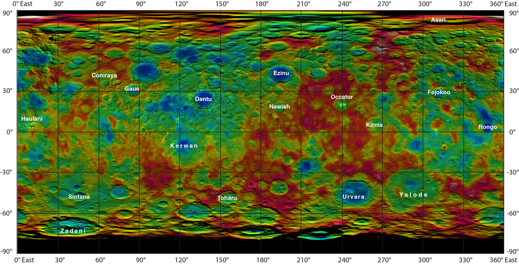
This color-coded map from NASA’s Dawn mission shows the highs and lows of topography on the surface of dwarf planet Ceres. It is labeled with names of features approved by the International Astronomical Union.
Occator, the mysterious crater containing Ceres’ mysterious bright spots, is named after the Roman agriculture deity of harrowing, a method of leveling soil. They retain their bright appearance in this map, although they are color-coded in the same green elevation of the crater floor in which they sit.
The color scale extends about 5 miles (7.5 kilometers) below the surface in indigo to 5 miles (7.5 kilometers) above the surface in white.
The topographic map was constructed from analyzing images from Dawn’s framing camera taken from varying sun and viewing angles. The map was combined with an image mosaic of Ceres and projected as an orthographic projection.
Note: The elevation scale used for this topographic map product differs slightly from the scale used to create PIA19605. These are preliminary data products; the Dawn science team may revisit the data to standardize the scale at a later date.
Image credit:
NASA/JPL-Caltech/UCLA/MPS/DLR/IDA