


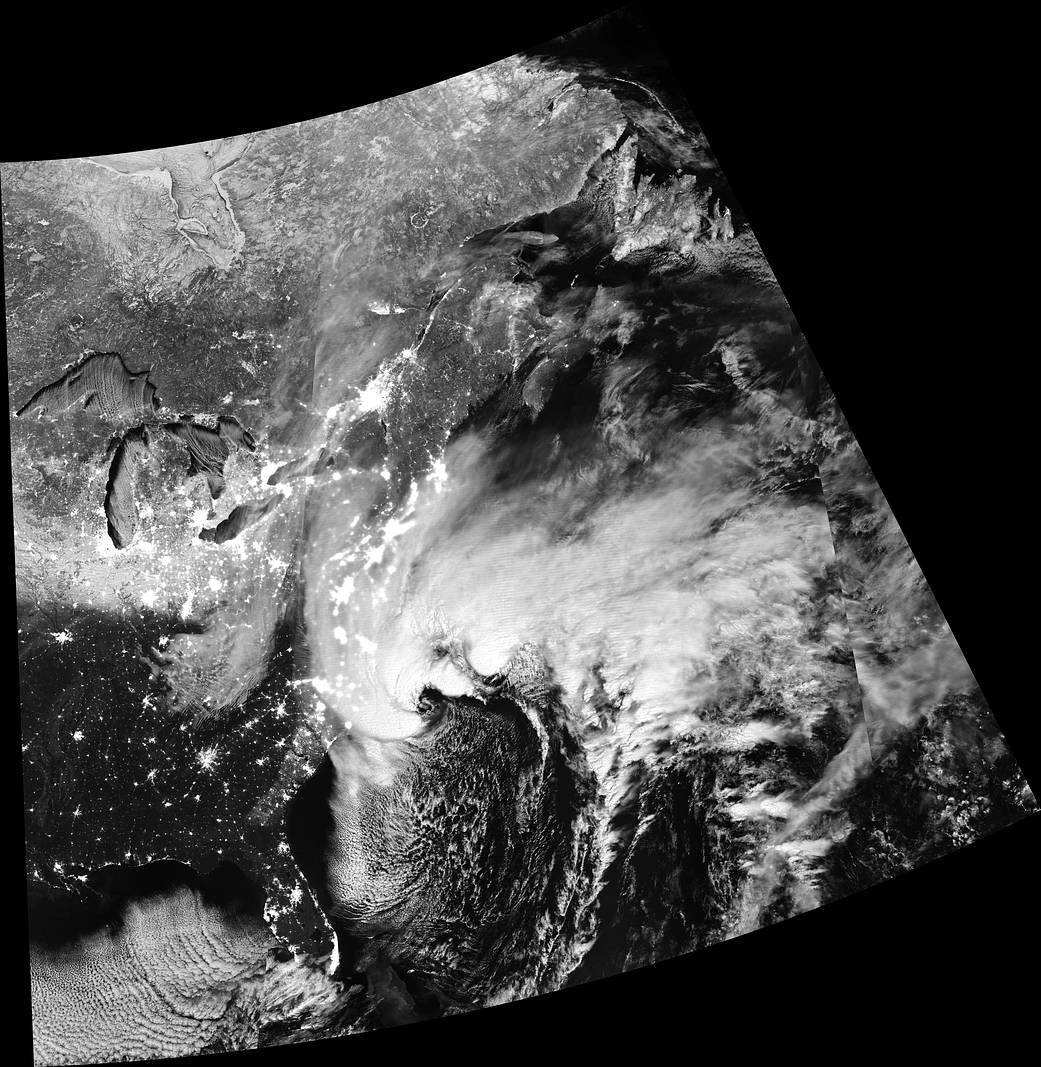
Millions of people along the East Coast of the United States faced snow and ice, gusty winds, power outages, travel delays, school closings, and flooding as a rapidly-intensifying Nor’easter plowed northward during the first week of 2018.
The fast-moving storm hit the Southeast on January 3, delivering snow to Tallahassee, Florida, for the first time in three decades and knocking out power to tens of thousands of people in Georgia and Florida. Strengthening over the ocean, it then pummeled coastal areas of South Carolina, North Carolina, Virginia, Delaware and New Jersey on January 4, with winds of up to 50 miles (80 kilometers) per hour and several inches of snow.
By the time the storm reached New England, it was dumping a foot or more of snow in white-out conditions in the worst-hit areas. In Boston, hurricane-force winds pushed tides to near-record levels and sent water spilling into the city.
This image was captured by the Visible Infrared Imaging Radiometer Suite (VIIRS) on the Suomi NPP satellite at 1:30 a.m. EST (06:30 Universal Time) on Jan. 4, 2018. It was composed through the use of the VIIRS “day-night band,” which detects faint light signals such as city lights, moonlight, airglow, and auroras. In the image, the clouds are lit from above by the nearly full Moon and from below by the lights of the heavily populated East Coast.
Image Credit: NASA/NASA Earth Observatory image by Joshua Stevens, using VIIRS day-night band data from the Suomi National Polar-orbiting Partnership